Apalachicola to Destin FL from 20 to 60 NM Marine Forecast
| Rest Of Today...East Winds 10 To 15 Knots, Becoming Southeast 5 To 10 Knots Late. Seas 2 To 3 Feet With A Dominant Period Of 3 Seconds. Protected Waters A Moderate Chop. |
| Tonight...Southeast Winds 5 To 10 Knots, Becoming East After Midnight. Seas Around 2 Feet With A Dominant Period Of 4 Seconds. Protected Waters A Light Chop. |
| Wednesday...East Winds Around 5 Knots, Becoming Southeast In The Afternoon. Seas Around 2 Feet With A Dominant Period Of 4 Seconds In The Morning, Then 1 Foot Or Less. Protected Waters Smooth. |
| Wednesday Night...West Winds Around 5 Knots, Becoming Northwest After Midnight. Waves 1 Foot Or Less. Protected Waters Smooth. |
| Thursday...Northeast Winds Around 5 Knots, Becoming Southeast In The Afternoon. Waves 1 Foot Or Less, Then Around 2 Feet With A Dominant Period Of 4 Seconds In The Afternoon. Protected Waters A Light Chop. |
| Thursday Night...South Winds 5 To 10 Knots, Becoming East After Midnight. Waves 1 Foot Or Less. Protected Waters A Light Chop. |
| Friday...Southeast Winds 5 To 10 Knots, Increasing To 10 To 15 Knots In The Afternoon. Seas Around 2 Feet With A Dominant Period Of 3 Seconds. Protected Waters A Moderate Chop. |
| Friday Night...Southeast Winds 5 To 10 Knots, Becoming East 15 To 20 Knots After Midnight. Seas 2 To 4 Feet With A Dominant Period Of 4 Seconds. Protected Waters Choppy. |
| Saturday...Southeast Winds 15 To 20 Knots. Seas 3 To 5 Feet With A Dominant Period Of 5 Seconds. Protected Waters Choppy. |
| Saturday Night...East Winds 10 To 15 Knots, Increasing To 15 To 20 Knots After Midnight. Seas 3 To 5 Feet With A Dominant Period Of 5 Seconds. Protected Waters Choppy. |
| Area Forecast Discussion National Weather Service Tallahassee FL 1135am EDT Tuesday April 23 2024 ...New Issued at 1130am EDT Tuesday April 23 2024 Forecast is on track and little changes were needed. Plenty of sunshine under high pressure and highs in the 70s. Near Term (Today and tonight) Issued at 506am EDT Tuesday April 23 2024 High pressure dominates the region for today with warming temperatures into the upper 70s and low 80s with light surface winds becoming southerly by this afternoon and evening; and zonal flow aloft. The sea breeze may develop and move towards Panama City this afternoon. Overnight temperatures will be in the low 50s. It'll be another chance for radiational cooling as we will have clear skies and light winds again but, not as cool as the previous night. .SHORT AND Long Term (Wednesday through Monday) Issued at 506am EDT Tuesday April 23 2024 Upper level ridging slowly builds into the region and then holds steady through the period. At the surface, high pressure will have shifted to the east and flattened due to frontal system passing by to our north. This could bring some light showers and perhaps a few rumbles of thunder to our northern AL and GA counties on Thursday, with mainly dry conditions prevailing before and after that time. A large low pressure system then develops over the north central plains, which will tighten the pressure gradient over the southeast. This could lead to some breezy and dry weather for the weekend. Marine Issued at 506am EDT Tuesday April 23 2024 Moderate easterly become gentle today, with winds becoming more light and variable for Wednesday. This will lead to subsiding seas and tranquil boating conditions. By mid to late week winds teeter between easterly and southerly. Winds are expected increase this weekend as the pressure gradient tightens. Fire Weather Issued at 506am EDT Tuesday April 23 2024 Lighter transport winds will lead to fairer dispersions for the next few days. Mixing heigheights are still expected to exceed 5500 feet but elevated dispersions are not expected. MinRH values will be in the low 30s and upper 20s for today, and gradually increase to the upper 30s and low 40s through the rest of the period. There are minimal chances for a wetting rain over the next several days. Hydrology Issued at 506am EDT Tuesday April 23 2024 Minor river flooding continues along the St. Marks, Aucilla, lower Withlacoochee, and lower and middle Suwannee Rivers. The St. Marks, Aucilla, and Withlacoochee have crested and are falling. The flood wave is just now reaching Luraville and will continue proceeding downstream over the next several days. No rainfall is anticipated, and no additional flood concerns are expected. NOAA Tallahassee FL Office: Watches - Warnings - Advisories FL...High Rip Current Risk until 11pm EDT this evening for FLZ115. GA...None. AL...None. GM...None. |
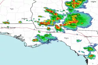 Tallahassee FL Radar
 Gulf Radar