Baffin Bay to Port Aransas 20 - 60 NM Marine Forecast
| Rest Of Tonight...Southeast Winds 10 To 15 Knots With Gusts Up To 20 Knots. Waves 3 To 4 Feet, Occasionally Seas Around 5 Feet. |
| Wednesday...Southeast Winds Around 10 Knots. Waves Around 3 Feet. |
| Wednesday Night...Southeast Winds 10 To 15 Knots With Gusts Up To 20 Knots. Waves 3 To 4 Feet, Occasionally Seas Around 5 Feet. |
| Thursday...Southeast Winds 10 To 15 Knots, Increasing To 15 To 20 Knots In The Afternoon. Waves 3 To 4 Feet, Occasionally Seas Around 5 Feet. |
| Thursday Night...Southeast Winds 20 To 25 Knots With Gusts Up To 30 Knots. Waves 5 To 7 Feet, Occasionally Seas Up To 9 Feet, Building To 7 To 9 Feet, Occasionally Seas Up To 11 Feet After Midnight. |
| Friday...Southeast Winds 20 To 25 Knots With Gusts Up To 30 Knots. Waves 8 To 9 Feet, Occasionally Seas Up To 11 Feet, Subsiding To 6 To 8 Feet, Occasionally Seas Up To 10 Feet In The Afternoon. |
| Friday Night...Southeast Winds Around 20 Knots With Gusts Up To 30 Knots. Waves 6 To 7 Feet, Occasionally Seas Up To 9 Feet. |
| Saturday...Southeast Winds Around 20 Knots. Waves 7 To 8 Feet, Occasionally Seas Up To 10 Feet. |
| Saturday Night...Southeast Winds Around 20 Knots. Waves 7 To 8 Feet, Occasionally Seas Up To 10 Feet. |
| Sunday...Southeast Winds 15 To 20 Knots. Waves 6 To 8 Feet, Occasionally Seas Up To 10 Feet. |
| Sunday Night...Southeast Winds Around 15 Knots. Waves 6 To 7 Feet, Occasionally Seas Up To 9 Feet. |
| Area Forecast Discussion National Weather Service Corpus Christi TX 1043pm CDT Tuesday April 23 2024 Long Term (Thursday through next Monday) Issued at 251pm CDT Tuesday April 23 2024 Key Messages: -Minor to moderate risk of heat-related impacts Saturday with heat indices around 105 degrees out west and around 100 degrees elsewhere The long term looks to remain relatively quiet as it begins with a series of upper level short waves moving across the Great Plains. These shortwaves that will move through the area Friday, Sunday, and Monday. With above normal PWAT (Precipitable Water) values ahead of these short waves (1.7-1.9 inches) an isolated shower/thunderstorm cannot be ruled out each of those days. The caveat is that there isn't any surface forcing available to enhance the environment. The best chance looks to be Monday with Probability of Precipitation chances are around 20% or less in the Victoria Crossroads and Coastal Plains. With the gradient along the ridge tightening over our area, onshore flow will likely increase to Small Craft Exercise Caution to Small Craft Advisory conditions beginning Thurday evening through Sunday. It will be hot through majority of the long term with high temperatures in the lower 80s to the east and upper 90s to the west. Feels like temperatures out west can potentially reach 105 degrees with lower 90s to the east. Gross I know, but this will unfortunately be the trend through next week. Marine Issued at 251pm CDT Tuesday April 23 2024 Weak to moderate southeasterly flow continues this evening through tomorrow night. Weak to moderate southeast flow Thursday is expected to strengthen to over 20 knots Thursday and continue impacting our local waters through Sunday. Therefore, Small Craft Advisory conditions will likely exist Thursday through Sunday. Onshore flow is expected to weaken to weak to moderate Monday and persist through the remainder of the period. NOAA Corpus Christi TX Office: Watches - Warnings - Advisories TX...None. GM...None. |
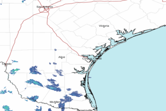 Corpus Christi TX Radar
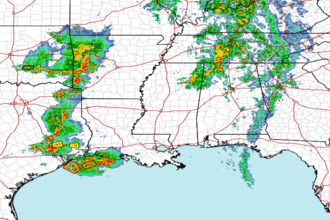 Gulf Radar