Baffin Bay to Port Mansfield, TX Marine Forecast
| Today...Southeast Winds 5 To 10 Knots Increasing To 10 To 15 Knots This Afternoon. Seas 3 To 4 Feet. Patchy Fog This Morning. A Slight Chance Of Showers And Thunderstorms This Morning. |
| Tonight...East Winds 10 To 15 Knots Decreasing To 5 To 10 Knots After Midnight. Seas 3 To 4 Feet. Patchy Dense Fog After Midnight. A Chance Of Showers With A Slight Chance Of Thunderstorms After Midnight. |
| Sunday...North Winds 20 To 25 Knots. Seas 3 To 5 Feet Building To 5 To 7 Feet, With Occasional Seas Up To 8 Feet In The Afternoon. A Chance Of Showers With A Slight Chance Of Thunderstorms. |
| Sunday Night...Northeast Winds 20 To 25 Knots Decreasing To 15 To 20 Knots After Midnight. Seas 6 To 9 Feet, With Occasional Seas Up To 11 Feet Subsiding To 5 To 7 Feet, With Occasional Seas Up To 8 Feet After Midnight. A Chance Of Showers With A Slight Chance Of Thunderstorms In The Evening, Then A Slight Chance Of Showers After Midnight. |
| Monday...Northeast Winds 10 To 15 Knots. Seas 4 To 6 Feet, With Occasional Seas Up To 7 Feet. A Slight Chance Of Showers. |
| Monday Night...East Winds 10 To 15 Knots Becoming Southeast 5 To 10 Knots After Midnight. Seas 3 To 4 Feet. |
| Tuesday...Southeast Winds 5 To 10 Knots. Seas 3 To 4 Feet. |
| Tuesday Night...Southeast Winds Around 10 Knots. Seas 3 To 4 Feet. |
| Wednesday...Southeast Winds 10 To 15 Knots. Seas 3 To 4 Feet. |
| Wednesday Night...Southeast Winds 10 To 15 Knots. Seas 3 To 4 Feet. Winds And Seas Higher In And Near Thunderstorms. |
| Area Forecast Discussion National Weather Service Brownsville TX 345am CDT Sat April 20 2024 ...New SHORT TERM, LONG TER Marine .SHORT TERM... (Today through Sunday) Issued at 342am CDT Sat April 20 2024 A nearly zonal mid-level flow will prevail through the period. A weak mid-level disturbance is currently moving eastward over the Rio Grande Valley. Another, more robust 500mb short wave trough is expected to arrive tonight. At the surface, a cold front extending from Eastern Texas through the Texas Hill Country to near Del Rio. This frontal boundary will begin to move south later today and advances through the our region tonight. Ahead of the front, today will be warm and humid with highs well into the 80s to lower 90s, except for the upper 70s at the beaches. Isolated showers and thunderstorms will be possible today with the departing aforementioned shortwave and daytime heating. However, rain chances will increase this evening as the cold front advances through the region. There is a medium to high probability of showers and thunderstorms across much of Deep South Texas tonight, the best chance of convection will be along and west of the I-69C corridor. The environment will be marginally conducive for strong to severe thunderstorms with damaging winds and large hail of at least one inch expected, mainly across the Rio Grande Plains and the northern Ranchlands. Storm Prediction Center depicts a Marginal Risk for Severe Thunderstorms for this area for today and tonight. The populated areas of the Rio Grande Valley and Willacy County remain in a general thunderstorm outlook for today and tonight. As for rainfall amounts, precipitable water values of near 1.8 inches should be sufficient for one-half to one inch amounts from any thunderstorm and can not rule out 2 inches in slow moving storms. Lows tonight are expected to fall into the 60s with the passage of the front. Much cooler on Sunday with highs in the 70s with breezy north winds. Scattered lingering showers and isolated thunderstorms will be possible on Sunday. Storm Prediction Center has the entire CWA (County Warning Area) in a general thunderstorm outlook for Sunday. Moderate Risk of Rip Currents continues into the weekend Long Term (Sunday night through Friday) Issued at 342am CDT Sat April 20 2024 Storm Prediction Center depicts the local CWA in a general thunderstorm outlook area Sunday night, the first period of the long term. Though a recent cold front will be well offshore by Sunday night, the models are keeping a mention of convection around. A couple of reasons appear germane. First, a weak coastal trough will set up just offshore. Second, cooler air will push toward the Sierra Madre Oriental range just west of the Rio Grande, and the surface convergence and maybe a little remaining mid level energy will be enough to keep scattered showers in the area. Sunday night itself will be cooler, with low temperatures ranging from the mid 50 across the Upper Valley and Ranchlands to the mid 60s for places like the Lower RGV. Monday will be a transition day to more seasonal weather. High temperatures will still be on the cooler side, in the lower to mid 70s. Rain chances will hang on for the day, however, but should be virtually gone by Monday night. Nonetheless, models do show a few coastal showers popping up on Tuesday and Wednesday, possibly a result of the previous cold front moving back north as a warm front. High temperatures on Tuesday and Wednesday will rise back into the 80s with the corresponding over- night low temps in the 60s and lower 70s. The tail end of a cold front may swing across South Texas on Friday, just north of our CWA, and we should have a quiet weather day. Friday high temperatures will poke into the 90s. To summarize, look for unsettled weather to start the long term, with a few rumbles still possible Sunday night into Monday. The Period will start out cool, on Monday, but temperatures will rebound to above average by Wednesday. We'll see a mix of clouds and sun most of the week, and there could still be a few showers in the area Tuesday through Thursday afternoons. Look for the South Texas wind machine to switch on Thursday and Friday as Gulf high pressure interacts with lower pressure over the Southern Plains. Marine Issued at 342am CDT Sat April 20 2024 Now through Sunday...Weak to moderate east to southeast flow and low to moderate seas are expected along the Lower Texas Coast today. A weak cold front will arrive late night with scattered showers and thunderstorms. Moderate to strong northerly winds will develop on Sunday in the wake of the front. Small Craft Advisories will likely be needed in wake of the frontal passage. Sunday night through Wednesday night...Small craft advisory conditions will be ongoing at the beginning of the period - Sunday night - with strong northeast winds and elevated seas behind a cold front. By Monday, marine conditions will improve with small craft should exercise caution to low end small craft advisory conditons on the Gulf. Monday night will feature a transition to moderate southeast winds and moderate seas for the remainder of the long term. NOAA Brownsville TX Office: Watches - Warnings - Advisories TX...None. GM...None. |
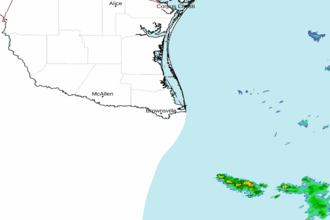 Brownsville TX Radar
 Gulf Radar