Calcasieu Lake Marine Forecast
| This Afternoon...South Winds 10 To 15 Knots. Lake Waters Choppy. |
| Tonight...South Winds 10 To 15 Knots, Diminishing To 5 To 10 Knots After Midnight. Lake Waters Choppy. Patchy Fog After Midnight. |
| Thursday...Southeast Winds 10 To 15 Knots, Becoming South 15 To 20 Knots In The Afternoon. Lake Waters Rough. Patchy Fog In The Morning. |
| Thursday Night...Southeast Winds 15 To 20 Knots, Increasing To 20 To 25 Knots After Midnight. Lake Waters Very Rough. |
| Friday...South Winds 20 To 25 Knots With Gusts Up To 30 Knots. Lake Waters Very Rough. |
| Friday Night...Southeast Winds 20 To 25 Knots, Increasing To 25 To 30 Knots After Midnight. Lake Waters Extremely Rough. |
| Saturday...Southeast Winds 25 To 30 Knots. Lake Waters Extremely Rough. |
| Saturday Night...Southeast Winds 25 To 30 Knots, Diminishing To Around 20 Knots After Midnight. Lake Waters Extremely Rough. |
| Sunday...Southeast Winds Around 20 Knots. Lake Waters Rough. A Slight Chance Of Showers And Thunderstorms In The Afternoon. |
| Sunday Night...Southeast Winds 15 To 20 Knots. Lake Waters Rough. A Slight Chance Of Showers And Thunderstorms. Winds And Waves Higher In And Near Thunderstorms. |
| Area Forecast Discussion National Weather Service Lake Charles LA 329pm CDT Wednesday April 24 2024 ...New SHORT TERM, Long Term .SHORT TERM... (Tonight through Friday night) Issued at 304pm CDT Wednesday April 24 2024 Broad and slack high pressure is currently in place across SETX and SWLA through the evening as indicated by low-mid level subsidence in this morning's sounding along with a weak vertical wind profile. Low level to surface moisture advection from the south continues allowing broken cumulus clouds over the area. That said, a lack of forcing along with subsidence inversion will be a key player in minimizing POPS, particularly south of the I-10 corridor during majority of the short range. An overall modifying high pressure regime will keep diurnal temperatures fairly stable over the next several days trending into the mid to upper 80’s for most locations. In the short term, strong sustained winds and gusts are forecast to develop across the area Friday - Sunday which will warrant relevant headlines for both inland and marine zones. Given a strong southerly fetch among periods of high tide, coastal flooding is a potential concern too. These concerns later alleviate Sunday night as winds/gusts trend down. An upper level shortwave digging south across the Rockies will deepen a large surface trough tomorrow night into Friday morning. The associated surface low under a strong region of divergence continues to further organize and deepen throughout the day while moderate to strong high pressure ridging extending north from Appalachia bay to the Great Lakes abuts the aforementioned pattern, creating an impressive pressure gradient along the Southern Plains and Western Gulf. Kowalski/30 Long Term (Saturday through next Tuesday) Issued at 304pm CDT Wednesday April 24 2024 As the above mentioned surface low occludes and stalls over the upper Midwest, modest troughing continues to shift east into the Western and Central Plain by early Saturday. Meanwhile, the high pressure regime budges very little over the Eastern Seaboard with moderate ridging extending south-southwest into the central Gulf. The maxima in gradient over SETX and SWLA occurs throughout the entire day Saturday. The ridge thenceforth will slowly broaden / weaken while shifting south offshore the Carolinas through the remainder of the weekend. This change will allow the gradient to slack along with opportunity for showers / storms to develop late Sunday trending into upcoming early work week. Regarding the precipitation, guidance hones on the idea of the shortwave developing across the central plains with a fairly progressive movement toward the TX/LA Gulf Coast and Lower Mississippi Valley into Monday morning. This portion of the forecast becomes unsettled as models diverge on handling the progression of the system over SETX / SWLA and downstream across the SE CONUS. With lower tropospheric winds expected to continue remaining out of the south while the upper level pattern accelerates out of the NW, continued opportunities for POPs to become enhanced late into and beyond the scope of the long range remains possible. Kowalski/30 Marine Issued at 248am CDT Wednesday April 24 2024 Onshore flow will slowly increase today with winds building to 10 knots by the evening. During this time waves will be less than four feet. Starting on Thursday winds will start to increase becoming moderate to strong. Winds will continue to increase on Friday with gusts up to 30 knots. Waves will also build in the outer waters possibly reaching 7 feet or more by Friday morning. Lakes and bays will be rough to very rough conditions. A Small Craft Advisory is likely starting on Thursday and lasting through Friday. NOAA Lake Charles LA Office: Watches - Warnings - Advisories LA...None. TX...None. GM...None. |
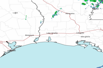 Lake Charles LA Radar
 Gulf Radar