Cape Cod Bay Marine Forecast
| Overnight...N Winds 20 To 25 Kt With Gusts Up To 30 Kt. Seas 3 To 4 Ft. Wave Detail: Nw 4 Ft At 5 Seconds And E 3 Ft At 9 Seconds. |
| Thu...N Winds 10 To 15 Kt With Gusts Up To 20 Kt, Becoming Ne Around 5 Kt In The Afternoon. Seas 2 To 4 Ft. Wave Detail: N 3 Ft At 5 Seconds. |
| Thu Night...S Winds 5 To 10 Kt, Becoming W After Midnight. Seas Around 2 Ft. Wave Detail: N 2 Ft At 6 Seconds. |
| Fri...N Winds Around 5 Kt, Becoming Ne In The Afternoon. Seas 1 Foot Or Less. Wave Detail: N 1 Ft At 5 Seconds. |
| Fri Night...S Winds 5 To 10 Kt, Becoming Sw After Midnight. Seas 1 Foot Or Less. Wave Detail: Se 1 Ft At 2 Seconds And Ne 1 Ft At 6 Seconds. |
| Sat And Sat Night...Sw Winds 10 To 15 Kt With Gusts Up To 20 Kt. Seas 1 Foot Or Less. Wave Detail: W 1 Ft At 2 Seconds And E 1 Ft At 5 Seconds. |
| Sun Through Mon Night...S Winds 10 To 15 Kt With Gusts Up To 20 Kt. Seas Around 2 Ft. Seas Are Reported As Significant Wave Height, Which Is The Average Of The Highest Third Of The Waves. Individual Wave Heights May Be More Than Twice The Significant Wave Height. |
| Area Forecast Discussion National Weather Service Boston/Norton MA 957pm EDT Wednesday April 24 2024 Synopsis A cold front moves off the coast by this evening followed by unseasonably cold conditions tonight. High pressure dominates Thursday through Saturday with dry weather and gradually moderating temperatures. Unsettled pattern sets up for Sunday into early next week with shower chances at times but turning milder. Near Term - Through Thursday Update: 10:00PM No adjustments needed for this update. Forecast remains on track with clearing sky cover and falling temperatures do to the CAA. Temperatures at this hour range from the upper 30s across northern Massachusetts while the south coast is still in the low 50s. Temperatures will rapidly cool off over the next several hours, no changes needed to the Frost/Freeze Headlines either. Previous discussion below... Scattered shower activity is quickly diminishing with sunset with the only remaining showers now over Cape Cod moving southeast. Rapid clearing develops this evening behind the front as PWATs (Precipitable Waters) crash. Cold advection maximizes this evening with NW gusts to 20-25 mph, and up to 30 mph along the coast, then diminishing overnight. Low temps forecast tricky as cooling will be from advection this evening, then radiational cooling late tonight as winds diminish. Still expecting lows mid/upper 20s interior, coldest NW MA, with lower 30s near the coast, but mid 30s Cape/Islands where winds will stay up through the night. Freeze watch was converted to Freeze warning and expanded along the entire coast. Short Term - Thursday Night High pressure will be in control with very dry airmass in place. Expect full sunshine Thu and clear skies Thu night. Winds will be light which will promote developing sea breezes by afternoon along the coast. Cooler airmass Thu as 850 mb temps bottom out at -2 to -4C. Highs will be in the mid-upper 50s but upper 40s along the immediate E MA coast where onshore winds develop. Very dry airmass with dewpoints well down into the teens Thu will result in RH values dropping to 15-25 percent, but winds will be light. Long Term - Friday Through Wednesday Key Points... * Warming trend through the middle of next week. * remaining dry Friday and Saturday. * Low chance for showers Saturday then again Tuesday and Wednesday. Friday and Saturday... Upper level ridge and surface high pressure remains centered over the region through Saturday. With subsidence aloft and very dry mid level air, skies look to remain clear with very little clouds until late Saturday afternoon when high clouds ahead of a short wave move in. This will help moderate day time temperatures into low to mid 60s Friday and mid to upper 60s Saturday. With a weak pressure gradient, local sea breezes will occur Friday and possibly again Saturday. However, winds begin to increase out of the south Saturday afternoon, which could keep a true sea breeze from forming along the east coasts. With the clear skies and weak winds Friday night, there will be very efficient radiational cooling setting up. low temps should drop near freezing in the typical cold spots of NW MA, and some low lying spots in SE MA. Otherwise lows drop into the mid to upper 30s across the rest of SNE. Upper level ridge axis passes to the east by Saturday night with some warm air advection ahead of the next shortwave trough. This will lead to increased cloud cover and and isolated to scattered showers. Lows stay warmer Saturday night in the upper 30s to low 40s. Sunday and Monday The center of the high pressure drops south to the Carolinas, but the upper level ridge axis continues to stretch north in SNE. Being at the top of the ridge axis, weak vort impulses, along with warm air advection aloft bring high clouds and low chances for isolated showers both Sunday and Monday. High temperatures Sunday and Monday will be very dependent on the possibility of a back door cold front working in. Latest GFS (Global Forecast System) and EURO is bringing that back door cold front through Sunday keeping temperatures in the low 60s. However, if that cold front stays offshore Sunday, temperatures could easily top the low to mid 70s. Given the uncertainty and run to run inconsistency, blended warmer NBM guidance with cooler CONSALL guidance. High temps will be warmer Monday regardless, but latest guidance has also trended temperatures back from the upper 70s to low 80s, down to the low to mid 70s due to the back door cold front. Again used a blend of the NBM and CONSALL guidance for Monday afternoon. Tuesday and Wednesday Upper level ridge axis again moves offshore to the east, but this time, a weakening shortwave trough moves through the region. Given this is a week out, stuck with NBM for precipitation chances, which shows 30-40% chance for showers. This seems reasonable given the weak forcing from the weakening trough. A cold front looks to move through behind the trough which could bring an isolated thunderstorms with it. Stuck with the NBM for high temperatures on Tuesday as southerly flow should kick out the back door cold front from Sunday and Monday. Highs should reach the mid to upper 70s, with a 30-40% chance at 80F in the CT river valley. Highs begin to trend cooler wednesday and beyond in the mid 60s to low 70s. Marine Forecaster Confidence Levels: Low - less than 30 percent. Medium - 30 to 60 percent. High - greater than 60 percent. Tonight through Thursday night...High Confidence. A period of NW wind gusts to 25-30 kt developing this evening behind the cold front, but diminishing overnight. SCA (Small Craft Advisory) for all waters. Northerly winds 10-15 kt Thu morning becoming light Thu afternoon/night. Onshore winds develop near the coast Thu afternoon as sea breezes develop. Outlook /Friday through Monday/... Friday through Saturday: Winds less than 25 kt. Saturday Night through Sunday Night: Winds less than 25 kt. Slight chance of rain showers. Monday: Winds less than 25 kt. NOAA Boston MA Office: Watches - Warnings - Advisories CT...Freeze Warning from 2am to 8am EDT Thursday for CTZ002>004. MA...Freeze Warning from 2am to 8am EDT Thursday for MAZ007- 014>021. RI...Freeze Warning from 2am to 8am EDT Thursday for RIZ001>007. Marine Small Craft Advisory until 4am EDT Thursday for ANZ230-231- 236-251. Small Craft Advisory until 8am EDT Thursday for ANZ232>235- 237. Small Craft Advisory until 2pm EDT Thursday for ANZ250- 254>256. |
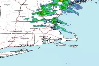 Boston MA Radar
 Northeast Radar
 East Coast Satellite