Cape Elizabeth ME to Merrimack River MA Marine Forecast
| Today...N Winds 10 To 15 Kt With Gusts Up To 25 Kt, Becoming Nw 5 To 10 Kt With Gusts Up To 20 Kt Late This Morning, Then Becoming Sw Early This Afternoon, Becoming S 10 To 15 Kt With Gusts Up To 20 Kt Late. Seas 4 To 6 Ft, Subsiding To 3 To 4 Ft This Afternoon. Wave Detail: E 4 Ft At 10 Seconds And N 2 Ft At 4 Seconds, Becoming E 4 Ft At 9 Seconds. |
| Tonight...S Winds 10 To 15 Kt With Gusts Up To 20 Kt, Becoming Nw 5 To 10 Kt After Midnight. Seas 2 To 3 Ft. Wave Detail: E 3 Ft At 8 Seconds And S 2 Ft At 4 Seconds. |
| Fri...N Winds 5 To 10 Kt, Becoming S In The Afternoon. Seas Around 2 Ft. Wave Detail: Ne 2 Ft At 8 Seconds. |
| Fri Night...Sw Winds 5 To 10 Kt. Seas Around 2 Ft. Wave Detail: Se 2 Ft At 8 Seconds. |
| Sat...W Winds 5 To 10 Kt, Becoming S With Gusts Up To 20 Kt In The Afternoon. Seas Around 2 Ft. Wave Detail: S 2 Ft At 4 Seconds. |
| Sat Night...S Winds 10 To 15 Kt With Gusts Up To 25 Kt. Seas 2 To 3 Ft. Wave Detail: S 3 Ft At 4 Seconds. |
| Sun...S Winds 10 To 15 Kt. Seas 2 To 3 Ft. |
| Sun Night...S Winds Around 10 Kt, Becoming W After Midnight. Seas 2 To 3 Ft. |
| Mon...Ne Winds 5 To 10 Kt, Becoming E In The Afternoon. Seas 2 To 3 Ft. |
| Mon Night...Se Winds 5 To 10 Kt. Seas 2 To 4 Ft. |
| Area Forecast Discussion National Weather Service Gray ME 231am EDT Thu April 25 2024 Synopsis Dry high pressure moves into and across the region today through Saturday. A warming trend can be expected over the weekend with chance of showers Saturday night or Sunday. Warmer weather is then expected early next week for most areas except possibly the coastal plain with scattered showers. Near Term - Until 6pm This Evening Nighttime microphysics satellite imagery early this morning shows clear skies across the region. West-northwesterly winds remain gusty in most locations with some gusts still between 25-30 mph. Breezy conditions will persist through daybreak in most locations, although a few valley spots could briefly decouple. Current temperatures are primarily into the 20s but a few lower 30 degree readings persist over southern NH and coastal western ME. A few additional degrees of cooling can be expected through daybreak. Surface high pressure will remain over the region today but a h5 trough axis will keep temperatures aloft on the cool side. This will result in mainly sunny skies and low afternoon relative humidity as we mix into a very dry airmass aloft. Afternoon relative humidity will fall into the middle teens to 20s percent range in most areas, lowest south of the mountains and away from the immediate coastline. West-northwesterly winds will also persist at between 10-15 mph, gusting to around 25 mph at times. This combined with the low relative humidity could cause increased fire weather concerns. Latest hi-res guidance continues to indicate the development of onshore flow along the coast by mid-afternoon, which will allow RH to increase over coastal locations. Given the very dry airmass and abundant sunshine, went on the warm side of guidance for afternoon high temperatures. This places readings into the middle to upper 50s for many areas south of the mountains and away from the immediate coast. Short Term - 6pm This Evening Through 6pm Friday Mainly clear skies will persist tonight with winds quickly decreasing this evening with the loss of daytime heating/mixing. This will set the stage for likely excellent radiational cooling conditions despite the relatively short nigheights of late April. As a result, used MOS guidance for overnight lows and pushed down the normally colder valleys down a few additional degrees. This places lows into the teens across the normally colder interior valley locations with 20s in most other locations. Sunny skies and dry conditions will continue on Friday with h850 temperatures warming by around 5C. This combined with deep afternoon mixing will allow for warmer high temperatures into the upper 50s to middle 60s south of the mountains, warmest in southern NH. Relative humidity will once again fall into the teens to 20s percent range during the afternoon hours. Surface westerly winds will be weaker as compared to today and this will likely allow for an earlier start to the seabreeze and it will likely penetrate further inland with increasing relative humidity behind it. Long Term - Friday Night Through Wednesday High pressure will remain anchored over northern New England as we begin the long term portion of the forecast. With clear skies, light winds and low dew points, expected a large diurnal curve with lows dropping below freezing in all areas with 20s in the north and lower 30s in the south. More sunshine is expected on Saturday as the large ridge of high pressure begins to slip off the Northeast coastline. A southwesterly flow will develop by late in the day and will allow temperatures to climb through the 60s. 00Z model runs remain in relatively good agreement allowing a warm front to approach the region from the west Saturday night. This will allow for a few showers to enter the region, mainly over northern and western areas. Scattered showers will continue on Sunday with readings in the 60s in most areas. The exception will be coastal areas where temperatures will be in the 50s. Temperatures will peak early next week. H8 temperatures near +12C and some sunshine will allow temperatures to reach the 70s over southern New Hampshire and 60s over interior Maine. Very cold water temperatures in the Gulf of Maine will allow for chilly temperatures will onshore winds and readings in the 50s. A nearly stationary from will allow for a few more scattered showers across the region. Temperatures will begin to cool off by midweek next week with plenty of cloud cover and some cold air advection. Marine Short Term West-northwesterly winds of 15-20 kts continue today before becoming light and variable tonight and then west at 10-15 kts on Friday. Seas will decrease below 5 ft by early this afternoon over the outer waters. Long Term Winds and seas to remain below thresholds hazardous to small crafts as high pressure builds over the waters Saturday and into early next week. NOAA Gray/Portland ME Office - Watches - Warnings - Advisories ME...None. NH...None. Marine Small Craft Advisory until 8am EDT this morning for ANZ150- 152-154. Small Craft Advisory until 4am EDT early this morning for ANZ151-153. |
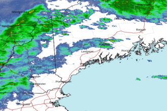 Portland ME Radar
 Northeast Radar