Chandeleur Sound Marine Forecast
| Tonight...South Winds 5 To 10 Knots. Waves 1 Foot Or Less. Patchy Fog Late. |
| Saturday...South Winds Around 5 Knots, Becoming Southeast In The Afternoon. Waves 1 Foot Or Less, Then Around 2 Feet In The Afternoon. |
| Saturday Night...Southeast Winds 5 To 10 Knots, Becoming East After Midnight. Waves 1 Foot Or Less, Then 1 To 2 Feet After Midnight. A Chance Of Showers With Isolated Thunderstorms After Midnight. |
| Sunday...Northeast Winds 10 To 15 Knots, Becoming North 20 To 25 Knots In The Afternoon. Waves 3 To 5 Feet. Showers With A Slight Chance Of Thunderstorms. |
| Sunday Night...North Winds 20 To 25 Knots With Gusts Up To 35 Knots. Waves 4 To 6 Feet. |
| Monday...Northeast Winds 20 To 25 Knots With Gusts Up To 30 Knots, Becoming North 10 To 15 Knots With Gusts Up To 20 Knots In The Afternoon. Waves 3 To 5 Feet, Subsiding To 2 Feet In The Afternoon. |
| Monday Night...Northeast Winds 5 To 10 Knots. Waves Around 2 Feet. |
| Tuesday...East Winds Around 10 Knots. Waves Around 2 Feet. |
| Tuesday Night...Southeast Winds 5 To 10 Knots. Waves 1 To 2 Feet. |
| Wednesday...East Winds 5 To 10 Knots. Waves 1 Foot Or Less, Then Around 2 Feet In The Afternoon. |
| Wednesday Night...Southeast Winds 5 To 10 Knots. Waves Around 2 Feet In The Evening, Then 1 Foot Or Less. Winds And Waves Higher In And Near Thunderstorms. |
| Area Forecast Discussion National Weather Service New Orleans LA 325pm CDT Fri April 19 2024 Long Term (Sunday through Thursday night) Issued at 323pm CDT Fri April 19 2024 Models show a shortwave on the backside of the northern trough moving on a much farther south trajectory, passing through the mid to lower Mississippi Valley Sunday afternoon. This is what'll be needed to finally drive a cold front completely through the CWA (County Warning Area) on Sunday morning. Ample moisture in place with lift from the front will be a good setup for increasing showers. Model soundings today compared to previous days show much less instability anywhere through the column. Thus, thinking it'll be fairly tough for much thunder to develop and therefore now only have isolated thunderstorms in the zone forecasts. Overall Quantitative Precipitation Forecast shouldn't be impactful generally speaking with areal amounts under an inch. Coverage forecast of 80% could still be too low. This cold front won't be particularly strong being that a shortwave it driving it, so only looking at a day of below normal temps with moderating conditions quickly returning as well as above normal temps Tuesday onward. Precip forecast next week continues to be on the lower end of confidence as models not doing a great job of resolving weaker troughs that may pass through the midsection of the country. So will just be going with deterministic NBM POPs which with the latest forecast package is on the drier side. Marine Issued at 323pm CDT Fri April 19 2024 A surface high pressure is centered in the western Atlantic and extending across the Gulf of Mexico. The western periphery of this ridge is being broken down by approaching surface trough to the north of the area. That'll result in a weakening of onshore flow with most of the coastal waters becoming light and variable tonight. Current global model runs indicate that a cold front will move through the coast waters Sunday morning. Cold air advection won't be particularly strong with this boundary and thus likely only looking at about 12 to 18 hours of Exercise Caution to low-end Small Craft conditions. NOAA New Orleans LA Office: Watches - Warnings - Advisories LA...None. GM...None. MS...None. GM...None. |
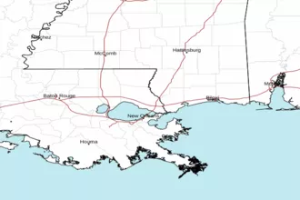 New Orleans LA Radar
 Gulf Radar