Charleston Harbor Marine Forecast
| Tonight...E Winds 10 Kt, Diminishing To 5 Kt Late This Evening, Then Increasing To 10 Kt Late. |
| Fri...E Winds 10 To 15 Kt, Increasing To 15 To 20 Kt In The Afternoon. |
| Fri Night...E Winds 10 To 15 Kt. |
| Sat...E Winds 10 Kt. |
| Sat Night...E Winds 5 To 10 Kt. |
| Sun...Se Winds 5 To 10 Kt. |
| Sun Night...Se Winds 5 To 10 Kt. |
| Mon...Se Winds 5 To 10 Kt. |
| Mon Night...S Winds 5 To 10 Kt. |
| Tue...S Winds 5 To 10 Kt. |
| Tue Night...S Winds 5 To 10 Kt. Unless Otherwise Noted, Waves 1 Foot Or Less. Charleston Harbor Water Temperature 70 Degrees. |
| Area Forecast Discussion National Weather Service Charleston SC 719pm EDT Thu April 25 2024 Synopsis A weak trough will drop south of the area tonight. High pressure will then build back into the region through the early part of next week. A weak cold front could approach the area around the middle of next week. Near Term - Until 6am Friday Morning Early this evening: Satellite and radar imagery show that the sea breeze has pushed about halfway through the forecast area and that diurnal cumulus are dissipating as we start to lose surface heating. Overnight, high pressure will strengthen and become centered over New England and increasingly ridge down the east side of the Appalachians. The forecast is dry and the main forecast challenge will be cloud cover. Model guidance depicts area of area low clouds developing upstream of the area across the Pee Dee region and advecting in within the arriving east- northeast flow. For the public forecast this will have virtually no sensible impact and is more notable for aviation interests. Lows are forecast to range from the mid 50s inland to the low 60s along the immediate coast. Short Term - 6am Friday Morning Through Sunday Aloft, a large omega block will set up with amplifying troughs over the Western Atlantic and Western U.S. A ridge axis will settle over the Eastern Seaboard. This pattern favors quiet weather with little to no forcing. An isolated shower is possible mainly Friday along the southeast Georgia coast or far inland, where weak llevel convergence and presence of mid-level moisture co-exist. However, no mentionable POPs have been included in the forecast due to dry lower levels. Otherwise partly cloudy skies will prevail nearly each day. High temperatures remain within a few degrees of normal, generally in the upper 70s to lower 80s each day through the weekend. Lows both Friday and Saturday night will range from the upper 50s inland to the mid 60s along the immediate coast. Long Term - Sunday Night Through Thursday The pattern remains largely unchanged into early next week with the omega block and deep high pressure in place. This favors increasing temperatures and virtually zero rain chances Monday and Tuesday. The upper ridge axis will begin to shift offshore Tuesday as a weakening trough and accompanying weak cold front moves toward the eastern U.S. The front will be positioned inland late Tuesday/early Wednesday, however guidance depicts a weak or stalled boundary at that point. Showers will remain dependent on how quickly the upper trough driving the front lifts north. The forecast currently mentions slight chance POPs Wednesday afternoon which are limited to the inland locations. Temperatures will start the period in the low 80s and will rise to the upper 80s/near 90F by the middle of the next week. Marine Tonight: Surface high pressure will build across the eastern Great Lakes and down into the southeast. Easterly winds will slowly increase overnight in response, particularly across the South Carolina coastal waters. Speeds will average 10 kt from Edisto Beach and points south with 10-15 kt over the South Santee-Edisto Beach out 20 NM leg. Seas will average 2-4 ft. Friday through Tuesday: Winds will shift NE Friday and then out of the east Saturday as high pressure builds from the north. Brief surge will bring winds to the 15-20 kt range Friday afternoon/evening. Seas in turn will build to 3-5 ft across the nearshore waters out 20 nm and 5-6 feet across the outer Georgia waters from 20-60 nm. A Small Craft Advisory could be needed for the offshore Georgia waters overnight Friday into Saturday. Winds around 10 kt or less will veer more southerly, and seas will decrease to 2- 4 ft Monday into Tuesday. Rip Currents Persistent onshore flow combined with moderate swell energy will enhance the rip current risk this weekend. There is currently a Moderate risk of rip currents for all area beaches Saturday. Equipment The KCLX radar is undergoing electrical maintenance and is tentatively scheduled to return to service April 26th. NOAA Charleston SC Office: Watches - Warnings - Advisories GA...None. SC...None. Marine None. |
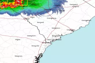 Charleston SC Radar
 Southeast Radar