Charlotte Harbor and Pine Island Sound Marine Forecast
| Rest Of Tonight...West Winds Around 5 Knots, Becoming Northeast Overnight. Bay And Inland Waters Light Chop. |
| Friday...East Winds Around 5 Knots, Becoming West Around 10 Knots In The Afternoon. Bay And Inland Waters Light Chop. |
| Friday Night...Northwest Winds 10 To 15 Knots, Diminishing To Around 5 Knots And Becoming Northeast Overnight. Bay And Inland Waters A Moderate Chop. |
| Saturday...East Winds Around 5 Knots, Becoming West Around 10 Knots In The Afternoon. Bay And Inland Waters Light Chop. |
| Saturday Night...West Winds 5 To 10 Knots, Becoming Southeast Overnight. Bay And Inland Waters Light Chop. |
| Sunday...Southeast Winds 5 To 10 Knots, Becoming Southwest Around 10 Knots In The Afternoon. Bay And Inland Waters Light Chop. |
| Sunday Night...Southwest Winds 5 To 10 Knots. Bay And Inland Waters Light Chop. |
| Monday...South Winds 5 To 10 Knots Becoming West Around 10 Knots In The Afternoon. Bay And Inland Waters Light Chop. |
| Monday Night...Northwest Winds Around 10 Knots, Becoming North After Midnight. Bay And Inland Waters Light Chop. |
| Tuesday...Northeast Winds 5 To 10 Knots, Becoming West In The Afternoon. Bay And Inland Waters Light Chop. |
| Area Forecast Discussion National Weather Service Tampa Bay Ruskin FL 740pm EDT Thu April 18 2024 Issued at 221pm EDT Thu April 18 2024 Broad upper-level ridging remains in place as a weak but dry surface high persists at the surface. The sea breeze boundaries are the main feature of note in this setup as the light flow is allowing inland propagation and a moderating of coastal temperatures with water temperatures in the 70s. However, the aforementioned dry and stable airmass remains a barrier to any convective development, despite a setup not unlike a summer day. Over the coming days, the gradual return of moisture may yield enough low-level convergence to support an isolated shower across the interior of the peninsula. That being said, this is still very low probability. As such, have introduced a 10% Probability of Precipitation for parts of the interior, but it's really difficult to have much more confidence than that into next week. The most notable feature on the horizon for next week is a shortwave trough that yields some amplification in the flow and a period of enhanced vertical ascent that may yield a few storms across mainly the northern half of the Florida peninsula on Monday. Otherwise, though, weather conditions are not really expected to change. If anything, it may yield an increase in the overall moisture content, favoring additional diurnal activity through the end of the week. Overall, though, conditions largely look warm and dry. While this is a little earlier than normal and favors some record high temperatures being set, we are fast approaching that period of the year where this becomes the norm. Marine Issued at 221pm EDT Thu April 18 2024 Light winds and seas continue through the weekend with an onshore flow developing each afternoon along the coast as a warm and dry airmass remains in place. As another storm system approaches north Florida on Monday, some thunderstorms and increasing winds Fire Weather Issued at 221pm EDT Thu April 18 2024 Conditions remain warm and dry through the weekend as high pressure remains in control. However, winds are forecast to remain light at this time with no red flag conditions expected. NOAA Tampa FL Office: Watches - Warnings - Advisories FL...None. Gulf waters...None. |
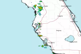 Tampa Bay FL Radar
 Gulf Radar