Chesapeake Bay From Sandy Point to North Beach MD Marine Forecast
| Rest Of The Overnight...Sw Winds 5 Kt. Waves Less Than 1 Ft. Numerous Showers. |
| Today...Nw Winds 5 To 10 Kt With Gusts To 20 Kt. Waves 2 Ft. Scattered Showers. |
| Tonight...Nw Winds 15 To 20 Kt...Becoming N 10 To 15 Kt Late. Gusts Up To 25 Kt. Waves 3 Ft. |
| Sun...Nw Winds 5 To 10 Kt. Waves 1 Ft. |
| Sun Night...Nw Winds 5 To 10 Kt With Gusts To 20 Kt. Waves 1 Ft. |
| Mon...Nw Winds 5 To 10 Kt. Waves 1 Ft. |
| Mon Night...S Winds 5 Kt. Waves Less Than 1 Ft. |
| Tue...S Winds 10 To 15 Kt. Waves 1 To 2 Ft...Building To 3 Ft. |
| Wed...Sw Winds 15 Kt...Becoming Nw. Waves 2 To 3 Ft. A Chance Of Showers. |
| Area Forecast Discussion National Weather Service Baltimore MD/Washington DC 400am EDT Sat April 20 2024 Synopsis A cold front will move through the area this morning. High pressure will build into the area tonight into early next week. Low pressure will track to our north on Wednesday, causing another cold front to move through the area. Near Term - Through Tonight A cold front is near the Appalachian crest this morning while a separate area of low pressure is located over the Carolinas. Showers have recently become more pronounced along the I-95 corridor, with some patchier light rain and drizzle still lingering to the west. While current showers are showing a steady eastward motion, some additional showers will be possible along the I-95 corridor due to the slow progression of the front and low passing by to the south. The clearing line will progress eastward today, with most areas seeing plenty of sun by early-mid afternoon. As pressures finally begin to rise this afternoon, expect an increase in northwest winds with gusts in the 20-30 mph range (locally higher in the mountains). The downslope flow will promote warming and drying, with highs ranging from the mid 60s to mid 70s in the lower elevations. The front will stall well to our south tonight while high pressure builds eastward from the plains. High level clouds will begin to increase ahead of troughing aloft. Colder air will continue to advect into the area, and overnight lows will range from the mid 30s to lower 40s, with below freezing temperatures in the higher elevations of the Alleghenies. While some patchy frost is possible, especially west of the Blue Ridge, the clouds, lingering light winds, and relatively large dew point spreads lower confidence. Short Term - Sunday Through Monday Night Low pressure will ride along the front well to our south on Sunday while a narrow ridge of high pressure continues to extend eastward from the Plains. Most guidance continues to keep rain south of the area, but there are still some northern solutions that bring some light rain from central Virginia to far southern Maryland. Abundant mid and high level clouds will be in place area wide and it will be much cooler. Highs will be in the mid 50s to lower 60s with 40s in the higher elevations. The lows to our south and over eastern Canada will depart Sunday night, allowing high pressure to finally build eastward. Skies will clear, and guidance has a better signal for radiational cooling. The only question mark in regards to frost is wind, which may remain around 5 mph out of the west. Lows will be in the 30s for most, except warmer in the urban centers. Besides the higher elevation, there is also potential for subfreezing temperatures in the central Shenandoah Valley. High pressure will build atop the area Monday and Monday night. Mostly clear skies are expected with temperatures slightly below average. Patchy frost could form again Monday night in sheltered valleys, but overall the airmass will start moderating by that time. Long Term - Tuesday Through Friday High pressure will influence dry conditions and near average temperatures on Tuesday. Highs should reach the upper 60s to the lower 70s. The high will move east to allow for a cold front to approach Tuesday night before passing through the region during the day on Wednesday. There is a chance for rain showers later Tuesday night and during the day Wednesday with respect to the passing front. High temperatures on Wednesday will be near average but a few degrees cooler than Tuesday. As the front passes each respective area later Wednesday, a downsloping component to the wind could squash additional chances of rain or lessen the effect from rain showers. On the other hand, an upslope component will influence rain shower chances along the western ridges. A second area of high pressure builds in behind the departing cold front Thursday with a reinforcing third high expected on Friday. The second high will usher in cooler and drier air on a gusty west to northwest breeze. The third area of high pressure will solidify dry and cool conditions going into the end of the week. Highs will be a couple of degrees below average Thursday, but should rebound a couple of degrees on Friday. Marine Winds are currently sub-SCA (Small Craft Advisory) level over the waters. A cold front will move through early this morning, causing winds to turn northwesterly in its wake. SCAs (Small Craft Advisories) are in effect this afternoon for most of the waters, expanding to all waters this evening as a surge of winds pushes southward. Winds will decrease the second half of the night. Low pressure will pass south of the area Sunday and winds will largely remain sub-SCA (Small Craft Advisory) in nature, but some gusts could come close across northern waters. A pressure surge Sunday night could result in SCA (Small Craft Advisory) conditions on the bay. Lighter winds are expected Monday and Monday night as high pressure builds across the area. Small craft advisories are likely Tuesday afternoon through Wednesday evening. Winds south 10 to 15 knots gusts up to 20 knots Tuesday afternoon and Tuesday night. Winds southwest becoming northwest 15 to 20 knots gusts higher Wednesday and Wednesday night. Tides / Coastal Flooding Tidal anomalies have already started to decrease. Besides the headlines for the current high tide cycle, additional advisories appear unlikely as water levels continue to decrease as northwest winds take hold later today. NOAA Baltimore MD/Washington DC Office: Watches - Warnings - Advisories DC...Coastal Flood Advisory until 9am EDT this morning for DCZ001. MD...Coastal Flood Warning until 8am EDT this morning for MDZ014. Coastal Flood Warning until 4am EDT early this morning for MDZ017. Coastal Flood Advisory until 4am EDT early this morning for MDZ018. VA...Coastal Flood Advisory until 9am EDT this morning for VAZ054. WV...None. Marine Small Craft Advisory from noon today to 2am EDT Sunday for ANZ530-535-536-538. Small Craft Advisory from noon today to 6am EDT Sunday for ANZ531-532-539-540. Small Craft Advisory from 4pm this afternoon to 6am EDT Sunday for ANZ533-541-542. Small Craft Advisory from 8pm this evening to 6am EDT Sunday for ANZ534-537-543. |
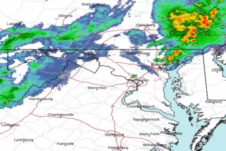 Baltimore/Washington Radar
 Northeast Radar
 East Coast Satellite