Chesapeake Bay from Smith Point to Windmill Point VA Marine Forecast
| Today...Ne Winds 15 To 20 Kt With Gusts Up To 25 Kt. Waves 2 To 3 Ft. |
| Tonight...E Winds 10 To 15 Kt. Waves Around 2 Ft. |
| Fri...E Winds 10 To 15 Kt. Waves Around 2 Ft In The Morning, Then 1 Foot Or Less. |
| Fri Night...E Winds 10 To 15 Kt. Waves Around 2 Ft In The Evening, Then 1 Foot Or Less. |
| Sat...Se Winds 10 Kt. Waves 1 Foot. |
| Sat Night...S Winds 10 Kt. Waves Around 2 Ft. |
| Sun...S Winds 10 Kt. Waves Around 2 Ft In The Morning, Then 1 Foot Or Less. |
| Sun Night...Sw Winds 10 Kt. Waves Around 2 Ft. |
| Mon...Sw Winds 5 To 10 Kt. Waves 1 Foot, Then Around 2 Ft In The Afternoon. |
| Mon Night...S Winds 10 Kt. Waves Around 2 Ft. |
| Area Forecast Discussion National Weather Service Wakefield VA 646am EDT Thu April 25 2024 Synopsis Strong high pressure builds east from the Great Lakes region today, before shifting offshore to end the week. After a couple of cooler days, expect a significant warming trend late in the weekend into early next week. Near Term - Through Tonight As of 305am EDT Thursday... Key Messages: - Scattered showers over the MD eastern shore this morning. - Partly to mostly cloudy and cooler today and tomorrow. - Patchy frost possible over the MD eastern shore late tonight/early Friday morning. Latest analysis shows that the weak cold front has finally pushed through the region early this morning. Scattered showers and isolated thunderstorms that formed just to the SE of the boundary have nudged offshore and are diminishing as expected. Winds have become E-NE over the region and will gust to 15-18 kt this morning along the coast. Meanwhile, 1030+mb surface high pressure over Ontario and the upper Great Lakes build south across the northeast CONUS today. One last shortwave embedded in the departing upper trough will dive across the Delmarva this morning, with an isolated shower possible through around noon. Otherwise, partly to mostly cloudy today (highest cloud cover along and east of I-95 in the developing maritime airmass). Cooler highs today in the 50s along the coast, upper 50s to mid 60s inland. Some milder upper 60s to around 70 possible south of US-58 across far southern VA into NE NC. Decreasing clouds and chilly tonight. Lows late tonight will be in the lower 40s inland, with mid to upper 40s from I-95 east to the coastal plain. Inland portions of the Maryland Eastern Shore will clear out a bit faster and with decoupling winds, could see lows in the mid to upper 30s Friday morning. This could result in some patchy frost in typically cooler, more sheltered areas, and a Frost Advisory could be needed. Will outline potential in the HWO for now. Short Term - Friday Through Friday Night As of 305am EDT Thursday... Key Messages: - Cool high pressure keeps temperatures near to just below normal Friday. The high slides just offshore of New England on Friday, keeping onshore flow regime in place. This portends another cool day Friday, with highs very similar to those of today (50s at the coast, low to mid 60s inland). It will be a little bit milder Friday night as the airmass modifies, with lows staying in the mid 40s inland. Long Term - Saturday Through Wednesday As of 305am EDT Thursday... Key Messages: - A few passing showers possible inland on Saturday. - A warming trend is expected for the weekend into early next week, with highs climbing above normal Sunday through the middle of next week. - Showers and storms return to the forecast late in the period Tuesday and Wednesday. A high amplitude upper ridge axis will be in place over the eastern seaboard to begin the day on Saturday, with surface high pressure settling in just off the New England/northeast coast. Meanwhile, a low pressure center will weaken as it drifts north across the upper midwest, sending a warm front across the Ohio River Valley and into the northern Mid- Atlantic Saturday morning. It may extend just far enough south to give us a very slight chance of light rain showers, particularly across the north and northwest section of the CWA. Elsewhere, expect mainly mostly cloudy skies and slightly warmer temperatures. Saturday marks the start of a warming trend, with highs Saturday topping out around 70 degrees inland, and in the low to mid 60s along the coast. As high pressure builds offshore and settles in the western Atlantic late in the weekend through early next week, expect temperatures to quickly trend back upward through the period; from highs jump into the 70s along the coast to low to mid 80s Sunday, with highs in the low to mid 80s for most away from the immediate coast on Monday through Wednesday, before the upper ridge finally starts breaking down by the middle of next week. The next front approaches from the west Mon/Tuesday next week. Our next chance for showers and isolated storms will be possible with the frontal passage itself by next Tuesday and Wednesday. Marine As of 305am EDT Thursday... Key Messages: 1) SCAs (Small Craft Advisories) remain in effect today. 2) A prolonged period of elevated seas/waves due to onshore flow is expected into Friday night. High pressure over the Great Lakes gradually builds into interior New England through Fri. A cold front on the leading edge of the high continues to push S across the local waters this morning with Cold Air Advection lagging behind. Winds were NE 5-10 kt across the local waters early this morning. As Cold Air Advection ramps up, winds increase to 15-20 kt with gusts to 25 kt later this morning across the N waters and by this afternoon across the S waters. As such, SCAs (Small Craft Advisories) go into effect from N to S this morning into this afternoon. Confidence has increased in SCA (Small Craft Advisory) criteria winds across the Rappahannock and York Rivers this morning with SCAs (Small Craft Advisories) now in effect. Confidence remains too low across the upper James River for SCAs. Winds gradually diminish this evening but remain 12-17 kt through Fri, becoming E 10-15 kt Fri night, and eventually becoming SE Sat as the high moves offshore. Given the prolonged period of onshore flow, seas (and waves at the mouth of the Ches Bay) remain elevated into Fri night with 4-6 ft seas (and 3-4 ft waves at the mouth of the bay) expected. SCAs (Small Craft Advisories) have therefore been extended until 10pm Fri for the N coastal waters, 1 AM Sat for the mouth of the bay and the coastal waters from Cape Charles Light to the VA/NC border, and until 4am Sat for the NC coastal waters. Tides / Coastal Flooding As of 455am EDT Thursday... A prolonged period of NE flow is expected to begin this morning behind a cold front passage, lingering into Friday. Mainly nuisance flooding is possible across the lower bay, James River, VA Atlantic-facing beaches, eastern Currituck County, and Dorchester County with tonight's high tide. As such, Coastal Flood Statements are in effect for these locations. Locally minor flooding is possible along the S/W portion of the James River during this evening's high tide due to a favorable fetch of swell given NE winds. Smithfield will likely reach minor flood stage (potentially high-end minor) with Sewell's Point also showing the potential for reaching minor flood stage. As such, a Coastal Flood Advisory has been issued for these areas. Additionally, will need to monitor Lewisetta as the NE winds may allow the tidal anomalies to rise higher than expected (current forecast keeps them below minor flood stage). NOAA Wakefield VA Office: Watches - Warnings - Advisories MD...None. NC...None. VA...Coastal Flood Advisory from 8pm this evening to 4am EDT Friday for VAZ089-093-095>097. Marine Small Craft Advisory until 7pm EDT this evening for ANZ630- 631. Small Craft Advisory until 1am EDT Friday for ANZ632. Small Craft Advisory from 1pm this afternoon to 1am EDT Friday for ANZ633. Small Craft Advisory until 1am EDT Saturday for ANZ634. Small Craft Advisory until 10am EDT this morning for ANZ635. Small Craft Advisory until 10am EDT this morning for ANZ636. Small Craft Advisory until 10pm EDT this evening for ANZ638. Small Craft Advisory until 10pm EDT Friday for ANZ650-652-654. Small Craft Advisory until 1am EDT Saturday for ANZ656. Small Craft Advisory from 10am this morning to 4am EDT Saturday for ANZ658. |
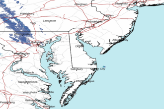 Dover DE Radar
 Northeast Radar