Chesapeake Bay from Windmill Point to New Point Comfort VA Marine Forecast
| Rest Of Tonight...W Winds 5 To 10 Kt, Becoming N 10 To 15 Kt Late. Waves Around 2 Ft. |
| Tue...Ne Winds 5 To 10 Kt, Becoming E Late. Waves Around 2 Ft In The Morning, Then 1 Foot Or Less. |
| Tue Night...Se Winds 5 To 10 Kt. Waves 1 Foot. |
| Wed...Se Winds 5 To 10 Kt. Waves 1 To 2 Ft. A Chance Of Showers In The Afternoon. |
| Wed Night...S Winds 10 To 15 Kt With Gusts Up To 20 Kt. Waves 1 To 2 Ft. A Chance Of Showers. |
| Thu...Sw Winds 10 Kt, Becoming N In The Afternoon. Waves 1 To 2 Ft. A Chance Of Showers. |
| Thu Night...Ne Winds 10 To 15 Kt. Waves 2 To 3 Ft. A Chance Of Showers In The Evening. |
| Fri...Ne Winds 10 Kt. Waves Around 2 Ft. |
| Fri Night...Se Winds 10 Kt, Becoming S After Midnight. Waves 1 Foot. |
| Area Forecast Discussion National Weather Service Wakefield VA 135am EDT Tuesday April 16 2024 Synopsis A cold front drops south through the area this evening with showers and thunderstorms possible for most of the area. This front is forecast to lift back north as a warm front Tuesday night. Another front crosses the area Thursday with a stronger cold front then expected by the weekend. Near Term - Until 6am This Morning As of 950pm EDT Monday... Key Messages: - Showers diminish overnight with partial clearing overnight. Lows mainly in the 50s. Latest analysis reveals weakening frontal boundary approaching the area from just north of the local area at 02z this evening. Trends continue to reflect diminishing convection over the next few hours and will therefore allow WW109 to expire at 10pm for southern VA including Hampton Roads. Expect all storms to continue to weaken over the next few hours, as outflow boundary weakens and slips farther south through midnight. Expect storms dissipate by 12-2am tonight as the front drops into the region, with just a lingering shower or two possible after midnight for US-58 corridor and points south. Lows late tonight will range from the mid 50s N to around 60 S. Mostly cloudy skies expected Tuesday with the front remaining near the area. This could spark additional showers and isolated thunderstorms. especially N. Highs Tuesday in the upper 70s-low 80s for most of VA and NC. It'll remain around 70 on the Eastern Shore where the flow will be off the cooler waters. .SHORT TERM /6am THIS MORNING THROUGH THURSDAY/... As of 330pm EDT Monday... Key Messages: - Additional scattered showers and storms possible Tuesday and Wednesday afternoon and evening. - Not quite as warm, but remaining above normal through midweek. The front sags southward into central NC early Tuesday before lifting back N and NE during the evening and overnight hours. Not quite as warm behind the front with highs ranging from the 60s/low 70s on the Eastern Shore, low/mid 70s for areas along and NE of the I-64 corridor, and upper 70s to low 80s SW. The SW third of the CWA (County Warning Area) will be closest to the front and associated low level moisture and instability tomorrow afternoon/evening and a few showers or storms are possible in these areas. Coverage is expected to be pretty sparse with minimal Quantitative Precipitation Forecast. Low-end chances for a shower or two continue into Tuesday night with lows in the 50s. Mostly cloudy skies expected Wednesday with the front remaining near the area. This could spark additional showers and isolated thunderstorms. especially N. Highs Wednesday in the upper 70s-low 80s for most of VA and NC. It'll remain around 70 on the Eastern Shore where the flow will be off the cooler waters. A weak cold front approaches from the W Wednesday night/early Thu which leads to a somewhat higher coverage of showers. Probability of Precipitation are 30-50% though Quantitative Precipitation Forecast should remain on the light side (0.25" or less). Overnight lows Wednesday in the 50s N/NE and 60s S. Thursday continues to look like the warmest day of the mid week period with highs in the 80s for most of the area (70s across the NE), despite the weak cold front moving through. Will keep chance/slight chance Probability of Precipitation over most of the area due to the cold frontal passage occuring during the day. Will also have a low-end thunder potential across the region during the afternoon. Long Term - Thursday Night Through Monday As of 330pm EDT Monday... Remaining on the mild side late week into the first half of the weekend with on and off unsettled periods. Another cold front moves toward the area later Friday into Saturday with additional chances for showers and possibly thunderstorms. The 12z suite of deterministic guidance is in somewhat better agreement with the timing of the FROPA. The GFS (Global Forecast System) and ECMWF (European Centre for Medium-Range Weather Forecasts) both show a Saturday FROPA, though the GFS is still several hrs faster. Whether this occurs in the morning or afternoon will dictate the extent of the tstm threat. There still isn't much of a high Quantitative Precipitation Forecast signal as the front traverses E of the Appalachians so will keep Probability of Precipitation in the 30-40%/chance range. Temps Friday will be seasonable with 70s for most of the area and perhaps 60s on the eastern shore. NBM guidance continues to suggest warmer temps on Saturday, though this is dependent on the frontal passage and continue to see a large spread in the guidance and ensembles. For now, expecting 70s and 80s (warmest S/SW). Sunday will be much cooler behind the front with temps topping out in the 60s, though some guidance suggests 50s across the N. Lows Sunday night range from the low 40s N to right around 50 degrees for areas near the Albemarle Sound. Cool on Monday as well with highs in the low to mid 60s. Marine As of 330pm EDT Monday... High pressure remains off the Southeast coast this afternoon. Conditions are calm locally right now with west/southwest winds of 8- 12kt with waves of 1-2ft and 2-3ft seas. A weakening cold front is slowly dropping south into the state. Storms are expected to develop ahead of the front and move south/southeastward later this afternoon and into the evening hours, generally between 5-10pm. At least a few SMWs will likely be needed for 34+ kt wind gusts and potentially isolated hail. Storm chances will end from north to south later this evening. Winds will become northeasterly behind the front during the early morning hours, then turn more easterly during the day. Speeds will generally remain below SCA (Small Craft Advisory) thresholds, though there may be a 2-3 hour period where the Bay sees very low-end SCA (Small Craft Advisory) winds roughly between 3-6am. Opted not to issue a SCA (Small Craft Advisory) now since it's so brief and right on the threshold line. Expecting sub-SCA (Small Craft Advisory) conditions for most of the week with off and on rain chances through mid-week. Waves will remain around 1-2ft with seas of 2-3ft. Seas will build to 4-5ft on Friday, but should subside to start the weekend. Climate Norfolk (KORF) set a new daily record high temperature with their high of 90 today, breaking the previous high of 89 (1941). Wallops (KWAL) set a new daily record high temperature with their high of 87 today, breaking the previous high of 84 (1967). NOAA Wakefield VA Office: Watches - Warnings - Advisories MD...None. NC...None. VA...None. Marine None. |
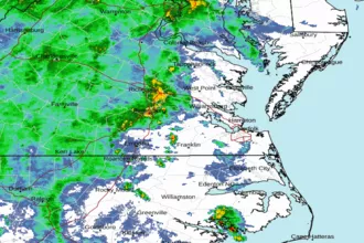 Wakefield Norfolk VA Radar
 Northeast Radar
 East Coast Satellite