Coastal Waters out 25 NM South of Marthas Vineyard and Nantucket Marine Forecast
| Rest Of Tonight...Nw Winds 5 To 10 Kt. Seas 3 To 4 Ft. Wave Detail: S 4 Ft At 7 Seconds And S 4 Ft At 9 Seconds. Scattered Showers. |
| Tue...Nw Winds 5 To 10 Kt, Becoming W With Gusts Up To 20 Kt In The Afternoon. Seas 3 To 4 Ft. Wave Detail: S 4 Ft At 8 Seconds. |
| Tue Night...W Winds 5 To 10 Kt, Becoming N After Midnight. Seas 2 To 4 Ft. Wave Detail: S 4 Ft At 8 Seconds. |
| Wed...Ne Winds 5 To 10 Kt, Becoming E In The Afternoon. Seas 2 To 4 Ft. Wave Detail: S 3 Ft At 7 Seconds And Se 3 Ft At 8 Seconds. |
| Wed Night...Se Winds 5 To 10 Kt. Seas Around 2 Ft. Wave Detail: S 2 Ft At 7 Seconds And Se 2 Ft At 8 Seconds. |
| Thu And Thu Night...E Winds 10 To 15 Kt With Gusts Up To 20 Kt. Seas 2 To 4 Ft. Wave Detail: Se 4 Ft At 6 Seconds. A Chance Of Showers. |
| Fri...E Winds 10 To 15 Kt With Gusts Up To 20 Kt. Seas 3 To 4 Ft. |
| Fri Night Through Sat Night...W Winds 10 To 15 Kt With Gusts Up To 20 Kt. Seas 3 To 4 Ft. A Chance Of Showers. Seas Are Reported As Significant Wave Height, Which Is The Average Of The Highest Third Of The Waves. Individual Wave Heights May Be More Than Twice The Significant Wave Height. |
| Area Forecast Discussion National Weather Service Boston/Norton MA 309am EDT Tuesday April 16 2024 Synopsis High pressure over Southern New England will bring dry weather through mid week. Mild temperatures are on tap for today, but it will be cooler Wednesday along the coast with sea breezes. Isolated to scattered showers across the interior on Thursday with slight cooler than seasonable temperatures. Dry on Friday with high pressure in control. A cold front brings another round of light rain showers late Friday through Saturday. Turning drier Sunday and Monday. Near Term - Until 6pm This Evening 310 AM * Plenty of sunshine & beautiful today with highs mainly 65-70 The last of the scattered showers across the Cape/Islands were in the process of coming to an end early this morning. This in association with a departing shortwave/cold front. Otherwise...dry northwest flow behind this front will result in a beautiful day. Plenty of sunshine is expected with just a bit of fair weather diurnal CU. Given northwest flow in pre-greenup...thinking temps overachieve the guidance by a few degrees. Afternoon highs should top off between 65 and 70. Enough mixing should yield some NW 20-25 mph wind gusts this afternoon...but a very nice mid-April day is in store for the region. Short Term - 6pm This Evening Through 6pm Wednesday Key Points... * Mainly clear tonight with light winds, lows mainly 30s to lower 40s * Filtered sun Wednesday with sea breezes...highs 50s coast & 60s inland Details... Tonight... A ridge of high pressure overhead will result in mainly clear skies, light/calm winds and a very good night of radiational cooling with the dry airmass in place. Overnight low temps will bottom out well down into the 30s across the outlying locations...to between 40 and 45 in some urban centers. Wednesday... Upper level ridge axis approaches from the west on Wednesday. Plenty of sunshine to start will be filtered by some increasing mid/high cloudiness as the day wears along. The mid level trough axis will weaken the pressure gradient sufficiently enough to result in sea breeze development along the coast. This should keep highs in the lower to middle 50s along much of the immediate coast...while further inland across the interior highs will be into the 60s. Long Term - Wednesday Night Through Monday Highlights * Isolated to scattered showers on Thu, mainly across the interior. Temps slightly cooler than seasonable. * Dry for much of Fri with temps returning to seasonable levels. * Cold front brings scattered showers late on Fri through Sat. Mild temps return. * The temp roller coaster continues with a return to near normal temps and dry weather for Sun/Mon. Wednesday Night through Thursday... Will have an omega block situated over eastern Canada, the Great Lakes and Northeast to start the period. The ridge axis will be extend from Long Island into western Quebec Wednesday Night, but a shortwave will be riding the ridge into early Thu. At the same time a trough will lift into the eastern Great Lakes. The trough lifts into Quebec/New England by late Thu. A warm front will lift toward our region during this timeframe, but remains shunted to our SW. Expect increasing chances of isolated to scattered light rain showers across southern New England during this period. Do have some uncertainty on the northeastward extent of the precipitation shield. Deterministic guidance shows this discrepancy via the PWAT (Precipitable Water) plume. The GFS (Global Forecast System) is much more progressive and pushes the 0.75-1" plume to the coastline, whereas the ECMWF/NAM/ICON/UKMET keep these values confined to the interior. In combination with the easterly LLJ am expecting the best shot for showers from roughly central MA to RI westward. Further to the east there could be some isolated hit/miss activity. Really not expecting to eek much of the moisture out given the upper forcing is well off to the NW. Could see perhaps a few hundredths of accumulation. Given the onshore easterly flow did opt to nudge down our temps from the NBM. Appeared to be running just a bit too warm, so went down to the 50th percentile of guidance for now. Highs in the low to mid 50s. Friday through Saturday... Ridge axis slides offshore on Fri. Will get stuck in cyclonic flow later on Fri. A trough will dig across the Great Lakes late Fri and into New England by Sat. The trough may be mostly through by late Sat, but there is some discrepancy on the timing. High pressure builds overhead early on Fri before shifting offshore late in the day. A cold front slides in from the west late on Fri through Sat. Dry and quiet weather expected for much of Fri with high pressure in control. There is some uncertainty with how quickly the front slides in from the west. Think that the NBM could be a tad to fast with the precipitation onset and may actually remain dry through the day. Though far western areas could see showers spread in toward the evening. Main reason for this thinking is the lower levels (1000-850 hPa) are quite dry and should take a bit to moisten. This will appears more likely to happen Fri eve and continue into Sat as the front is sliding through. Fortunately the front is progressive and am not expecting much precipitation as it slides through. Temperatures will return to near normal levels for this time of year on Fri as winds turn southerly. Highs range from the 50s to the low 60s. Better shot for mild readings on Sat as we get into breezy W to WNW flow. The NBM in this case appears a bit too cool, so did bump up our temps a bit due to a well mixed boundary layer. Highs range from the upper 50s to the mid 60s. Sunday and Monday... Still caught under cyclonic flow through this time period. Will have some mid level ridging in place over the Great Lakes and into New England. This should nudge high pressure into our region keeping our weather dry and quiet. The NBM seems reasonable at this point, so haven't deviated for this timeframe. High temps right around seasonable levels. Marine Forecaster Confidence Levels: Low - less than 30 percent. Medium - 30 to 60 percent. High - greater than 60 percent. Today through Wednesday...High Confidence. Weak pressure gradient will keep winds & seas below small craft advisory thresholds through Wednesday. Good mixing over the land may result in some NW 20 knot near shore wind gusts this afternoon. We are also not expecting any issues with visibility/fog given the dry nature of the airmass. Outlook /Wednesday Night through Saturday/... Wednesday Night: Winds less than 25 kt. Isolated rain showers. Thursday through Thursday Night: Winds less than 25 kt. Seas locally approaching 5 ft. Isolated rain showers. Friday: Winds less than 25 kt. Friday Night through Saturday: Winds less than 25 kt. Seas locally approaching 5 ft. Chance of rain showers. NOAA Boston MA Office: Watches - Warnings - Advisories CT...None. MA...None. RI...None. Marine None. |
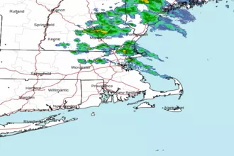 Boston MA Radar
 Northeast Radar
 East Coast Satellite