Delaware Bay south of East Point NJ to Slaughter Beach DE Marine Forecast
| Rest Of Today...E Winds 10 To 15 Kt. Waves Around 2 Ft. |
| Tonight...Se Winds 5 To 10 Kt, Becoming S After Midnight. Waves Around 2 Ft. Scattered Showers After Midnight. Patchy Fog After Midnight With Vsby 1 To 3 Nm. |
| Sat...Nw Winds 5 To 10 Kt. Waves Around 2 Ft. Scattered Showers In The Morning With Vsby 1 To 3 Nm. |
| Sat Night...Nw Winds 10 To 15 Kt. Waves 2 To 3 Ft. |
| Sun...Nw Winds 5 To 10 Kt, Becoming W In The Afternoon. Waves Around 2 Ft In The Morning, Then 1 Foot Or Less. |
| Sun Night...W Winds 5 To 10 Kt. Waves 1 Foot Or Less. |
| Mon...N Winds Around 10 Kt, Becoming W In The Afternoon. Waves 1 Foot Or Less. |
| Mon Night...S Winds 5 To 10 Kt. Waves 1 Foot Or Less. |
| Tue...Se Winds 5 To 10 Kt, Increasing To 10 To 15 Kt In The Afternoon. Waves 1 Foot Or Less, Then Around 2 Ft In The Afternoon. |
| Tue Night...S Winds 10 To 15 Kt. Waves Around 2 Ft. |
| Area Forecast Discussion National Weather Service Mount Holly NJ 919am EDT Fri April 19 2024 Synopsis High pressure near Nova Scotia will continue to shift east today. Meanwhile, an area of low pressure will track through southern Canada as a trailing cold front sweeps across our area tonight. The front will eventually stall along the Southeast coast over the weekend as high pressure builds across the Central Plains. High pressure will build east with time through Tuesday, before another cold front approaches the area Tuesday night into Wednesday. High pressure will then return on Thursday. Near Term - Through Tonight Forecast on track this morning with some low stratus hanging around. Only minor tweaks made. Previous full discussion follows... In the wake of a backdoor cold front, high pressure will remain centered near Nova Scotia and the Gulf of Maine with ridging extending southward across the Mid-Atlantic for Friday. However, an area of low pressure cutting across the Great Lakes will send a cold front across the Appalachians tonight, as that high pressure and ridging quickly gives way. A steep inversion with low clouds trapped across our region along with chilly northeast flow in the boundary layer will result in another generally gloomy day, though as the ridge shifts east, winds will turn more southeasterly, allowing for a little milder air to push in. Additionally, while the day will start off chilly with temperatures in the low to mid 40s for most spots, cloud bases will be noticeably higher along with an absence of any drizzle, compared to the damp conditions Thursday morning. The exception will be right around the Pocono Plateau and some of the adjacent ridgetops into NW NJ early this morning. Highs will reach farther into the 50s, with even some low 60s possible from around Philadelphia southward into the Delmarva. This afternoon as a weak pre-frontal shortwave trough and some isentropic lift combine, scattered light showers will begin to spread eastward across Pennsylvania, with isolated showers possibly reaching the I-95 corridor toward sunset. Scattered showers will then spread eastward across the coastal plain toward midnight, then gradually taper off from west to east, with just some lingering activity along the coast after sunrise on Saturday morning. Rainfall amounts will only be around a tenth of an inch. Some patchy fog may develop at times overnight, but dense fog is not expected. Short Term - Saturday Through Sunday Night The cold front will be located offshore by Saturday morning leaving behind a few showers in its wake, mainly along the coast. All showers will come to an end by late morning giving way to a mix of sun and clouds during the afternoon as high pressure builds over the High Plains. Despite the frontal passage, the front lacks any push of "cold" air, so while drier air follows in its wake, temps on Saturday will be relatively mild and seasonable. Model soundings continue to suggest that our boundary layer will be well-mixed with downsloping WNW surface flow, thus used the 850mb technique to get our high temps on Saturday. Mostly mid to upper 60s with a few spots (especially away from the coast) that may approach 70 degrees. Clear skies are expected for Saturday night with light winds. Will have to monitor the potential for some frost development across N NJ and the Lehigh Valley in which the growing season becomes active. For Sunday, the forecast remains tranquil and dry. High pressure over the Central CONUS will broaden as it extends its ridge axis east. Will have to keep eyes on a stalled boundary along the Southeast Coast on Sunday where an area of low pressure develops along it before moving into the western Atlantic. However, any shower activity is expected to remain south of the Delmarva. Otherwise, just an increase in clouds is expected on Sunday into Sunday night with temperatures running a few degrees below normal. Long Term - Monday Through Thursday High pressure located over the center of the country over the weekend will shift east on Monday before moving south of the area and offshore on Tuesday. At the same time, an area of low pressure will track through the Great Lakes on Tuesday lifting into southern Canada Tuesday night. A trailing cold front associated with the low will bring a chance for some rain showers during the Tuesday night into Wednesday timeframe. Have continued to carry an areawide chance of Probability of Precipitation (30-50%), with a targeted area of likely Probability of Precipitation (up to 60%) across the Poconos and north Jersey. After the frontal passage on Wednesday, another area of high pressure builds over the Midwest allowing dry conditions to return for Thursday. Temperatures during the long term period will be near-normal through Wednesday. Thereafter, temps look to lean below-normal as upper trough settles over the Northeast late in the week. Marine A Small Craft Advisory is in effect currently for all the ocean zones due to elevated seas from stronger NE winds on Thursday and Thursday night. SCA (Small Craft Advisory) conditions are expected on the ocean waters through late tonight as seas around 6-7 ft this morning gradually lower toward 5 ft into tonight. Otherwise, winds are gradually easing this morning, ENE 10-15 kt, tending SE 5-10 kt tonight. Outlook... Saturday through Tuesday Fair weather. No marine headlines expected. Winds up to 20 kt possible on Saturday night. Seas of 2-4 feet through Tuesday. Tides / Coastal Flooding Spotty minor tidal flooding is being observed within some of the back bay communities of Ocean County, NJ and Sussex County, DE. Minor tidal flooding should cease with this high tide cycle within Rehoboth Bay, however some minor tidal flooding remains possible through tomorrow morning around high tide within Barnegat Bay. Tidal flooding is not expected oceanside for any communities. NOAA Mount Holly NJ Office: Watches - Warnings - Advisories PA...None. NJ...None. DE...None. MD...None. Marine Small Craft Advisory until 6am EDT Saturday for ANZ450>455. |
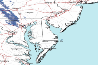
 Dover DE Radar
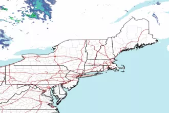
 Northeast Radar