Edisto Beach, SC to Savannah, GA Marine Forecast
| Tonight...S Winds 10 To 15 Kt, Becoming Sw Late. Seas 2 To 3 Ft. Wave Detail: Se 3 Ft At 9 Seconds And S 2 Ft At 4 Seconds. |
| Sat...Sw Winds 5 To 10 Kt. Seas 2 To 3 Ft. Wave Detail: S 2 Ft At 5 Seconds And Se 2 Ft At 8 Seconds. A Slight Chance Of Showers And Tstms In The Afternoon. |
| Sat Night...Sw Winds 5 To 10 Kt, Becoming W After Midnight. Seas 2 To 3 Ft. Wave Detail: S 2 Ft At 5 Seconds And Se 2 Ft At 8 Seconds. Showers Likely With A Chance Of Tstms In The Evening, Then A Chance Of Showers With A Slight Chance Of Tstms After Midnight. |
| Sun...Ne Winds 5 To 10 Kt, Increasing To 10 To 15 Kt In The Afternoon. Seas 2 To 3 Ft. Wave Detail: Ne 2 Ft At 3 Seconds And E 2 Ft At 8 Seconds. A Slight Chance Of Tstms. A Chance Of Showers In The Morning, Then Showers Likely In The Afternoon. |
| Sun Night...N Winds 10 To 15 Kt. Seas 3 Ft. Wave Detail: Ne 2 Ft At 4 Seconds And Se 2 Ft At 8 Seconds. Showers With A Slight Chance Of Tstms. |
| Mon...Ne Winds 15 To 20 Kt With Gusts To 25 Kt. Seas 3 To 4 Ft. Wave Detail: E 4 Ft At 6 Seconds And Se 1 Ft At 12 Seconds. A Chance Of Showers In The Morning, Then A Slight Chance Of Showers And Tstms In The Afternoon. |
| Mon Night...Ne Winds 10 To 15 Kt With Gusts To 20 Kt. Seas 3 To 4 Ft. A Slight Chance Of Showers And Tstms In The Evening, Then A Slight Chance Of Showers After Midnight. |
| Tue...Ne Winds 10 To 15 Kt. Seas 3 To 4 Ft. |
| Tue Night...E Winds 5 To 10 Kt. Seas 3 To 4 Ft. |
| Wed...Sw Winds 5 To 10 Kt. Seas 2 To 3 Ft. |
| Wed Night...Sw Winds 5 To 10 Kt. Seas 2 To 3 Ft. Winds And Seas Higher In And Near Tstms. |
| Area Forecast Discussion National Weather Service Charleston SC 958pm EDT Fri April 19 2024 Synopsis A slow moving front will bring unsettled weather to the region Saturday through early next week. High pressure will then return and prevail into the middle of next week. Near Term - Until 6am Saturday Morning Radar late Friday was still showing the sea breeze, which was through all but far northern Allendale County. It then was curved through the interior counties of Georgia. Between now and about 5 am with the remnants of the sea breeze and the approach of a cold front, there will be isolated showers and a few t-storms. This is most likely across parts of the Charleston quad-county district where the moisture is a little better, and this region is in closer proximity to the cold front. Elsewhere we feel that conditions will stay rainfree. Within a south-southwest synoptic flow and with dew points in the 60s, it'll be a warm night for this time of year. Lows will be mainly in the mid and upper 60s. Short Term - 6am Saturday Morning Through Monday Mid-level ridging will be centered across the southern Gulf of Mexico Saturday with a shortwave over southeast Texas slowly heading east. Across eastern Canada, a longwave trough will slowly translate off the coast with a weak cold front oozing to the south. The first batch of precipitation is forecast to arrive with the shearing out wave (originating from Texas) Saturday afternoon into evening. PWATs (Precipitable Waters) ahead of the wave Saturday are forecast to be around 1.4" along with warm cloud depths around 7kft. Initially, precipitation will likely struggle to hold together across the Low Country due to the dry air. Expect high temperatures in the upper 80s. By 5pm and 8pm showers and thunderstorms will fill in towards the coast Saturday. MLCAPE values are forecast to be around 1000 J/kg which will support thunder across all zones. The wave will then start to exit the coast Sunday morning with precipitation temporarily coming to an end and a weak cold front oozing to the SC coastline. Another wave will then approach the area Sunday afternoon and is slightly more amplified that in previous runs. As this occurs, surface cyclogenesis will occur off the coast of South Carolina in association with the stalled frontal zone. Some global guidance is indicating weak FGEN forcing occurring around 875 MB with the Quantitative Precipitation Forecast field responding by arching back into a slight banded feature. Given that the forcing is weak, most of the area will likely see precipitation Sunday afternoon, but the focus of the Quantitative Precipitation Forecast being towards the Midlands of SC. Expect high temperatures in the 60s interior SC Sunday, and upper 70s forecast over GA (or south of the cold front). Sunday night into Monday, temperatures will fall into the 50s across the region. Latest global guidance continues to struggle with Monday as another mid-level low, potentially rather amplified, will cross the area. The latest run of the GEFS is by far the most amplified, while the GEPS is the least amplified. For now, have introduced Probability of Precipitation into the forecast for Monday to account for this. Long Term - Monday Night Through Friday Strong DAVA will set in across Georgia and South Carolina for Tuesday as a mid-level low pressure exits the region. Temperatures will fall below normal with no precipitation expected. Wednesday into Thursday a strong closed low pressure is forecast to move across the Great Lakes with the core of the DCVA remaining well north of the area. Another cold front is then forecast to cross the area Thursday into Friday. No precipitation is currently expected with this frontal passage either. Marine A modest S to SW flow will continue through tonight as high pressure remains offshore and a cold front drops into the Southeast. Winds will be no higher than 10-15 kt, with 2 or 3 foot seas. Saturday through Wednesday: South to southwest winds will persist Saturday as a cold front slowly oozes towards the coast. Weak surface cyclogenesis will then occur Sunday afternoon with winds turning around from the northeast. Winds will then continue to increase in speed and be sustained 20 to 25 kts with gusts 25 to to 30 kt. The highest probability for Small Craft Advisories appear to be in the Atlantic waters adjacent to Charleston. Expect seas 4 to 6 ft. Winds will start to relax from the northeast Tuesday morning and slowly veer around from the southwest Tuesday afternoon into Wednesday. NOAA Charleston SC Office: Watches - Warnings - Advisories GA...None. SC...None. Marine None. |
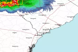 Charleston SC Radar
 Southeast Radar