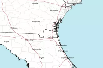
Fernandina Beach to St. Augustine, FL 20 - 60 NM Marine Forecast
| Rest Of Tonight...Southwest Winds 10 To 15 Knots. Seas 3 To 4 Feet With A Dominant Period 8 Seconds. |
| Saturday...West Winds 5 To 10 Knots, Becoming South In The Afternoon. Seas Around 3 Feet With A Dominant Period 8 Seconds. |
| Saturday Night...South Winds Around 10 Knots, Becoming West After Midnight. Seas Around 3 Feet With A Dominant Period 8 Seconds. A Slight Chance Of Showers And Thunderstorms In The Evening. |
| Sunday...Southwest Winds Around 10 Knots. Seas Around 3 Feet With A Dominant Period 8 Seconds. A Chance Of Showers With A Slight Chance Of Thunderstorms In The Afternoon. |
| Sunday Night...Northwest Winds 10 To 15 Knots. Seas 3 To 4 Feet With A Dominant Period 8 Seconds. Showers Likely. A Chance Of Thunderstorms, Mainly In The Evening. |
| Monday...North Winds 10 To 15 Knots, Increasing To 15 To 20 Knots In The Afternoon. Seas 4 To 6 Feet With A Dominant Period 7 Seconds. A Chance Of Showers With A Slight Chance Of Thunderstorms. |
| Monday Night...North Winds 15 To 20 Knots. Seas 5 To 7 Feet With A Dominant Period 7 Seconds. A Slight Chance Of Thunderstorms. A Chance Of Showers, Mainly In The Evening. |
| Tuesday...Northeast Winds 15 To 20 Knots, Diminishing To 10 To 15 Knots In The Afternoon. Seas 5 To 7 Feet. |
| Tuesday Night...Northeast Winds 5 To 10 Knots. Seas 4 To 6 Feet. |
| Wednesday...North Winds 5 To 10 Knots, Becoming East In The Afternoon. Seas 3 To 4 Feet. |
| Wednesday Night...Southeast Winds Around 10 Knots, Becoming Southwest After Midnight. Seas 3 To 4 Feet. Winds And Seas Higher In And Near Thunderstorms. |
| Area Forecast Discussion National Weather Service Jacksonville FL 709pm EDT Fri April 19 2024 Near Term Issued at 323pm EDT Fri April 19 2024 For the latest NE FL and SE GA Daily Key Messages please visit: https://www.weather.gov/media/jax/briefings/nws-jax-briefing.pdf Unseasonably warm conditions continue under the influence of a dominating upper ridge. Temperatures continue to rise through the 80s and will challenge daily records across the region as peak temps read near 90F (daily records in the climate section below). Otherwise fair weather reigns across NE FL and SE GA as abnormally warm temperatures drive a stubborn Atlantic sea breeze inland, which should reach the I-95 corridor before dissipating this evening. There is an outside chance of sprinkle north of Jacksonville along the SE GA coast this afternoon as better moisture, characterized by a cumulus Field, exists across GA. Fair conditions continue into tonight as thin cirrus pushes through the ridge flow and a weakening front approaches from the northwest. The primary focus tonight and early Saturday will an advective low stratus and fog event emanating from the Big Bend. Areas could become locally dense by sunrise Saturday, particularly across the Suwannee River valley and I-75 corridor, and it may require Dense .SHORT TERM... (Saturday through Monday night) Issued at 323pm EDT Fri April 19 2024 Early morning fog will begin to clear during the early daylight hours on Saturday. By the afternoon, an increase in moisture over southeast Georgia from the approaching frontal boundary will bring scattered showers and chances for isolated thunderstorms. A Marginal risk of severe storms over northern southeast Georgia due to strong daytime heating and an increase in moisture, resulting in an unstable air mass, in which some isolated damaging wind gusts may occur as storms develop. Come Sunday, the cold front will begin to move through the area, with widespread showers and isolated storms expected. Instability is not expected to be as strong as Saturday, which will limit the the potential for any severe storms. As the cold front lingers over north central Florida, showers and isolated storms will remain for most of the day on Monday, clearing out by the overnight hours into Tuesday. Above normal temperatures during the weekend, as SE GA and NE FL will see highs the upper 80s to lower 90s Saturday. Sunday will be a few degrees cooler, with highs in the mid to upper 80s across NE FL, and upper 70s to mid 80s across SE GA depending on the front's position. .SHORT TERM... (Saturday through Monday night) Issued at 323pm EDT Fri April 19 2024 Early morning fog will begin to clear during the early daylight hours on Saturday. By the afternoon, an increase in moisture over southeast Georgia from the approaching frontal boundary will bring scattered showers and chances for isolated thunderstorms. A Marginal risk of severe storms over northern southeast Georgia due to strong daytime heating and an increase in moisture, resulting in an unstable air mass, in which some isolated damaging wind gusts may occur as storms develop. Come Sunday, the cold front will begin to move through the area, with widespread showers and isolated storms expected. Instability is not expected to be as strong as Saturday, which will limit the the potential for any severe storms. As the cold front lingers over north central Florida, showers and isolated storms will remain for most of the day on Monday, clearing out by the overnight hours into Tuesday. Above normal temperatures during the weekend, as SE GA and NE FL will see highs the upper 80s to lower 90s Saturday. Sunday will be a few degrees cooler, with highs in the mid to upper 80s across NE FL, and upper 70s to mid 80s across SE GA depending on the front's position. Long Term (Tuesday through next Friday) Issued at 323pm EDT Fri April 19 2024 High pressure will begin to build into the region in the cold front's wake, leading to dry weather becoming established through the remainder of the week. Temperatures will gradually warm through the upcoming week, with daytime Highs primarily in the mid 70s on Tuesday, rising to the 80s by midweek, and finally reaching again into the lower 90s by Thursday. Marine Issued at 323pm EDT Fri April 19 2024 Weak high pressure ridging continues with prevailing offshore flow over local waters. Nearshore waters will experience a wind shift toward shore this afternoon as the sea breeze develops. A weak cold frontal approaches from the north Saturday, stall along the Florida Georgia state line, and accelerated southward Sunday through Monday. Scattered thunderstorms will accompany the frontal passage this weekend. A low end surge of northeast winds will follow behind the front Monday then weaken and turn onshore Tuesday and Wednesday as high pressure then builds across area waters once again. RIP CURRENTS: Moderate risk of rip currents will be present through the weekend, particularly during the afternoon hours with sea breeze development. NOAA Jacksonville FL Office: Watches - Warnings - Advisories FL...None. GA...None. AM...None. |
 Jacksonville Radar
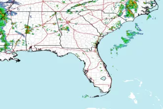
 Southeast Radar