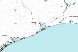
High Island to Freeport, TX Marine Forecast
| Today...Southeast Winds Around 10 Knots. Seas 2 To 3 Feet. |
| Tonight...Southeast Winds 10 To 15 Knots. Seas 2 To 3 Feet. |
| Wednesday...Southeast Winds Around 10 Knots, Increasing To 10 To 15 Knots Late. Seas Around 2 Feet. |
| Wednesday Night...Southeast Winds 10 To 15 Knots. Seas 2 To 3 Feet. |
| Thursday...Southeast Winds 10 To 15 Knots. Seas 2 To 3 Feet. |
| Thursday Night...Southeast Winds Around 20 Knots, Increasing To 20 To 25 Knots After Midnight. Seas 3 To 5 Feet. |
| Friday...South Winds 20 To 25 Knots. Seas 4 To 6 Feet With Occasional Seas Up To 8 Feet. |
| Friday Night...Southeast Winds Around 20 Knots. Seas 4 To 6 Feet With Occasional Seas Up To 8 Feet. |
| Saturday...Southeast Winds Around 20 Knots. Seas 5 To 7 Feet With Occasional Seas Up To 9 Feet. |
| Saturday Night...Southeast Winds Around 20 Knots. Seas 5 To 7 Feet With Occasional Seas Up To 9 Feet. |
| Area Forecast Discussion National Weather Service Houston/Galveston TX 1230pm CDT Tuesday April 23 2024 Long Term (Thursday through Monday) Issued at 357am CDT Tuesday April 23 2024 Summer creeps closer and closer during the long term as persistent southerly flow at the surface and southwesterly flow aloft bringing increasing temperatures and humidity. Afternoon high temperatures will be in the low to mid 80s on Thursday, mainly mid 80s on Friday, and then upper 80s Saturday through Monday. Dew points will be in the upper 60s to low 70s through the long term thanks to that moist, southerly flow, leading to heat indicies will be rising into the low 90s by Saturday. bleh. Overnight lows will see a similar warming trend with minimum temperatures upper 60s to low 70s Thursday night becoming low to mid 70s by the weekend. The upper level ridge overnight will begin to break down on Friday allowing for some short wave to pass through the Southern Plains through the weekend. Main impact to SE Texas will be increased cloudiness, but can't out rule some isolated showers or storms making their way into the northern third (generally north of Conroe) over the weekend into early next week. Marine Issued at 357am CDT Tuesday April 23 2024 Light onshore flow and low seas will continue through Thursday. The onshore flow begins to strengthen Thursday night into Friday morning ahead of some approaching weak disturbances. The winds will strengthen to around 15-25kts with occasion higher gusts, so small craft may will likely need to exercise caution as early as Thursday night and Small Craft Advisories may be needed heading into the weekend. The increase in winds will also lead to an increase in seas to around 5 to 8 feet. Conditions improve into next week as high pressure build overhead. NOAA Houston/Galveston TX Office: Watches - Warnings - Advisories TX...None. GM...None. |
 Houston/Galveston TX Radar
 Gulf Radar