Intracoastal City to Cameron, LA 20 - 60 NM Marine Forecast
| Today...East Winds 5 To 10 Knots. Seas 2 To 3 Feet. |
| Tonight...Southeast Winds 5 To 10 Knots, Becoming Northeast 10 To 15 Knots After Midnight. Seas 2 To 3 Feet. Showers Likely With A Slight Chance Of Thunderstorms After Midnight. |
| Sunday...Northeast Winds 20 To 25 Knots With Gusts Up To 30 Knots. Seas 4 To 6 Feet, Occasionally To 8 Feet. Showers Likely With A Slight Chance Of Thunderstorms In The Morning, Then A Slight Chance Of Showers In The Afternoon. |
| Sunday Night...Northeast Winds 20 To 25 Knots With Gusts Up To 30 Knots. Seas 5 To 6 Feet, Occasionally To 8 Feet. |
| Monday...Northeast Winds 20 To 25 Knots, Diminishing To 10 To 15 Knots In The Afternoon. Seas 4 To 6 Feet, Occasionally To 8 Feet. |
| Monday Night...East Winds Around 10 Knots. Seas 2 To 3 Feet. |
| Tuesday...Southeast Winds Around 10 Knots. Seas Around 2 Feet. |
| Tuesday Night...Southeast Winds Around 10 Knots. Seas Around 2 Feet. |
| Wednesday...East Winds Around 10 Knots. Seas Around 2 Feet. |
| Wednesday Night...Southeast Winds 10 To 15 Knots. Seas Around 2 Feet. Winds And Seas Higher In And Near Thunderstorms. |
| Area Forecast Discussion National Weather Service Lake Charles LA 656am CDT Sat April 20 2024 .SHORT TERM... (Today through Monday night) Issued at 428am CDT Sat April 20 2024 Rain chances will remain generally limited early today, although a few light showers cannot be ruled out. Broad ascent will begin to develop later today as the shortwave trough moves into TX, with convection forming and spreading into SE TX during the afternoon. Convection will continue to spread east across the area during the evening and overnight hours as more robust lift accompanies the trough as it moves into the region. The frontal boundary will slowly meander south, and most of the convection that develops should remain elevated to the north side of the boundary. Severe parameters (lapse rates, instability) appear greatest this afternoon, but the better support for deep convection will be focused west of the area. However, an isolated strong storm capable of strong winds or isolated hail could slip into our SE TX counties before weakening late this afternoon or early evening. Otherwise, forecast soundings show increasing deep layer shear developing during the evening and overnight as a midlevel speed max translates over the area. This should be sufficient to support updrafts capable of producing thunder, but lapse rates and instability appear too limited to generate stronger storms with the arrival of the disturbance aloft. The risk for heavy rainfall and possible isolated to widely scattered instances of flash flooding continues to be the primary hazard tonight into early Sunday. Moisture will be plentiful with PWATs (Precipitable Waters) increasing to 1.7-1.8 inches (well above the 90th percentile and close to the seasonal maximum). Storms will be capable of producing heavy rainfall with high precipitation rates. While convection should be fairly progressive, there is the potential for some training as storms track along and just north of the quasi-stationary surface boundary. The axis of highest Quantitative Precipitation Forecast remains oriented from SE TX north of the Houston metro northeast across N LA, but any deviation southward would place these higher amounts of 2+ inches into our region (where heavy rainfall occurred last week). The latest WPC ERO for Day 1 now paints areas northwest of a line from Alexandria to Sour Lake in a SLGT risk (level 2 out of 4) for excessive rainfall, with a MRGL (level 1 out of 4) elsewhere with the exception of the Acadiana region. At this point, have opted not to issue a Flash Flood Watch for our parishes and counties in the SLGT risk area as deterministic NBM Quantitative Precipitation Forecast remains relatively low (storm totals between 1-1.5 inches across our northern tier of zones), while CAM guidance and HREF probs for 2+ inch amounts suggest an isolated risk. Convection will shift east across the area by Sunday morning, with rain chances tapering off from west to east through the afternoon as the trough moves east of the lower MS Valley. This trough, along with a northern stream shortwave digging southeast in its wake, will help propel the front offshore and allow much cooler high pressure to build into the region. This will lead to some brisk northeast winds on Sunday, while lingering cloud cover and decent Cold Air Advection will keep high temperatures in the middle to upper 60s across all but the immediate coast. Some of the coolest temperatures of the period will occur Sunday night into Monday morning as the ridge axis slides over the region, with lows falling into the lower 40s across central LA, and to around 50 degrees along the I-10 corridor. Dry weather will prevail into the early part of the workweek, with temperatures expected to rebound into the 70s Monday afternoon under mostly sunny skies. 24 Long Term (Tuesday through Saturday) Issued at 428am CDT Sat April 20 2024 The long-term forecast will start with the region firmly under the influence of high pressure. After the passage of the cold front on Sunday, cold air advection will push a continental airmass into our region. This will lead to slightly cooler than average temperatures on Tuesday, with highs in the upper 70s and lows still in the 50s. For those who enjoy cooler weather, enjoy it while it lasts. On Wednesday, our winds will have flipped, and warm, moist Gulf air will be pulled north across the southeastern US. Winds will remain onshore for the rest of the forecast period, and we will see robust moisture return with our PWATs (Precipitable Waters) going from the bottom 10th percentile on Tuesday to the 75th percentile by Thursday. Temperatures will also rise, with highs in the mid- to upper-80s for the rest of the forecast period. Low will also rise, reaching the 70s by midweek. A few weak short-wave troughs will increase rain chances throughout the week, but not by much, with Probability of Precipitation staying below 30%. This week, we could start to see the return of diurnally driven showers and thunderstorms. 14/Slaughter Marine Issued at 442am CDT Sat April 20 2024 Light to moderate east to southeast winds can be expected today, as a weak frontal boundary meanders slowly south over the region. Showers and a few thunderstorms will increase tonight into Sunday as a disturbance aloft moves into the area. The front will move offshore by early Sunday, with strong offshore winds developing in its wake Sunday morning and continue into early Monday before diminishing. Small Craft Advisories are expected to be in effect during this timeframe. Winds will diminish through the day Monday, with onshore flow redeveloping by Tuesday as surface high pressure moves over the eastern seaboard. 24 NOAA Lake Charles LA Office: Watches - Warnings - Advisories LA...None. TX...None. GM...None. |
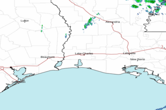 Lake Charles LA Radar
 Gulf Radar