Laguna Madre from Port Mansfield to Baffin Bay Marine Forecast
| Rest Of Today...Southeast Winds 15 To 20 Knots Increasing To 20 To 25 Knots This Afternoon. Choppy On The Bay Becoming Rough This Afternoon. |
| Tonight...Southeast Winds 20 To 25 Knots Decreasing To 15 To 20 Knots After Midnight. Rough On The Bay Becoming Choppy After Midnight. |
| Friday...Southeast Winds 20 To 25 Knots With Gusts Up To 30 Knots. Rough On The Bay. |
| Friday Night...Southeast Winds 20 To 25 Knots With Gusts Up To 30 Knots Decreasing To 15 To 20 Knots After Midnight. Rough On The Bay Becoming Choppy After Midnight. |
| Saturday...Southeast Winds 15 To 20 Knots Increasing To 20 To 25 Knots In The Afternoon. Gusts To 35 Knots. Choppy On The Bay Becoming Rough In The Afternoon. |
| Saturday Night...Southeast Winds 20 To 25 Knots With Gusts Up To 35 Knots. Rough On The Bay. |
| Sunday...Southeast Winds 20 To 25 Knots With Gusts Up To 30 Knots Decreasing To Around 15 Knots In The Afternoon. Rough On The Bay Becoming A Moderate Chop In The Afternoon. |
| Sunday Night...Southeast Winds 10 To 15 Knots. A Moderate Chop On The Bay. |
| Monday...Southeast Winds 10 To 15 Knots. A Moderate Chop On The Bay. A Slight Chance Of Showers And Thunderstorms In The Afternoon. |
| Monday Night...Southeast Winds 10 To 15 Knots. A Moderate Chop On The Bay. A Chance Of Showers And Thunderstorms, Mainly In The Evening. Winds And Waves Higher In And Near Thunderstorms. |
| Area Forecast Discussion ...UPDATED National Weather Service Brownsville TX 1159am CDT Thu April 25 2024 Long Term (Friday night through Wednesday) Issued at 341am CDT Thu April 25 2024 Key Messages: * Breezy to windy conditions continue Friday night into Sunday; wind gusts up to 40 mph out of the southeast are possible. * Adverse marine conditions are expected to continue into Monday. * Low grade (20-30%) or isolated chances for showers and storms are possible Monday - Wednesday ght. The long-term forecast period will feature mostly dry conditions over the local CWA. There will be the chance for some low grade/isolated (20-30% PoPs) chances for showers and thunderstorms to develop each day/night from Monday - Wednesday ght. Areas west of I-69C and over the northern Ranchlands will have the best chance to see showers and thunderstorms as forecast models are signaling for storms to develop over the mountains of north-central Mexico and a frontal boundary stalling out just to our north. Chances for storms will depend on if and how far east the storms that form over mountains translate east and how far south a frontal boundary to our north sags south. Greatest confidence as far as timing currently is Tuesday/Tuesday night. Other than that, expect for a continuation of dry weather over the area with warm to very warm temperatures and increased humidity levels. Winds will remain a factor Friday night into Sunday amid a tight pressure gradient over the region. Forecast models are suggesting low level jet (LLJ) 850 mb winds ranging between 30-45 kts during this time period. Couple this with local topographic enhancements and wouldn't be surprised for wind gust to reach Wind Advisory criteria (especially Saturday night). Daytime high temperatures are expected to range from the upper 80s to mid 90s each day. Overnight lows are expected to be in the 70s. Marine Issued at 341am CDT Thu April 25 2024 Today through Friday While conditions will start out favorable, the tightening pressure gradient between a developing low near the Rockies and high pressure over the Gulf, will see winds and seas become elevated by this afternoon resulting in hazardous conditions. A Small Craft Advisory is in effect for the Laguna Madre and nearshore Gulf waters through tonight. While conditions for the offshore Gulf waters look to remain under criteria for a Small Craft Advisory since the winds don't stay strong enough or have enough presence at this current point, Small Craft Should Exercise Caution for the offshore Gulf waters as the seas will be adverse. Friday Night through Wednesday Night....Breezy to windy conditions from a strong pressure gradient will result in continued adverse marine conditions Friday evening into the early parts of next week. Small Craft conditions are likely Friday night through Sunday night and possibly into Monday especially over the Gulf Waters. Marine conditions will look to improve Monday night into Wednesday of next week with light to moderate winds returning. NOAA Brownsville TX Office: Watches - Warnings - Advisories TX...High Rip Current Risk through Friday evening for TXZ451-454-455. GM...Small Craft Advisory until 7pm CDT Friday for GMZ130-132-135- 150-155-170-175. |
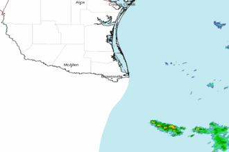 Brownsville TX Radar
 Gulf Radar