Laguna Madre from the Arroyo Colorado to Port Mansfield, TX Marine Forecast
| Rest Of Tonight...Southeast Winds 15 To 20 Knots. Choppy On The Bay. |
| Tuesday...Southeast Winds 15 To 20 Knots. Gusts To 30 Knots In The Afternoon. Choppy On The Bay. |
| Tuesday Night...Southeast Winds 15 To 20 Knots Decreasing To 10 To 15 Knots After Midnight. Choppy On The Bay Becoming A Moderate Chop After Midnight. |
| Wednesday...Southeast Winds 5 To 10 Knots Increasing To 10 To 15 Knots In The Afternoon. Light Chop On The Bay Becoming A Moderate Chop In The Afternoon. Patchy Dense Fog In The Afternoon. |
| Wednesday Night...Southeast Winds 10 To 15 Knots. A Moderate Chop On The Bay. |
| Thursday...Southeast Winds 10 To 15 Knots Increasing To 15 To 20 Knots In The Afternoon. A Moderate Chop On The Bay Becoming Choppy In The Afternoon. |
| Thursday Night...Southeast Winds 10 To 15 Knots. A Moderate Chop On The Bay. |
| Friday...Southeast Winds 10 To 15 Knots. A Moderate Chop On The Bay. |
| Friday Night...Southeast Winds 10 To 15 Knots. A Moderate Chop On The Bay. |
| Saturday...Southeast Winds 10 To 15 Knots. A Moderate Chop On The Bay. |
| Saturday Night...Southeast Winds 10 To 15 Knots. A Moderate Chop On The Bay. A Slight Chance Of Showers And Thunderstorms. Winds And Waves Higher In And Near Thunderstorms. |
| Area Forecast Discussion National Weather Service Brownsville TX 231am CDT Tuesday April 16 2024 ...New SHORT TERM, LONG TER Marine .SHORT TERM... (Today through Wednesday) Issued at 227am CDT Tuesday April 16 2024 500 mb high pressure will continue to be the dominant feature influencing Deep South Texas and the Rio Grande Valley during the period, which will produce dry weather across the BRO CWFA. Meanwhile, well above normal daytime highs and overnight lows for this time of year will also occur. This will be especially true today, as the approach of a weak cold front produces a downsloping effect off of the high terrain of neighboring Mexico. Finally, wind and sea conditions will result in a HIGH RISK of rip currents at the local beaches today and until around sunrise Wednesday. Long Term (Wednesday night through Monday) Issued at 227am CDT Tuesday April 16 2024 Storm Prediction Center places the upper RGV/Rio Grande Valley Plains in a general thunderstorm outlook Wednesday night. The NBM has brought in low end convective chances, just enough to show up in the forecast. Unstable southwest mid-level flow ahead of NW Mexico short wave trough will trigger overnight Sierra Madre Oriental convection, some of which could drift into the upper RGV. Otherwise, a bit of coastal and inland fog will be possible Wednesday night. The upper Rio Grande Valley is again in the Storm Prediction Center general thunderstorm outlook for Thursday afternoon/evening. The cause looks similar to that of Wednesday night. A weak signal is back again Friday evening. The upstream trough will lose definition, becoming simple perturbations moving through the flow, but the time of year is right for the Sierra Madre based convection. Aside from the low end thunderstorm threat to the west this week, not much else will be going on until the weekend. Until then see a mix of clouds and sun along with moderate winds and warmer than average temperatures. The next good opportunity for convection will be on Saturday and Sunday. Unleashed by a Plains high pressure outbreak, a cold front will push south into the CWA (County Warning Area) on Saturday. The mid level flow will again advertise ripples of energy from the southwest at the base of a tough over the southern Plains. The result will be a chance of showers and thunderstorms along the front, increasing in coverage Saturday night through Sunday, with chances lingering into Monday. Winds will shift to northeast Sunday morning, becoming moderate. Some clearing should occur Monday afternoon. The cooler air behind the front should drop temps down from above normal to near normal Sunday and Monday, but expect a mild rebound on Tuesday as high pressure shifts east. Rain amounts overall will probably not be impressive, measuring in tenths of inches, which could be generous. Marine Issued at 227am CDT Tuesday April 16 2024 Today through Wednesday...A Small Craft Advisory will remain in effect for the Gulf of Mexico waters from 0 to 60 nautical miles offshore until noon today. Meanwhile, Small Craft Should Exercise Caution is likely on the Laguna Madre. Afterwards, Small Craft Should Exercise Caution will likely be needed for the remainder of the forecast period for the Gulf of Mexico waters, with more moderate winds for the Laguna Madre. Wednesday night through Saturday night...High pressure across the Gulf of Mexico will support moderate southeast winds and moderate seas through Saturday. A weak cold front is forecast to move offshore the lower Texas coast Saturday night to Sunday morning, bringing moderate to fresh northeast winds and a slight chance to chance of shower with a few included thunderstorms. NOAA Brownsville TX Office: Watches - Warnings - Advisories TX...High Rip Current Risk through Wednesday morning for TXZ451-454- 455. GM...Small Craft Advisory until noon CDT today for GMZ150-155-170-175. |
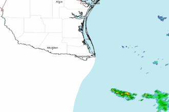 Brownsville TX Radar
 Gulf Radar