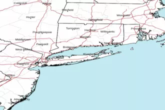
Long Island Sound West of New Haven CT / Port Jefferson NY Marine Forecast
| Tonight...S Winds 5 To 10 Kt, Becoming Nw Late. Seas 1 Ft Or Less. |
| Fri...Ne Winds Around 5 Kt, Becoming Se In The Afternoon. Seas 1 Ft Or Less. |
| Fri Night...S Winds 5 To 10 Kt. Seas 1 Ft Or Less. |
| Sat...S Winds Around 5 Kt, Increasing To 10 To 15 Kt With Gusts Up To 20 Kt In The Afternoon. Seas 1 Ft Or Less, Then 1 To 2 Ft In The Afternoon. Wave Detail: S 1 Ft At 2 Seconds. |
| Sat Night...S Winds 10 To 15 Kt. Seas Around 2 Ft In The Evening, Then 1 Ft Or Less. Wave Detail: Sw 1 Ft At 2 Seconds. Slight Chance Of Showers After Midnight. |
| Sun...Sw Winds 10 To 15 Kt. Seas 1 Ft Or Less. Wave Detail: Sw 1 Ft At 2 Seconds. |
| Sun Night...S Winds 5 To 10 Kt, Becoming W After Midnight. Seas 1 Ft Or Less. |
| Mon...N Winds 5 To 10 Kt. Seas 1 Ft Or Less. |
| Mon Night...Se Winds 5 To 10 Kt. Seas 1 Ft Or Less. |
| Tue...Se Winds 5 To 10 Kt. Seas 1 Ft Or Less. Chance Of Showers. |
| Tue Night...Sw Winds 5 To 10 Kt. Seas 1 Ft Or Less. Chance Of Showers. |
| Area Forecast Discussion National Weather Service New York NY 334pm EDT Thu April 25 2024 Synopsis Strong high pressure building in through tonight will remain over the region into Saturday. The high will give way to an approaching warm front Saturday night. A warm front lifts north of the area Saturday night into Sunday morning followed by high pressure through Monday. A cold front approaches Tuesday and moves across the region Tuesday night. Another cold front may pass through late Wednesday or next Thursday. .NEAR TERM /UNTIL 7am FRIDAY MORNING/... Northern stream trough remains over northern New England/SE CT tonight, with Canadian high pressure building in from the northwest through tonight. Synoptically aided SE breeze front will continue to push inland through early evening, before weakening. Ideal radiational cooling conds tonight with fresh Canadian airmass, clear skies, and light winds. Lows in the upper 20s to around freezing for interior of NE NJ, LoHud, and S CT, and pine barrens of LI where freeze warnings have been posted. Frost conditions for all but NYC/NJ metro and immediate surroundings tonight with lows in the mid 30s. Lows around 40 for NYC/NJ metro. .SHORT TERM /7am FRIDAY MORNING THROUGH SATURDAY/... Northern stream shortwave trough gradually slides east on Friday, with upper ridging building in from the west Fri Night into Saturday. At the same time, good agreement in a vigorous closed upper low over the northern plains on Friday shearing into Ontario on Saturday. At the surface, the center of Canadian high pressure builds over the area Friday morning and sinks south of the region late Friday into Saturday. Unseasonably cool airmass remains over the region on Friday with light northerly flow giving way to aggressive afternoon sea breeze development once again. Despite plentiful sunshine and deep mixing, 850 temps just below freezing will only have temps topping in the upper 50s to around 60 (several degrees below seasonable). Another night of good radiational cooling conds Fri Night, although with a slightly moderated and moistened airmass, temps should be a few degrees warmer than tonight. Will likely have temps dropping into the lower to mid 30s with frost conditions across interior of NE NJ, LoHud, and S CT, and pine barrens of LI. Continued moderation of airmass on Saturday with strengthening return flow around high pressure to the SE and approaching warm front to the west. Strong sea breeze signature will likely push maritime airmass well inland and keeping temps several degrees below seasonable once again (upper 50s to around 60) for much of the coastal plain. In addition, increasing high clouds streaming in ahead of approaching warm front and over the top of the ridge axis will likely filter sunshine in the afternoon. Appears any light precipitation should stay west of the region during the day though. Long Term - Saturday Night Through Thursday Main story to start the long term will be anomalously strong ridging making its way over the eastern US Sunday into Monday before potentially breaking down Tuesday. A few shortwaves likely pass across the northeast Tuesday night into Thursday. The modeling is in good agreement through Monday on the larger scale pattern before timing/amplitude differences arise Tuesday through the middle of next week. *Key Points* *Mainly dry conditions expected with a few low chances of showers both Saturday night/early Sunday and then again Tuesday into Tuesday night. *A warming trend is likely to begin on Sunday and continue into Monday with temperatures potentially reaching 10-15 degrees above normal Monday, especially away from the immediate coast. *Temperatures remain above normal Tuesday through next Thursday. A warm front lifts over the area Saturday night and should end up north Sunday morning. Heigheights aloft are rising through this time frame and lift is weak. A few showers are possible with the front, especially across the interior Saturday night. The continuation of the building ridge over the eastern states on Sunday will likely result in at least partial clearing through the day. A SW flow develops behind the passage of the warm front allowing temperatures to warm significantly compared to recent days. There is a significant amount of spread in high temperatures for Sunday, especially for locations away from the immediate coast. For some of the warmer locations the NBM deterministic actually falls below the 25th to 75th percentile of the ensemble. There should be enough clearing along with building heigheights aloft and little onshore flow influence for temperatures to end up on the higher side. Have decided to blend in the NBM 50th percentile for now away from the coast which yields highs middle to upper 70s. The 75th percentile of the NBM indicates temperatures could reach or exceed 80 degrees. Onshore flow over Long Island and southern CT likely holds temperatures in the 60s with some locations potentially close to 70 degrees. The ridge axis will be overhead on Monday. Strong subsidence will likely lead to even warmer temperatures compared to Sunday. The NBM deterministic is near the 25th percentile with much of the spread on the warmer side of the warmer side of the ensemble. Have once again blended in the NBM 50th percentile for the NYC metro, NE NJ, and Lower Hudson Valley/interior SW CT. The flow is weak during the first half of the day, but sea breezes should develop in the afternoon. Forecast highs range from the lower to middle 80s in the warmer spots to the upper 60s to middle 70s near the coast. High temperatures spread only increases further on Tuesday. For example at KEWR, the 25th percentile is 71 and 75th percentile is 87 degrees. Given that this is next Tuesday, have gone close to the NBM deterministic for now (60s east and lower to middle 70s west). The warmer highs in the ensemble spread could easily be realized away from the coast if the front is slower and ridge does not break down as quickly. The aforementioned cold front swings through sometime late Tuesday or Tuesday night. A few showers and potentially a thunderstorm could accompany the frontal passage. The CSU MLP has been indicating a very low probability for a severe thunderstorm with this front during its last few cycles. Confidence is very low with any convection at this time range. Confidence is also low in sensible weather details for Wednesday and Thursday and have followed the NBM deterministic. Marine Winds and seas will remain below advisory levels through early next week. Coastal jet development Sat after could have marginal SCA (Small Craft Advisory) wind gusts (20-25kt) for ocean waters and nearshore around the entrance to NY Harbor. Warmer air moving over the colder ocean early next week could develop fog, but it is much too early for any specific details and timing and extent. Hydrology No hydrologic concerns through the middle of next week. NOAA New York NY Office: Watches - Warnings - Advisories CT...Freeze Warning from 2am to 8am EDT Friday for CTZ005>008-012. Frost Advisory from 2am to 8am EDT Friday for CTZ009>011. NY...Freeze Warning from 2am to 8am EDT Friday for NYZ067>070-079- 081. Frost Advisory from 2am to 8am EDT Friday for NYZ078-080. NJ...Freeze Warning from 2am to 8am EDT Friday for NJZ002. Frost Advisory from 2am to 8am EDT Friday for NJZ004-103-105- 107. Marine None. |
 New York Radar
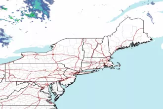
 Northeast Radar
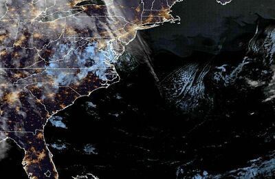
 East Coast Satellite