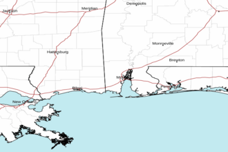
Mississippi Sound GMZ632 Marine Forecast
| This Afternoon...South Winds 5 To 10 Knots. Waves 1 Foot Or Less. |
| Tonight...South Winds 5 To 10 Knots. Waves 1 Foot Or Less. Patchy Fog After Midnight. |
| Friday...Southwest Winds Around 5 Knots, Becoming South In The Afternoon. Waves 1 Foot Or Less. Patchy Fog In The Morning. |
| Friday Night...Southwest Winds 5 To 10 Knots. Waves 1 Foot Or Less. |
| Saturday...West Winds Around 5 Knots, Becoming South In The Afternoon. Waves 1 Foot Or Less. A Slight Chance Of Showers And Thunderstorms In The Afternoon. |
| Saturday Night...South Winds 5 To 10 Knots, Becoming Northeast After Midnight. Waves 1 Foot Or Less. |
| Sunday...North Winds 5 To 10 Knots, Increasing To 10 To 15 Knots In The Afternoon. Waves 1 Foot Or Less. A Chance Of Showers With A Slight Chance Of Thunderstorms In The Morning, Then Showers Likely With A Chance Of Thunderstorms In The Afternoon. |
| Sunday Night...North Winds 15 To 20 Knots. Waves Around 2 Feet. |
| Monday...North Winds 10 To 15 Knots, Diminishing To 5 To 10 Knots In The Afternoon. Waves Around 2 Feet. |
| Monday Night...North Winds 5 To 10 Knots, Becoming East After Midnight. Waves 1 Foot Or Less. Winds And Waves Higher In And Near Thunderstorms. |
| Area Forecast Discussion National Weather Service Mobile AL 401pm CDT Thu April 18 2024 ...New NEAR TERM, SHORT TERM, LONG TER Marine .NEAR AND SHORT TERM... (Now through Saturday night) Issued at 401pm CDT Thu April 18 2024 Weak shortwave ridging embedded within zonal flow aloft continues to extend across the north central Gulf Coast region this afternoon. A surface ridge of high pressure also continues to nose westward across the Florida peninsula and eastern Gulf of Mexico this afternoon. The combination of weak ridging aloft and moist southerly surface flow is allowing for warm and humid conditions across our region. Skies remain mostly cloudy this afternoon with abundant mid/upper level moisture spreading overhead. A few lower level cloud decks are also persisting along the coast. The main weather impact of concern tonight will be the potential for patchy to areas of fog development, especially after midnight as light S/SW flow continues to bring rich low level moisture with dewpoints in the upper 60s to around 70 degrees into the area, while mid/upper level decks potentially decrease in coverage somewhat late. SREF probabilities of visibility less than a mile continue to increase, with some of the CAMs showing decent coverage of fog, some potentially locally dense, across central and southern portions of the forecast area. We have mention of patchy to areas of fog overnight into early Friday morning and will let later shifts assess visibility trends for possible advisory issuance. Fog should lift by 9am or so with another warm and humid day expected on Friday. A surface cold front should move into central portions of MS and into northwest AL by Friday afternoon before potentially entering or stalling over our far northern zones Friday night. Weak shortwave impulses embedded within zonal flow aloft may provide enough ascent to bring a small chance of light rain showers or possibly a thunderstorm over our far northern CWA (County Warning Area) Friday afternoon and evening ahead of this feature. Another round of patchy to areas of fog development will be possible again across much of our region Friday night. The surface boundary may push a little further south into interior portions of our area on Saturday. Increased deep layer moisture and ascent in association with a series of shortwave impulses should allow for more scattered coverage of showers and perhaps a few thunderstorms, especially over interior areas north of I-10 on Saturday. Additional showers and storms may impact locations along and west of I-65 ahead of the next shortwave trough late Saturday night. Lows tonight and Friday night should generally range in the lower to mid 60s over inland communities and in the mid 60s to near 70 degrees along the immediate coast. Highs Friday will be quite warm in the mid to upper 80s over interior locations and in the upper 70s to lower 80s along the coast. Highs Saturday may trend slightly cooler in the upper 70s to mid 80s. Lows by Saturday night will fall into the 50s over interior southeast MS/southwest AL behind the front, and trend a little warmer in the lower to mid 60s near the coast. A MODERATE rip current risk continues through Friday along area beaches and drops to LOW this weekend. /21 .EXTENDED TERM... (Sunday through Thursday) Issued at 401pm CDT Thu April 18 2024 Zonal flow will quickly become northwesterly in the wake of the subtle shortwave that will bring us rain during the day Sunday. Sunday will be the only chance for rain as a very weak and subtle subtropical impulse will move across the westerly flow. This will lead to a rather small window of ascent over the area along the slowly sagging surface boundary draped across the area. Expect overrunning rain and maybe some thunder across the area Sunday morning into the early afternoon. The surface cold front will move offshore leading to drier conditions returning. Dry northwesterly flow will temporarily work its way into the area monday leading to a cooler and drier forecast through the middle of the week. Behind the front temperatures will drop into the 70s for highs and 40s for lows before steadily increasing back into the 80s for highs and 60s for lows by Thursday. Marine Issued at 401pm CDT Thu April 18 2024 No significant marine impacts through the weekend as light to occasionally moderate onshore flow continues. Locally higher winds and seas will be possible near thunderstorms Sunday. /21 NOAA Mobile AL Office: Watches - Warnings - Advisories AL...None. FL...None. MS...None. GM...None. |
 Mobile AL Radar
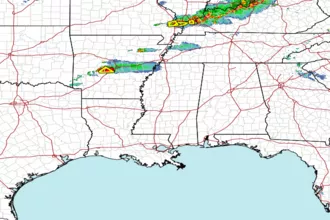
 Gulf Radar