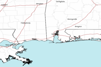
North Mobile Bay Marine Forecast
| Today...West Winds Around 5 Knots, Becoming South This Afternoon. Waves 1 Foot Or Less. Patchy Fog Early This Morning. A Slight Chance Of Showers And Thunderstorms This Afternoon. |
| Tonight...South Winds 5 To 10 Knots, Becoming North After Midnight. Waves 1 Foot Or Less. A Slight Chance Of Showers And Thunderstorms. |
| Sunday...North Winds 10 To 15 Knots With Gusts Up To 20 Knots. Waves 1 Foot Or Less, Then Around 2 Feet In The Afternoon. Showers Likely With A Slight Chance Of Thunderstorms. |
| Sunday Night...North Winds 15 To 20 Knots With Gusts Up To 25 Knots. Waves Around 2 Feet. |
| Monday...North Winds 15 To 20 Knots, Diminishing To Around 10 Knots In The Afternoon. Waves Around 2 Feet In The Morning, Then 1 Foot Or Less. |
| Monday Night...Northeast Winds 5 To 10 Knots. Waves 1 Foot Or Less. |
| Tuesday...East Winds 5 To 10 Knots, Becoming Southeast In The Afternoon. Waves 1 Foot Or Less. |
| Tuesday Night...South Winds 5 To 10 Knots, Becoming Southwest After Midnight. Waves 1 Foot Or Less. |
| Wednesday...Northeast Winds Around 5 Knots, Becoming South In The Afternoon. Waves 1 Foot Or Less. |
| Wednesday Night...Southwest Winds 5 To 10 Knots, Becoming Northwest After Midnight. Waves 1 Foot Or Less. Winds And Waves Higher In And Near Thunderstorms. |
| Area Forecast Discussion National Weather Service Mobile AL 439am CDT Sat April 20 2024 ...New NEAR TERM, LONG TER Marine Near Term (Now through Sunday) Issued at 438am CDT Sat April 20 2024 Similar to the past few nights, low ceilings are the predominant forecast concern through mid-morning ahead of the rain showers slowly filtering into the area. Light rain showers continue to slide east across the region this morning, well ahead of schedule. Coverage of showers and storms increases this afternoon and evening as a cold front continues to lay down across the region and subtle shortwaves drift overhead in the zonal flow aloft. There will be ample instability with favorable lapse rates (especially across the southern half of the area) for storms to tap into by this afternoon, however, there isn't a lot of shear (25kts south of the boundary). It's looking slightly more favorable for strong to potentially severe storms this afternoon in this pattern with gusty winds being the predominant threat (although can't rule out the hail threat north of the boundary later today). We will continue to keep an eye on trends this morning given that the coverage of showers is already over performing at this hour. Storms this afternoon will also be efficient rainmakers as they train along/near the boundary. There is a signal in the HREF ensemble guidance for upwards of 2-3 inches of rain by late afternoon across the coastal counties (north of I-10) with a stronger signal across our southeast Mississippi counties. There are some indications in the guidance that we may see a brief lull in activity overnight (prior to midnight) before another shortwave pivots into the Deep South. Another round of rain is expected early on Sunday, but the bulk of the coverage looks to stay north of the Highway 84 corridor in the morning. Heavy rain will eventually slide across the entire area late Sunday morning through the early afternoon hours. Not anticipating thunderstorms with the activity on Sunday as the front will be well to our south - this will all be post-frontal rain. Temperatures likely won't rise much on Sunday in the wake of the front with temperatures hovering in the mid to upper 50s inland while staying in the 60s along the coast. Not exactly great beach weather on Sunday. Beach Note: Risk of rip currents remains LOW through the middle of this week. However, rip current MOS probabilities are indicating a quick bump to just below MODERATE this afternoon along the Florida panhandle, so we will need to keep an eye on conditions at the Florida beaches this afternoon. 07/mb Long Term (Sunday night through Friday) Issued at 438am CDT Sat April 20 2024 The positively-tilted upper trough approaching the Ohio River valley will swing southeastward over the Tennessee Valley and adjacent Gulf Coast states through noon Monday, and then move eastward off the southeast coast in a more neutral fashion by Monday evening. A dry northwesterly flow pattern aloft will generally occur across our forecast area through midweek behind this departing feature, followed by shortwave ridging aloft to our west building over the forecast area Thursday and Friday. Surface high pressure is forecast to build from the Plains to the Gulf Coast states early next week, with surface ridging remaining prevalent into Friday. Temperatures will start off chilly Monday and Tuesday morning, with lows in the 40s over inland locations and in the lower to mid 50s along the immediate coast. Highs in the upper 60s to mid 70s Monday should trend warmer in the low to mid 80s over most inland areas during the middle to latter part of the week (mid 70s to near 80 along the coast). /22 Marine Issued at 438am CDT Sat April 20 2024 Patchy fog is possible near the coast, especially in the bays and sounds, through the pre-dawn hours this morning. Locally higher winds and seas possible near thunderstorms through Sunday. Northerly winds increase to exercise caution levels by Sunday afternoon behind a cold front with winds ramping up to advisory levels briefly Sunday night into early Monday morning. After Monday, there are no marine impacts for the remainder of the week. 07/mb NOAA Mobile AL Office: Watches - Warnings - Advisories AL...None. FL...None. MS...None. GM...None. |
 Mobile AL Radar
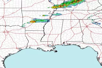
 Gulf Radar