Ocracoke Inlet to Cape Lookout, NC out 20 NM Marine Forecast
| Overnight...Sw Winds 10 To 15 Kt. Seas 4 To 5 Ft. Dominant Period 5 Seconds. Adjacent Sounds And Rivers A Moderate Chop. |
| Tue...W Winds 5 To 10 Kt, Becoming E In The Afternoon. Seas 3 To 5 Ft. Dominant Period 5 Seconds. Adjacent Sounds And Rivers Light Chop. |
| Tue Night...E Winds 5 To 10 Kt, Becoming Se After Midnight. Seas 3 To 4 Ft. Dominant Period 5 Seconds. Adjacent Sounds And Rivers Light Chop. |
| Wed...Sw Winds 10 To 15 Kt. Seas 3 To 4 Ft. Dominant Period 5 Seconds. Adjacent Sounds And Rivers A Moderate Chop. |
| Wed Night...Sw Winds 15 To 20 Kt. Gusts Up To 25 Kt After Midnight. Seas 4 To 5 Ft. Adjacent Sounds And Rivers Choppy. A Slight Chance Of Showers After Midnight. |
| Thu...Sw Winds 15 To 20 Kt. Gusts Up To 25 Kt In The Morning. Seas 3 To 5 Ft. Adjacent Sounds And Rivers Choppy. |
| Thu Night...Sw Winds 10 To 15 Kt, Becoming Nw After Midnight. Seas 3 To 4 Ft. Adjacent Sounds And Rivers A Moderate Chop, Diminishing To Light Chop After Midnight. |
| Fri...Ne Winds 10 To 15 Kt, Becoming E In The Evening, Then Becoming Sw After Midnight. Seas 3 To 4 Ft. Adjacent Sounds And Rivers A Moderate Chop, Diminishing To Light Chop After Midnight. |
| Sat...Sw Winds 10 To 15 Kt, Becoming S In The Evening, Then Becoming W After Midnight. Seas Around 3 Ft. Adjacent Sounds And Rivers A Moderate Chop, Diminishing To Light Chop After Midnight. A Chance Of Showers. |
| Area Forecast Discussion National Weather Service Newport/Morehead City NC 137am EDT Tuesday April 16 2024 Synopsis High pressure remains offshore today while a backdoor cold front approaches from the north and moves through the area tonight. This front will then lift back north as a warm front tomorrow. High pressure ridging briefly builds back into the Southeast around midweek before the next cold front impacts the area next weekend. Near Term - Until 6am This Morning As of 1045pm Monday...The back door cold front is currently over the Delmarva peninsula and northern VA, making its way south. Ahead of the front, a line of strong thunderstorms and showers are making its way south, encroaching on the NC/VA border at the time of this update. Southerly flow ahead of the front is rapidly switching to northwesterly behind the front. The front will slowly continue moving south, but as we get into tonight, convection becomes less favorable due to a lack of daytime heating and an inversion allows a stubborn 300 J/kg of CIN to develop. The more unfavorable environment as the storms approach the CWA (County Warning Area) will result in rapid weakening, with the most likely outcome being scattered showers with a few rumbles of thunder for northern most counties and waters. As the showers which enter northern portions of the CWA around 3Z struggle to sustain themselves moving south, they break down further and dissipate altogether by 6-8Z, leaving the southern two-thirds of the CWA rain free. While unlikely, if these storms find a way of sustaining themselves despite the diminishing instability, mid- level lapse rates around 8C, ample bulk shear (~45 kt), and impressive DCAPE (~1300 J/kg) are enough to bring forth strong to severe wind gusts and small hail concerns. If severe storms are able to persist, the best chance will be north of HWY 264 between 03-06Z with chances decreasing as the line moves farther south. Once the convection dies out, debris clouds will hang around overnight and help keep us mild with lows in the low-60s across the CWA. Short Term - 6am This Morning Through 6pm Today As of 8pm Monday...No major changes with this update. Previous Discussion...As of 4PM Monday...The backdoor cold front pushing through tonight will lift north as a warm front tomorrow. Highs will push well into the 80s again for the coastal plain while the OBX will remain around 70. The warm front will support scattered shower and thunderstorm development tomorrow afternoon with greatest chances (15-20%) across the coastal plain. .LONG TERM /TONIGHT THROUGH MONDAY/... As of 330am Mon... A fairly active pattern is on tap this week with multiple frontal passages impacting the area into this weekend. Tuesday and Wed... Upper ridging will push east across the Mid-Atlantic on Tuesday and eventually off the coast by Wednesday while a weakening trough lifts NE'wards from the Central CONUS into the Great Lakes Tuesday into Wed. Mid level shortwave will track along this upper ridging passing across the Carolinas Tuesday evening with a second shortwave moving across the area on Wed. At the surface stalled frontal boundary across the southern half of the CWA will gradually lift N'wards Tuesday evening as a warm front. As this front lifts N'wards ample moisture will combine with increasing lift to result in isolated to widely scattered shower and thunderstorm activity Tuesday afternoon and evening with this activity lifting to the north of ENC by early Wednesday morning as the front moves out of the area. As the second shortwave moves across the Mid-Atlantic on Wednesday another round of isolated to widely scattered shower and thunderstorm activity will be possible as a surface trough sets up along the Coastal Plain. At the same time a weakening cold front will be approaching from the west as well nearing the area by late Wednesday night. Temps will remain above average across the Coastal Plain with highs generally in the low to mid 80s with temps nearing 70 along the SOBX. Temps wilL be much cooler along the NOBX on Tuesday behind the stalled boundary as NE'rly flow will bring a cool maritime airmass over the region with temps rebounding on Wednesday into the 70s as SW'rly flow quickly returns. Thurs into Next Weekend Some minor tweaks to the forecast given the latest trends as it now looks like multiple fronts will be impacting the area to end our week. Weak upper trough quickly transits across the Mid-Atlantic on Thursday with zonal flow overspreading the area this weekend. A second stronger trough then approaches from the west at the start of next week. At the surface cold front sweeps through the area Thurs morning once again bringing a chance for some scattered showers and isolated thunderstorms through Thurs evening before we dry out on Fri. Yet another frontal boundary impacts ENC Sat afternoon into Sunday bringing a chance for more widespread precipitation this weekend. Otherwise temps generally remain above average into this weekend before cooling off behind the second frontal passage on Sat. Marine SHORT TERM Through Tonight As of 1030pm Monday...SW winds at 10-15 kt will persist until a gust front moves through the region over the next couple of hours from the north, and a back door cold front follows through early this morning. The train of boundaries will make winds variable over night, gusting near 25 kts at times, particularly for northern waters and sounds. The predominant flow behind the backdoor cold front will result in winds quickly switching to become more northeasterly. The gust front has been handled with a Marine Weather Statement valid till 1215am Tuesday. Seas between the capes are expected to remain at 4-5 ft for much of the night, decreasing to 3-4 feet by Tuesday afternoon. Long Term - Tuesday Through Friday As of 510am Mon... Cold front will stall along the southern periphery of our waters in Tuesday keeping the gradient light and allowing winds to generally remain around 5-10 kts across all waters. WInds to the south of the front will be SE-E while to the north wind direction will be NE-E. Front lifts north as a warm front Tuesday night bringing a threat for some scattered showers and isolated thunderstorms as well as shifting the winds to a S-SW direction at 10-15 kts. Winds increase slightly to 15-20 kts out ahead of an approaching cold front with winds then shifting THur night behind the front back to a N'rly direction. Seas across our coastal waters generally remain around 2-4 ft through the period, occasionally getting to 5 ft along the Gulf Stream waters. NOAA Newport/Morehead City NC Office - Watches - Warnings - Advisories NC...None. Marine None. |
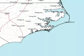 Newport NC Radar
 Southeast Radar
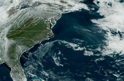 East Coast Satellite