Pamlico River & Pungo River Marine Forecast
| Rest Of Tonight...Se Winds 5 To 10 Kt. Waves Light Chop. A Slight Chance Of Showers Late. Patchy Fog Late. |
| Sat...Sw Winds Around 5 Kt, Becoming N In The Afternoon. Waves Flat, Increasing To Light Chop In The Afternoon. Patchy Fog In The Morning. A Slight Chance Of Showers. |
| Sat Night...E Winds 5 To 10 Kt. Waves Light Chop. A Slight Chance Of Rain After Midnight. |
| Sun...Ne Winds 10 To 15 Kt. Waves A Moderate Chop. Rain. |
| Sun Night...N Winds 10 To 15 Kt. Waves A Moderate Chop. Rain. |
| Mon...N Winds 10 To 15 Kt. Waves A Moderate Chop. A Chance Of Rain In The Morning. |
| Mon Night...Ne Winds 10 To 15 Kt. Waves A Moderate Chop. |
| Tue...Ne Winds Around 10 Kt, Becoming S After Midnight. Waves Light Chop. |
| Wed...W Winds 10 To 15 Kt, Becoming N After Midnight. Waves A Moderate Chop. |
| Area Forecast Discussion National Weather Service Newport/Morehead City NC 233am EDT Sat April 20 2024 Synopsis A cold front tracks south across the region and stalls just offshore on Saturday. An area of low pressure will lift NE along the front Sunday bringing rain across the region. High pressure briefly builds into the area Tuesday followed by a cold front with limited moisture pushing across the area Wednesday. High pressure builds back into the area for the latter half of the work week. Near Term - Until 6am This Morning As of 2am Saturday...Low stratus is over much of the area, and fog has started building in for southern portions of the CWA. Will keep an eye on observations, but given current trends, a SPS for patchy dense fog is likely as we approach sunrise. A small cluster of thunderstorms is just west of Fayetteville, but are expected to weaken as they approach Duplin and Lenoir Counties. While a few rumbles of thunder is possible, it will largely become showers with light to moderate rainfall. NAM3km is the outlier, showing thunderstorms advancing as far east as hwy 17 before falling apart. Given the propensity for the NAM3km to overdo convection, decided to exclude that outcome from this forecast, but the progression of these storms will be closely monitored over the next hour. Outside of MLCAPE > 500 J/KG, thunderstorm parameters are not supportive of sustained thunderstorm organization. More mild temperatures are likely tonight as the frontal boundary continues to lift northward, with lows in the low 60s inland and mid 50s across NOBX. Short Term - 6am This Morning Through 6am Sunday As of 230pm Saturday...No major changes with this update. As of 330pm Fri... SW'rly flow will continue to persist across the region Sat morning before the next cold front sweeps southwards across ENC Sat afternoon shifting the winds behind this front to a NE'rly direction. Any leftover shower activity from the previous evenings activity will be quickly pushing out to sea Sat morning with perhaps the biggest change to the forecast for Sat being a reduction in PoP's Sat afternoon. Latest thinking is that there will no longer be much forcing with the incoming front which should keep the Coastal Plain dry while maybe a few showers develop along the OBX and Crystal Coast Sat afternoon as the front makes its way through. Though capped PoP's at SChc along the coast and OBX given the downward trend in precipitation potential. Otherwise temps get into the low to mid 70s inland and into the mid 60s to near 70 along the OBX on Sat. Long Term - Sunday Through Friday As of 330pm Friday...Broad cyclonic flow prevails over the Eastern CONUS through the long term bring a progressive pattern with several frontal passages and an area of low pressure lifting off the coast early next week. Sunday through Monday...Shortwave energy moving through the flow aloft will bring better forcing across the area Sunday and Sunday night with favorable jet dynamics over the area. Surface low pressure will develop along the offshore front and pass off the OBX Sunday night and push the cold front farther offshore on Monday. There remains some timing differences with the low but expect widespread rain to develop across the area Sunday and continue into Sunday night. Rainfall amounts expected around a half to one inch with highest amounts occuring along the coast. NE winds, clouds and rain will keep cooler temps across the area with highs expected in the low to mid 60s. Most of the rain will push offshore Sunday night but an upper trough will push across the Southeast which may trigger additional showers across the area on Monday, however guidance has been trending farther south and weaker with the trough which may keep us on the drier side. Below normal temps continue on Monday with highs in the low to mid 60s. Tuesday through Thursday...High pressure builds into the area Tuesday but will quickly move offshore by Wednesday with additional shortwave energy and surface cold front sliding across the area bringing the chance for a few showers, though moisture appears to be limited with this system. High pressure builds back into the area on Thursday with dry conditions prevailing. A warming trend will develop Tuesday and Wednesday with highs in the low to mid 70s, and a few upper 70s possible Wednesday. Temps cool back to the low to mid 70s Thursday. Marine SHORT TERM /Through Saturday/... As of 330pm Fri... Weak warm front will lift N'wards across our waters this evening allowing E'rly winds to veer to a SE and eventually a SW'rly direction tonight while winds remain around 5-15 kts. A cold front then sweeps S'wards across the area Sat afternoon once again shifting winds behind the front to a N'rly direction at 10-20 kts with only a few gusts mainly along the Gulf Stream waters to about 25 kts Sat afternoon. Seas generally remain around 3-5 ft through the period precluding any issuance of SCA's (Small Craft Advisories) across our waters through the period LONG TERM /Saturday night through Wednesday/... As of 330pm Friday...The front will stall off the coast Saturday night with winds diminishing to around 15 kt or less but low pressure will develop along the front Sunday and pass off the OBX Sunday night into Monday bringing a period NE winds around 15-25 kt, strongest Sunday night into Monday morning. High pressure builds across the Mid- Atlantic on Tuesday with NE winds around 10-20 kt continuing across the waters. Seas expected to be around 3-5 ft Saturday into Sunday morning, then will build to 4-7 ft across the northern and southern waters and 6-9 ft across the central waters Sunday night and Monday. Seas will gradually subside Monday night and Tuesday. NOAA Newport/Morehead City NC Office - Watches - Warnings - Advisories NC...Beach Hazards Statement from 8am EDT this morning through this evening for NCZ203-205. Marine None. |
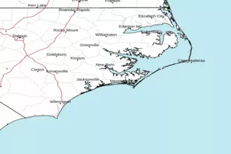 Newport NC Radar
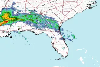 Southeast Radar
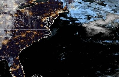 East Coast Satellite