Pamlico Sound Marine Forecast
| Overnight...Se Winds 5 To 10 Kt. Waves 1 Ft Or Less. A Slight Chance Of Showers. |
| Sat...Sw Winds 5 To 10 Kt, Becoming N 10 To 15 Kt In The Afternoon. Waves 1 Ft Or Less. A Slight Chance Of Showers. |
| Sat Night...Ne Winds 15 To 20 Kt, Diminishing To 10 To 15 Kt After Midnight. Waves Around 2 Ft In The Evening, Then 1 Ft. |
| Sun...Ne Winds 10 To 15 Kt, Increasing To 15 To 20 Kt In The Afternoon. Waves Around 2 Ft. Rain. |
| Sun Night...Ne Winds 15 To 20 Kt. Gusts Up To 25 Kt After Midnight. Waves 2 To 3 Ft. Rain. |
| Mon...Ne Winds 15 To 20 Kt. Gusts Up To 25 Kt In The Morning. Waves 2 To 3 Ft. A Chance Of Rain In The Morning. |
| Mon Night...Ne Winds Around 15 Kt. Waves Around 2 Ft. |
| Tue...Ne Winds 10 To 15 Kt, Diminishing To 5 To 10 Kt In The Evening, Then Becoming S After Midnight. Waves Around 2 Ft, Then 1 Ft. |
| Wed...Sw Winds 5 To 10 Kt, Increasing To 10 To 15 Kt In The Afternoon And Evening, Then Becoming N After Midnight. Waves 1 Ft Or Less, Then Around 2 Ft. |
| Area Forecast Discussion National Weather Service Newport/Morehead City NC 1000pm EDT Fri April 19 2024 Synopsis A cold fronttracks south across the region and stalls just offshore on Saturday. An area of low pressure will lift NE along the front Sunday bringing rain across the region. High pressure briefly builds into the area Tuesday followed by a cold front with limited moisture pushing across the area Wednesday. High pressure builds back into the area for the latter half of the work week. .NEAR TERM /Overnight/... As of 10pm Fri...No big changes. Satellite imagery depicting areas of low stratus forming across ENC this evening. Will have to watch for some pockets of fog, possibly locally dense, forming along with the sub 500 ft stratus deck. For now, have visibilities around 3-5 miles with patchy mention. Prev disc... As of 710pm Fri...A brief area of thunderstorms with rain formed over the northern coastal plain early this evening, but is now dissipating with loss of daytime heating. Still could be a few iso to scattered tstorms through mid evening, and then mainly dry outside of an iso shower through the rest of the overnight. Have added in some patchy light fg, as a saturated bndry layer should be in place tonight with light winds expected. Prev disc... As of 330pm Fri... In the veryNear Term - Rest Of Today Through Tonight much has changed as continued low level cloud cover has kept things cool and damp along the NOBX with temps barely getting into the mid 50s, while temps reached the upper 70s to near 80 across the Coastal Plain in areas where low cloud cover had dissipated this morning resulting in a fairly large temperature gradient across ENC this afternoon. Otherwise we begin to look at the most active period of the near term. Latest surface analysis shows a developing low pressure system near the Triad region this afternoon with its associated warm front nearing the SC/NC border. This low and frontal boundary will continue to lift NE'wards through tonight allowing the ongoing east to southeasterly winds this afternoon to slowly veer to a SW'rly direction tonight. Latest mesoanalysis shows building instability across our southwestern zones where a combination of around 500-1000 J/kg of SBCAPE and 25-35 kts of 0-6 km shear is noted while lower instability and shear are noted the farther north and east you get as a marine layer has allowed the airmass to stay stable north of about Hwy 264 for now. In addition to this, onshore flow has resulted in a gradual moistening of of the atmospheric column this afternoon and with the incoming front providing ample lift some isolated to widely scattered shower and thunderstorm activity has developed to the south and west of the area with some of this activity becoming severe in nature. General trends have been for this activity to push north and east through the remainder of the afternoon impacting our SW'rn counties within the next 1-3 hours and then continuing onwards before gradually dissipating this evening after sunset. While we have slightly more instability across our SW'rn zones, it is much lower across ENC than across areas to the south and west given this mornings cloud cover thus limiting the severe threat. While it is not zero, general thinking is if any storm can survive its trek into our area, strong wind gusts (40-50 mph), small hail, and frequent lightning would be the primary concern within the strongest storms with this threat being isolated at best. After sunset any left over activity will quickly weaken and continue off to the north and east eventually nearing the coast by daybreak on Saturday with any thunder threat ending by about 9-10PM. More mild temperatures are likely tonight as the frontal boundary continues to lift northward, with lows in the low 60s inland and mid 50s across NOBX. Short Term - Saturday As of 330pm Fri... SW'rly flow will continue to persist across the region Sat morning before the next cold front sweeps southwards across ENC Sat afternoon shifting the winds behind this front to a NE'rly direction. Any leftover shower activity from the previous evenings activity will be quickly pushing out to sea Sat morning with perhaps the biggest change to the forecast for Sat being a reduction in PoP's Sat afternoon. Latest thinking is that there will no longer be much forcing with the incoming front which should keep the Coastal Plain dry while maybe a few showers develop along the OBX and Crystal Coast Sat afternoon as the front makes its way through. Though capped PoP's at SChc along the coast and OBX given the downward trend in precipitation potential. Otherwise temps get into the low to mid 70s inland and into the mid 60s to near 70 along the OBX on Sat. Long Term - Saturday Night Through Friday As of 330pm Friday...Broad cyclonic flow prevails over the Eastern CONUS through the long term bring a progressive pattern with several frontal passages and an area of low pressure lifting off the coast early next week. Sunday through Monday...Shortwave energy moving through the flow aloft will bring better forcing across the area Sunday and Sunday night with favorable jet dynamics over the area. Surface low pressure will develop along the offshore front and pass off the OBX Sunday night and push the cold front farther offshore on Monday. There remains some timing differences with the low but expect widespread rain to develop across the area Sunday and continue into Sunday night. Rainfall amounts expected around a half to one inch with highest amounts occuring along the coast. NE winds, clouds and rain will keep cooler temps across the area with highs expected in the low to mid 60s. Most of the rain will push offshore Sunday night but an upper trough will push across the Southeast which may trigger additional showers across the area on Monday, however guidance has been trending farther south and weaker with the trough which may keep us on the drier side. Below normal temps continue on Monday with highs in the low to mid 60s. Tuesday through Thursday...High pressure builds into the area Tuesday but will quickly move offshore by Wednesday with additional shortwave energy and surface cold front sliding across the area bringing the chance for a few showers, though moisture appears to be limited with this system. High pressure builds back into the area on Thursday with dry conditions prevailing. A warming trend will develop Tuesday and Wednesday with highs in the low to mid 70s, and a few upper 70s possible Wednesday. Temps cool back to the low to mid 70s Thursday. Marine SHORT TERM /Through Saturday/... As of 330pm Fri... Weak warm front will lift N'wards across our waters this evening allowing E'rly winds to veer to a SE and eventually a SW'rly direction tonight while winds remain around 5-15 kts. A cold front then sweeps S'wards across the area Sat afternoon once again shifting winds behind the front to a N'rly direction at 10-20 kts with only a few gusts mainly along the Gulf Stream waters to about 25 kts Sat afternoon. Seas generally remain around 3-5 ft through the period precluding any issuance of SCA's (Small Craft Advisories) across our waters through the period LONG TERM /Saturday night through Wednesday/... As of 330pm Friday...The front will stall off the coast Saturday night with winds diminishing to around 15 kt or less but low pressure will develop along the front Sunday and pass off the OBX Sunday night into Monday bringing a period NE winds around 15-25 kt, strongest Sunday night into Monday morning. High pressure builds across the Mid- Atlantic on Tuesday with NE winds around 10-20 kt continuing across the waters. Seas expected to be around 3-5 ft Saturday into Sunday morning, then will build to 4-7 ft across the northern and southern waters and 6-9 ft across the central waters Sunday night and Monday. Seas will gradually subside Monday night and Tuesday. NOAA Newport/Morehead City NC Office - Watches - Warnings - Advisories NC...Beach Hazards Statement from 8am EDT Saturday through Saturday evening for NCZ203-205. Marine None. |
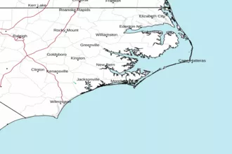 Newport NC Radar
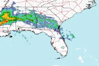 Southeast Radar
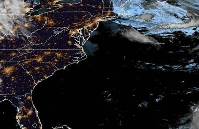 East Coast Satellite