Patuxent River to Broomes Island MD Marine Forecast
| Rest Of The Overnight...Ne Winds 10 Kt With Gusts To 20 Kt. Waves 1 Ft. Scattered Sprinkles. |
| Today...Ne Winds 5 To 10 Kt. Gusts Up To 20 Kt In The Morning. Waves 1 Ft. |
| Tonight...E Winds 5 To 10 Kt. Waves 1 Ft. |
| Fri...E Winds 5 To 10 Kt. Waves 1 Ft. |
| Fri Night...Se Winds 5 To 10 Kt. Waves 1 Ft. |
| Sat...Se Winds 5 To 10 Kt. Gusts Up To 20 Kt In The Afternoon. Waves 1 Ft. |
| Sat Night...S Winds 10 Kt With Gusts To 20 Kt. Waves 1 Ft. |
| Sun...Sw Winds 10 Kt. Waves 1 Ft. |
| Mon...S Winds 5 To 10 Kt. Waves 1 Ft. |
| Area Forecast Discussion National Weather Service Baltimore MD/Washington DC 337am EDT Thu April 25 2024 Synopsis High pressure will return today and Friday. A warm front will lift into the area this weekend bringing a significant warm up early next week. The next chance for widespread precipitation arrives with a cold front Tuesday into Wednesday next week. Near Term - Through Tonight A reinforcing shortwave is currently moving across northern Virginia and heading toward the southern half of the Delmarva Peninsula. This shortwave will give yesterday's cold front a little nudge farther south early this morning. High pressure will build to our north today and tonight. As the high moves to the east, winds will become more northeasterly this morning, then easterly this afternoon, finally southeasterly by late tonight. Today and tonight will be dry. High temperatures will be noticeably cooler today and tonight with highs in the 50s and lows in the middle to upper 30s. Short Term - Friday Through Saturday Night A mix of sun and clouds expected Friday with increasing clouds in the southwest. Highs Friday will not be as chilly as today, but mainly reach near 60 to lower 60s in most places. Lows Friday night will drop into the 40s and should not be as chilly as tonight. The next chance for showers will come Friday night as warm advection ensues aloft ahead of a system over the center of the country and its associated warm front. High pressure will continue to nudge to the southeast on Saturday. The warm front is expected to push farther east and northeast during the day and bring a few showers mainly along and west of the Blue Ridge. Highs on Saturday will range from the upper 50s and lower 60s north of I-66 with middle to upper 60s to the south of this corridor. Saturday night's lows a few degrees milder. Long Term - Sunday Through Wednesday Deep ridging builds across the Southeast to Mid-Atlantic states Sunday into Monday. Dry conditions, and very warm to near record warmth is likely across the area. Highs reach the upper 70s to low 80s Sunday, and mid to upper 80s Monday. A few spots could reach 90F Monday afternoon. Mild overnight lows in the upper 50s to mid 60s, especially Monday night. Models are in a good agreement for Tuesday, indicating a cold front sweeping through the area in the afternoon to early evening. Given the building heat for 2-3 days, there is likely to be modest instability for thunderstorms even with dew points in the upper 50s to low 60s. Forcing along the cold front is likely to generate isolated to scattered thunderstorms, some of which could be strong. This cold front brings little relief from the warmth as highs still reach the lower 80s Wednesday. Marine SCAs (Small Craft Advisories) remain in effect through this morning. Sub-SCA (Small Craft Advisory) northeast, then easterly winds expected this afternoon. Sub-SCA (Small Craft Advisory) southeast winds are expected Friday, though channeling is possible late in the day. Winds could reach SCA (Small Craft Advisory) for a few hours both Saturday and Sunday. A warm front will lift across the waters Saturday changing the winds toward more of a southerly direction. South to southwest winds prevail Sunday into the start of next week, with mostly dry conditions across the local waters. Southerly channeling is possible, which could result in a few hours of near- SCA (Small Craft Advisory) conditions during the afternoon to evening each day. Tides / Coastal Flooding A prolonged period of northeast to east, then southeast to south winds through the weekend is going to cause water levels to rise across the Chesapeake Bay and Tidal Potomac River. Starting later this morning, sensitive locations at Annapolis and Straits Point will reach Action Stage. The evening high tide being the astronomically lower of the day will likely stay out of minor flooding, though still reach Action Stage. The first impactful high tide cycle is expected to be Friday morning. Coastal Flood Watches are in effect for Annapolis and Straits Points as moderate coastal flooding is possible at that time. Other spots could reach minor flood stage, which would require additional Coastal Flood Advisories. Additional periods of coastal flooding are likely over the weekend as southerly winds persist, and many locations approach or reach minor flood stage. NOAA Baltimore MD/Washington DC Office: Watches - Warnings - Advisories DC...None. MD...Coastal Flood Watch from late tonight through Friday morning for MDZ014. Coastal Flood Watch from late tonight through Friday morning for MDZ017. VA...None. WV...None. Marine Small Craft Advisory until 9am EDT this morning for ANZ530- 531-536-539-540-542. Small Craft Advisory until noon EDT today for ANZ532>534-537- 541-543. Small Craft Advisory until 6am EDT early this morning for ANZ538. |
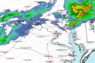 Baltimore/Washington Radar
 Northeast Radar
 East Coast Satellite