Peconic and Gardiners Bays Marine Forecast
| Overnight...S Winds 5 To 10 Kt. Waves 1 Ft Or Less. |
| Wed...S Winds 10 To 15 Kt, Becoming W In The Afternoon. Waves 1 Ft Or Less. Chance Of Showers, Mainly In The Morning. |
| Wed Night...N Winds 10 To 15 Kt With Gusts Up To 20 Kt. Waves 1 Ft Or Less, Then Around 2 Ft After Midnight. |
| Thu...N Winds 10 To 15 Kt, Becoming S Around 5 Kt In The Afternoon. Waves Around 2 Ft In The Morning, Then 1 Ft Or Less. |
| Thu Night...S Winds 5 To 10 Kt, Becoming Sw After Midnight. Waves 1 Ft Or Less. |
| Fri...Ne Winds Around 5 Kt, Becoming Se In The Afternoon. Waves 1 Ft Or Less. |
| Fri Night...S Winds 5 To 10 Kt. Waves 1 Ft Or Less. |
| Sat...S Winds 5 To 10 Kt. Waves 1 Ft Or Less. |
| Sat Night...S Winds Around 10 Kt. Waves 1 Ft Or Less. |
| Sun...Sw Winds 10 To 15 Kt With Gusts Up To 20 Kt. Waves 1 Ft Or Less. |
| Sun Night...Sw Winds Around 10 Kt. Waves 1 Ft Or Less. |
| Area Forecast Discussion ...CORRECTED National Weather Service New York NY 1025pm EDT Tuesday April 23 2024 Synopsis A frontal system approaches overnight and moves across the area on Wednesday. Strong high pressure then builds in Wednesday night through the end of the week. The high centered over the region on Friday gradually shifts offshore into Saturday then pushes farther south on Sunday as a low from the western Great Lakes moves into Canada. This low brings a warm front Saturday night into Sunday. We remain between low pressure to the north and high pressure to the south through early next week. Near Term - Through Today Weakening high pressure offshore continues to give way to an approaching frontal system. Mid and high level will increase overnight along with a southerly flow ahead of the system. Most of the night will be dry with a few showers possible in the early morning as the associated warm front moves through the area. Moisture and lift are limited and any of the showers look light. In fact, most CAMs show the activity diminishing as it moves eastward, likely due to dry low levels. Low temperatures tonight will not be as cold as recent nigheights with lows in the 40s across the region. Behind the warm front, a WNW-WSW flow develops late morning into the afternoon. The trailing cold front will quickly sweep across the area from NW to SE middle to late afternoon. Forecast soundings are continuing to show some surface instability. However, there are still hints of middle level capping along with dry sub cloud. For these reasons, have continued to leave thunder out of the forecast. Some isolated low topped convection may still develop in the afternoon and could contain gusty winds with the inverted V soundings/dry subcloud air. Dew points should start mixing out in the afternoon, but a more substantial drop in dew points is likely late in the afternoon and evening. The westerly component and deep mixing should allow temperatures to rise into the 60s across the entire area. Wind gusts 25-30 mph are possible late in the day. Temperatures could end up around 70 degrees in the NYC metro and urban NE NJ. Short Term - Tonight Through Thursday Night Any lingering showers end by sunset with skies quickly becoming clear. The main story for Wednesday night will be the much colder air that settles over the region in response to a strong high pressure building in from southeast Canada. Temperatures are likely to fall into the upper 20s and lower 30s across the interior and middle to upper 30s most elsewhere. Lows in the NYC metro should fall close to 40 degrees. Winds will likely remain up through the night although there is a short window early Thursday morning just before sunrise for winds to lighten across the interior. These areas have a higher probability for seeing temperatures fall below freezing. Have issued a Freeze Watch for interior S CT, Lower Hudson Valley, and W Passaic and W Bergen from 3am through 9am Thursday. Frost will not occur due to the dry air (dew points falling into the teens and low 20s). Strong high pressure will then dominate the weather Thursday into Thursday night. The center of the high settles overhead on Thursday with winds becoming light. An unseasonably cool air mass in place will lead to below normal temperatures in the 50s. Frost and freeze conditions appear likely again Thursday night into Friday morning with coldest readings inland. Modification of the air mass should lead to more low level moisture and potential frost development. Additional frost/freeze headlines may be needed. Lows range from the low 30s inland to the middle and upper 30s near the coast. Long Term - Friday Through Monday An Omega blocking pattern becomes established on Friday, as a deep trough remains across eastern Canada into the northern Atlantic, with another trough through the Rocky Mountain region into the Plains, and a high amplitude ridge in between. As a result, systems will be slow to move eastward into the beginning of next week. And a northern Plains low will be slow to move into the ridge Sunday into Monday. With surface high pressure over the region moving offshore Saturday, there is a lot of uncertainty with the development and movement of a warm front Saturday night into Sunday, as ridging remains. This warm from will be coming from a low in the western Great Lakes as it moves into Canada to our north. Some isolated to spotty showers could for along the warm front boundary Saturday evening into early Sunday morning. A deep return flow sets up for late in the upcoming weekend and temperatures initially below normal through Saturday quickly rise to as much as 10-15 degrees above normal Saturday night into the beginning of next week. The warmest day looks to be Monday with the western interior and the NYC metro warming into the low-80s, while the rest of the region will be in the upper-to-mid 70s. Used the NBM guidance through the extended period with the exception of POPs. A weak low will attempt to bring more slight chance POPs to the area on Tuesday with a cold front. Frost headlines look less likely Friday night with the exception of the far interior. Marine Strengthening S flow continues into tonight. A southerly jet along the Jersey shore up into the NY Bight and lower NY Bay will gust over 25 kt this evening, so will have an SCA (Small Craft Advisory) continue there. SCA (Small Craft Advisory) conditions then expand eastward across the ocean later tonight into Wednesday with gusts up to 25 kt and seas 5-7 ft. Winds will start weakening Wednesday night and especially Thursday, but ocean seas will remain elevated. The SCA (Small Craft Advisory) remains in effect on the ocean through Wednesday night, but may need to be extended into Thursday. A weakening pressure gradient will otherwise lead to conditions below SCA (Small Craft Advisory) levels through the end of the week. High pressure remains in control Saturday, moving offshore Saturday night, with conditions below SCA (Small Craft Advisory) levels through the weekend. Fire Weather RH will be higher for the first half of Wednesday, but increasing W winds in the afternoon will lead to falling RH values. A wetting rainfall is not expected. Elevated fire spread conditions may present themselves for NE NJ in the later parts of the afternoon/early evening as gusts 25-30 mph occur and RH values fall into the lower to middle 30s. Min RH values will be in the lower 20s on Thursday, but winds will be light and largely under 10 mph. Hydrology No hydrologic concerns through early next week. NOAA New York NY Office: Watches - Warnings - Advisories CT...Freeze Watch from late Wednesday night through Thursday morning for CTZ005>008. NY...Freeze Watch from late Wednesday night through Thursday morning for NYZ067>070. NJ...Freeze Watch from late Wednesday night through Thursday morning for NJZ002-103. Marine Small Craft Advisory until midnight EDT tonight for ANZ338. Small Craft Advisory from 5am Wednesday to 6am EDT Thursday for ANZ350. Small Craft Advisory until 6am EDT Thursday for ANZ353. Small Craft Advisory until 6am EDT Thursday for ANZ355. |
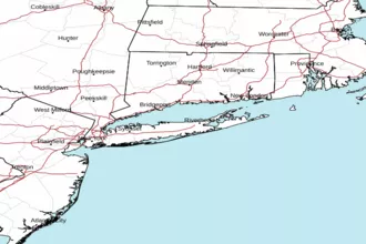
 New York Radar
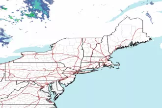
 Northeast Radar
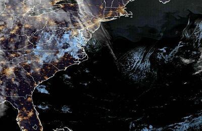
 East Coast Satellite