Pensacola Bay including Santa Rosa Sound Marine Forecast
| Today...North Winds Around 5 Knots, Becoming South 10 To 15 Knots In The Afternoon. Waves 1 Foot Or Less. |
| Tonight...Southwest Winds 5 To 10 Knots, Becoming South After Midnight. Waves 1 Foot Or Less. |
| Friday...Southeast Winds 10 To 15 Knots With Gusts Up To 20 Knots. Waves 1 Foot Or Less. |
| Friday Night...Southeast Winds 10 To 15 Knots, Increasing To 15 To 20 Knots After Midnight. Waves 1 Foot Or Less. |
| Saturday...Southeast Winds 20 To 25 Knots, Diminishing To 15 To 20 Knots In The Afternoon. Waves 1 To 2 Feet. |
| Saturday Night...Southeast Winds 15 To 20 Knots With Gusts Up To 25 Knots. Waves 1 To 2 Feet. |
| Sunday...Southeast Winds 20 To 25 Knots, Diminishing To 15 To 20 Knots In The Afternoon. Waves Around 2 Feet. |
| Sunday Night...Southeast Winds 10 To 15 Knots. Waves 1 To 2 Feet In The Evening, Then 1 Foot Or Less. |
| Monday...Southeast Winds 10 To 15 Knots. Waves 1 To 2 Feet. |
| Monday Night...Southeast Winds 10 To 15 Knots, Diminishing To 5 To 10 Knots After Midnight. Waves 1 Foot Or Less. |
| Area Forecast Discussion National Weather Service Mobile AL 422am CDT Thu April 25 2024 ...New NEAR TERM, SHORT TERM, LONG TER Marine Near Term (Now through Friday) Issued at 419am CDT Thu April 25 2024 A broad upper level trough continues to move along the Mid-Atlantic states and Eastern Seaboard region early this morning while ridging aloft meanwhile builds across the Plains states. A northwesterly flow pattern aloft is in place across the north central Gulf Coast region between these features. A weak surface boundary is located across central portions of MS/AL early this morning. Weak surface ridging otherwise remains in place over our area. Patchy fog is starting to develop across a few locations near the coast as of 3am CDT and also probably across far northern portions of our area along and just ahead of the surface boundary. Fog is expected to remain patchy in nature through around or shortly after sunrise, but visibility could be reduced to less than one mile, perhaps very briefly dense down around 1/4 mile in isolated spots. Northwesterly flow aloft is expected to remain prevalent over our forecast area today with embedded shortwave ridging gradually building into our region this afternoon. The weak surface boundary should become oriented across interior portions of southwest and south central AL this afternoon. Most of the deterministic and CAM guidance is not optimistic with isolated convective development this afternoon given the ridging aloft, but an isolated afternoon shower or thunderstorm could still develop roughly north of a Butler to Andalusia line in the vicinity of the boundary. We will leave a slight Probability of Precipitation between 15-20% in place over those areas. We otherwise expect warmer temperatures today with afternoon highs expected to range in the lower to mid 80s over most of the region, except for readings in the mid 70s to near 80 degrees along the immediate coast. Upper level ridging will continue to build across the north central Gulf Coast region tonight. A dry forecast continues with potential for more patchy fog development during the overnight hours across a good portion our region. Overnight lows should range in the upper 50s to lower 60s over most inland areas and in the mid 60s to near 70 degrees along the immediate coast and beaches. The upper level ridge axis will remain overhead through much of the day Friday before gradually shifting to our east by late in the afternoon. Southeasterly to southerly winds will increase in speed on Friday as the pressure gradient increases between high pressure over the eastern U.S. and developing low pressure over the central Plains. Dry weather conditions are forecast to continue Friday with high temperatures once again reaching into the lower to mid 80s over inland areas and into the mid 70s to near 80 degrees along the immediate coast and beaches. For beach interests: The rip current risk will be LOW today and tonight, but will gradually become MODERATE by Friday evening and night given the increasing onshore flow and swell. A HIGH risk of dangerous rip currents will return this weekend with surf potentially building up to 4-6 feet along area beaches Saturday night through Sunday night. /21 .SHORT THROUGH Long Term (Friday night through Wednesday) Issued at 419am CDT Thu April 25 2024 A strong upper ridge over the Eastern Conus will deflect shortwave energy moving through a mean trough over the Plains well west and northwest of the forecast area through Monday. A stronger shortwave system moves over the Mississippi River Monday, shifting the upper ridge off the East Coast. Another upper ridge begins to build north over the Southern Plains into mid week in its wake. A surface ridge over the East Coast will bring southeast to southerly low level flow to the northern Gulf coast. Subsidence from the upper ridge will help to limit better Gulf moisture influx to areas well west of the forecast area into Monday. Around 1" or less of precipitable h2o is advertised by guidance through the weekend. With the upper ridge weakening and shifting east, the East Coast ridge shifts south to become a surface high off the Fl/Ga/Sc Atlantic coast, and the influx of better moisture moves to just west of the forecast area, and precipitable h20 levels rise into the 1.3"-1.6" range over areas west of the Alabama River. Rain showers return to mainly western portions of the forecast area Monday through Wednesday with the moisture increase and subsidence decrease. Temperatures remain above seasonal norms though the period, with high temperatures ranging from the low to mid 80s most areas, around 80 along the coast. Low temperatures are expected to range from around 60 to mid 60s well inland, upper 60s closer to and along the coast. /16 Marine Issued at 419am CDT Thu April 25 2024 A light and variable flow pattern will continue through early this morning. Onshore flow will strengthen late Friday and especially this weekend when winds may become sustained between 15-25 kt over the marine area. Seas may build to 5-8 ft over the Gulf waters Saturday night into Sunday. Small Craft Advisories will likely become necessary this weekend. /21 NOAA Mobile AL Office: Watches - Warnings - Advisories AL...None. FL...None. MS...None. GM...None. |
 Mobile AL Radar
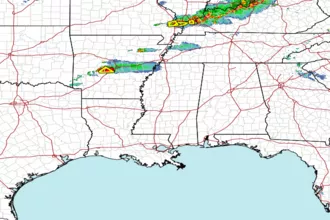
 Gulf Radar