Port Clyde ME to Cape Elizabeth ME Marine Forecast
| Tonight...Sw Winds 10 To 15 Kt With Gusts Up To 20 Kt, Becoming W 5 To 10 Kt Late This Evening, Then Becoming Nw After Midnight, Becoming N Late. Seas 2 To 4 Ft. Wave Detail: Se 3 Ft At 9 Seconds And Sw 2 Ft At 4 Seconds. |
| Fri...N Winds 5 To 10 Kt, Becoming S With Gusts Up To 20 Kt In The Afternoon. Seas 2 To 3 Ft. Wave Detail: Se 2 Ft At 9 Seconds. |
| Fri Night...S Winds 5 To 10 Kt With Gusts Up To 20 Kt, Becoming W After Midnight. Seas Around 2 Ft. Wave Detail: Se 2 Ft At 9 Seconds. |
| Sat...Nw Winds Around 5 Kt, Becoming S In The Afternoon. Seas Around 2 Ft. Wave Detail: Se 2 Ft At 8 Seconds And S 2 Ft At 4 Seconds. |
| Sat Night...S Winds Around 10 Kt. Seas 2 To 3 Ft. Wave Detail: S 2 Ft At 4 Seconds. |
| Sun...S Winds 10 To 15 Kt With Gusts Up To 20 Kt. Seas Around 3 Ft. Wave Detail: Se 2 Ft At 9 Seconds And S 2 Ft At 5 Seconds. |
| Sun Night...S Winds 5 To 10 Kt With Gusts Up To 20 Kt, Becoming Sw After Midnight. Seas 2 To 3 Ft. |
| Mon...N Winds 5 To 10 Kt, Becoming E In The Afternoon. Seas 2 To 3 Ft. |
| Mon Night...E Winds 5 To 10 Kt. Seas 2 To 3 Ft. |
| Tue...Se Winds Around 10 Kt. Seas 2 To 3 Ft. |
| Tue Night...S Winds 10 To 15 Kt. Seas 2 To 3 Ft. A Chance Of Showers. |
| Area Forecast Discussion National Weather Service Gray ME 352pm EDT Thu April 25 2024 Synopsis High pressure will continue to build over the region into Saturday. As winds turn to the southwest on Saturday a warming trend can be expected over the weekend in to early next week. A weak front will bring a few showers Saturday night into Sunday. Monday will be warm away from the coast, with cooler temperatures along the coast where an onshore flow of cooler air will develop. Expect a better chance of showers on Tuesday. Near Term - Until 6am Friday Morning Breeze today subsides tonight as a low level inversion sets up. Given the dry conditions and calm winds, will see temperatures fall off overnight. Didn't stray far from the night shift's forecast lows tonight, with 20s across much of the area and some teens in more prominent rad cooling locations. Short Term - 6am Friday Morning Through Friday Night Friday, high pressure moves overhead. Don't expect much change from today...another sunny, dry day. Winds may be just a bit lighter, perhaps by 5 mph or so. This decrease in offshore wind direction and speed could help a afternoon seabreeze move inland quicker. While highs in the mid to upper 50s are expected across much of the area, immediate coastal locations may see these values dipping mid afternoon as this marine air infiltrates. Friday night will again be calm, and have blended some overnight lows towards MOS guidance to account for another night of radiational cooling. Long Term - Saturday Through Thursday A rather changeable weather pattern in the long term forecast with a few opportunities for showers mixed in with dry periods. Temperatures will warm to at or above normal conditions for much of the area this weekend and Monday. An onshore wind component will prevail along the coast for much of next week resulting in noticeable cooler conditions along the coast. In the dailies: On saturday high pressure over the region will drift offshore by days end. This will result in light winds to become southwest which will initiate a start to a warming trend. Low dewpoints on Saturday will bring one more day of low relative humidities which will could have implications on fire weather concerns. A weak warm front will cross the area Saturday Night into Sunday which may result in a few showers. Expect coverage to be limited as aloft strong ridging will persist which will likely result in the shower activity to dry out as it moves east. Best chances of showers will likely be in northern most areas. Expect dewpoints and relative humidities to increase during the day on Sunday. Monday we will be in the warm sector between offshore high pressure and low pressure over southern Canada. The warm front become stationary along the Northern New England Canadian border. This will become the focus of another round of showers on Tuesday as upper level energy moves along the front. Initially the best chances of showers will be over northern areas. As the upper level ridge breaks down, during Tuesday Afternoon a cold front will move east. There may be a weak area of low pressure that develops on the front as it moves east. This will serve as a focus area for more widespread showers across all areas Tuesday Afternoon and Evening. Weak high pressure builds in for Wednesday before another round of showers on Thursday. A period of steadier rain is possible Thursday should low pressure form on the front. Right now the most aggressive global model that indicates low pressure forming on the front is the operational ECMWF...while it's AI counterpart does not. The GFS (Global Forecast System) forms the area of low pressure further north an keeps most of the rain north and east of the area. Marine Short Term Conditions below SCA (Small Craft Advisory) expected as high pressure drifts overhead. A more onshore component is continued as this high shifts east Saturday. Long Term Wind and waves to remain below SCA (Small Craft Advisory) conditions through the extended forecast period. NOAA Gray/Portland ME Office - Watches - Warnings - Advisories ME...None. NH...None. Marine None. |
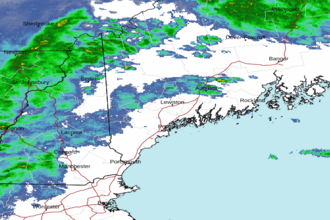 Portland ME Radar
 Northeast Radar