Port Mansfield, TX to the Rio Grande River 20 - 60 NM Marine Forecast
| Rest Of Today...Southeast Winds Around 10 Knots. Seas 3 To 4 Feet. |
| Tonight...Southeast Winds 10 To 15 Knots. Seas 3 To 4 Feet. |
| Thursday...Southeast Winds 10 To 15 Knots Increasing To 15 To 20 Knots In The Afternoon. Seas 3 To 4 Feet. |
| Thursday Night...Southeast Winds 20 To 25 Knots With Gusts Up To 30 Knots. Seas 4 To 6 Feet, With Occasional Seas Up To 7 Feet Building To 6 To 9 Feet, With Occasional Seas Up To 11 Feet After Midnight. |
| Friday...Southeast Winds 20 To 25 Knots With Gusts Up To 30 Knots Decreasing To 15 To 20 Knots In The Afternoon. Seas 7 To 9 Feet, With Occasional Seas Up To 11 Feet. |
| Friday Night...Southeast Winds 15 To 20 Knots Increasing To 20 To 25 Knots After Midnight. Seas 6 To 8 Feet, With Occasional Seas Up To 9 Feet. |
| Saturday...Southeast Winds 20 To 25 Knots With Gusts Up To 30 Knots. Seas 6 To 9 Feet, With Occasional Seas Up To 11 Feet. |
| Saturday Night...Southeast Winds 15 To 20 Knots With Gusts Up To 30 Knots. Seas 7 To 9 Feet, With Occasional Seas Up To 11 Feet. |
| Sunday...Southeast Winds 15 To 20 Knots With Gusts Up To 30 Knots Decreasing To 10 To 15 Knots In The Afternoon. Seas 7 To 9 Feet, With Occasional Seas Up To 11 Feet. |
| Sunday Night...Southeast Winds 10 To 15 Knots. Seas 6 To 8 Feet, With Occasional Seas Up To 9 Feet. |
| Area Forecast Discussion National Weather Service Brownsville TX 631am CDT Wednesday April 24 2024 Long Term (Thursday night through Tuesday) Issued at 414am CDT Wednesday April 24 2024 Generally dry and tranquil weather will prevail through the long term period. A couple of mid to upper level short waves will swing over the Plains Friday and Saturday night into Sunday. At the surface, high pressure across the region will interact with a series of low pressure systems moving across the Plains. The tight pressure gradient accompanying the aforementioned pattern will maintain strong southeast to south winds, especially for Friday and Saturday. Friday and Saturday will be breezy to windy and could reach wind advisory criteria over the eastern third or so of the CWA, each afternoon. Breezy conditions are expected to continue across the area on Sunday. Rain-free conditions are expected through the weekend. Rain chances are expected to increase early next week due to convection from the Sierra Madre Oriental. Showers and thunderstorms are in the forecast staring Monday afternoon and night. Temperatures will remain several degrees above normal through the period. Highs each afternoon should range from the 80s near the coast to around the mid 90s across the Rio Grande Plains under a mix of sun and clouds. Overnight lows are expected to fall into the low to mid 70s each night. High Risk of Rip Currents will be likely Friday into Saturday. Marine Issued at 414am CDT Wednesday April 24 2024 Today through Thursday...Light to moderate seas and moderate winds are expected to continue through today. A strengthening pressure gradient on Thursday will result in strong southeasterly winds developing. This ultimately will result in adverse marine conditions developing as early as Thursday with building seas and heightened rip current risk. That said, a High Risk for Rip Current Statement has been issued along the island beaches beginning Thursday morning and persisting into Thursday evening. Thursday night through Monday...Ongoing adverse conditions are expected through much of the forecast period. Strong southeast winds will prevail Friday through Saturday, courtesy of interaction between Plains low pressure and higher pressure across the West Gulf. Small Craft Advisories will likely continue on the Laguna Madre through Saturday. Small craft should exercise caution conditions are expected to develop Saturday night and continue through Monday as winds moderate to fresh. Small Craft Advisory conditions will be likely on the Gulf through the period due to strong winds and high seas. NOAA Brownsville TX Office: Watches - Warnings - Advisories TX...High Rip Current Risk from Thursday morning through Thursday evening for TXZ451-454-455. GM...None. |
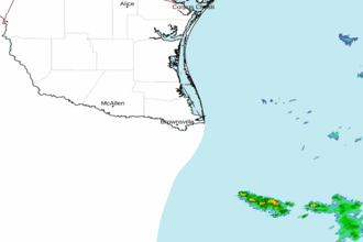 Brownsville TX Radar
 Gulf Radar