Sabine Lake Marine Forecast
| Today...Southeast Winds 5 To 10 Knots, Becoming South 10 To 15 Knots With Gusts Up To 20 Knots This Afternoon. Lake Waters Choppy. Patchy Fog Early This Morning. |
| Tonight...Southeast Winds 15 To 20 Knots With Gusts Up To 25 Knots. Lake Waters Rough. |
| Friday...South Winds 20 To 25 Knots, Diminishing To 15 To 20 Knots In The Afternoon. Lake Waters Very Rough. |
| Friday Night...Southeast Winds 20 To 25 Knots, Increasing To 25 To 30 Knots After Midnight. Lake Waters Extremely Rough. |
| Saturday...Southeast Winds 25 To 30 Knots. Lake Waters Extremely Rough. |
| Saturday Night...Southeast Winds 25 To 30 Knots. Lake Waters Extremely Rough. |
| Sunday...Southeast Winds 20 To 25 Knots. Lake Waters Very Rough. A Slight Chance Of Showers And Thunderstorms In The Afternoon. |
| Sunday Night...Southeast Winds 15 To 20 Knots. Lake Waters Rough. A Slight Chance Of Showers And Thunderstorms In The Evening, Then A Chance Of Showers And Thunderstorms After Midnight. |
| Monday...South Winds Around 15 Knots, Diminishing To Around 10 Knots In The Afternoon. Lake Waters Choppy. A Chance Of Showers And Thunderstorms. |
| Monday Night...Southeast Winds Around 10 Knots. Lake Waters Light Chop. A Chance Of Showers And Thunderstorms, Mainly In The Evening. Winds And Waves Higher In And Near Thunderstorms. |
| Area Forecast Discussion National Weather Service Lake Charles LA 239am CDT Thu April 25 2024 ...New SHORT TERM, LONG TER Marine .SHORT TERM... (Today through Saturday night) Issued at 139am CDT Thu April 25 2024 Weak high pressure remains the main factor influencing our weather and will continue to be so for most of the short-term forecast. Across Arkansas, a frontal boundary is slowly moving southward and will increase our pressure gradient. As the PG builds, winds will increase, especially on Friday and Saturday, with advisories likely both inland and offshore. At the surface, high pressure will remain to our east, which will continue to push warm, moist Gulf air into the southeast US. Temperatures will continue to slowly rise through the weekend, with our highs in the mid- to upper-80s. This strong onshore flow is also a concern for coastal flooding during high tide. By Sunday, the PG will start to lessen and the winds will weaken. A robust upper-level trough will be ejected from the Rockies this weekend. This system will mainly impact north Louisiana and Texas, with little in the way of convection for our area until Monday. Long Term (Sunday through Thursday) Issued at 139am CDT Thu April 25 2024 As the forecast period begins, the pattern will continue to see high pressure at the surface off the southeast US coast ridging into the forecast area providing southerly flow that will bring in warm and moist Gulf of Mexico air. Another deep low pressure system is expected to be over the Plains that will tighten the gradient across the region with very breezy and gusty south winds that are currently projected to be sustained in the 15 to 25 mph range with gusts around 35 mph. Therefore, there is a good chance that a wind advisory may be needed for Sunday. The one change that will begin on late Sunday will be the upper level ridge weakening and shifting to the east. This will allow a short wave to move west to east into the forecast area late in the day. By that time, plenty of Gulf moisture will be around with PWAT (Precipitable Water) values ranging from 1.40 to 1.75 inches, with the higher values above the 90th percentile of Storm Prediction Center daily climo. Also, the higher numbers will be over western portions of the forecast area. Therefore, rain chances will be introduced to the forecast for southeast Texas and west central Louisiana to coincide with the higher moisture values and weakness aloft. Decent instability will also be noted on Sunday afternoon and evening with CAPE values over 2000 j/kg to go along with forecast slow storm motion speed with movement becoming parallel to the mid level flow. Therefore, with the high atmospheric moisture content, the stronger convection will have some potential to produce high rainfall rates over a prolonged time for a location. Therefore, WPC will have southeast Texas into a portion of west central Louisiana outlined in a Marginal Risk (level 1 out of 4) Potential for Excessive Rainfall. The weakness aloft will continue to expand east on Monday with the high moisture content hanging around with PWAT (Precipitable Water) values in the 1.50 to 1.75 inch range, again above 90th percentile of Storm Prediction Center daily climo, with 100H-50H mean layer relative humidity in the 60 to 70 percent range. Again, slow storm motions are forecast along with movement parallel to the mid level flow. Favorable instability will be hanging around with CAPE near or above 2000 j/kg. Therefore, the stronger storms again will have the potential for high rainfall rates that may stay over a location for a prolonged period. Therefore, WPC will have a Slight Risk (level 2 out of 4) Potential for Excessive Rainfall for portions of southeast Texas and central Louisiana, with the remainder of the forecast area in a Marginal Risk. The unsettled pattern will continue into Tuesday before upper level ridging begins to build back into the forecast area for mid week. Marine Issued at 211am CDT Thu April 25 2024 Starting on today winds will start to increase becoming moderate to strong. Winds will continue to increase on Friday with gusts up to 30 knots. The elevated winds will continue on Saturday as well before weakening on Sunday. Waves will also build in the outer waters reaching 7 feet or more by Friday morning. Lakes and bays will be rough to very rough conditions. A Small Craft Advisory is likely starting on Thursday night and lasting through Saturday as the pressure gradient further tightens across the area building seas further into the weekend under a strong southerly regime. NOAA Lake Charles LA Office: Watches - Warnings - Advisories LA...None. TX...None. GM...None. |
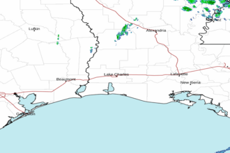 Lake Charles LA Radar
 Gulf Radar