South Santee River to Edisto Beach, SC Marine Forecast
| Today...W Winds 10 Kt, Becoming N Later This Morning, Then E This Afternoon. Seas 2 To 3 Ft. Wave Detail: Sw 3 Ft At 5 Seconds And E 3 Ft At 11 Seconds, Becoming S 2 Ft At 5 Seconds And E 2 Ft At 11 Seconds. |
| Tonight...E Winds 5 To 10 Kt, Increasing To 10 To 15 Kt With Gusts To 20 Kt After Midnight. Seas 2 To 3 Ft. Wave Detail: E 3 Ft At 4 Seconds And E 2 Ft At 11 Seconds. |
| Fri...Ne Winds 15 To 20 Kt. Seas 3 To 4 Ft. Wave Detail: E 4 Ft At 10 Seconds And E 3 Ft At 4 Seconds. |
| Fri Night...E Winds 15 To 20 Kt. Seas 4 To 5 Ft. Wave Detail: E 5 Ft At 6 Seconds. |
| Sat...E Winds 10 To 15 Kt. Seas 3 To 4 Ft. Wave Detail: E 4 Ft At 7 Seconds. |
| Sat Night...E Winds 10 To 15 Kt. Seas 3 To 4 Ft. Wave Detail: E 4 Ft At 7 Seconds. |
| Sun...Se Winds 10 Kt. Seas 3 To 4 Ft. |
| Sun Night...Se Winds 5 To 10 Kt. Seas 3 To 4 Ft. |
| Mon...S Winds 5 To 10 Kt. Seas 2 To 3 Ft. |
| Mon Night...S Winds 5 To 10 Kt. Seas 2 To 3 Ft. |
| Area Forecast Discussion National Weather Service Charleston SC 319am EDT Thu April 25 2024 Synopsis A weak trough will drop south of the area today. High pressure builds back into the region late week through the early part of next week. Near Term - Through Tonight Today: A weak surface trough will move steadily south through the area today as high pressure ever so slowly builds in from the north. A zonal flow aloft will gradually more anticyclonic through the day as subtropical ridging begins to build to the west. Within a weak surface pressure pattern, a modest sea breeze circulation is likely to develop along the beaches by early afternoon and move steadily inland. Low-level thickness schemes support highs in the lower-mid 80s inland this afternoon with cooler conditions closer to the beaches. A band of clouds around 6-8 kft will gradually mix out as it drops to the south. Mostly sunny skies will prevail for much of the day, although some shallow cumulus could develop across the coastal counties along/ahead of the sea breeze. Tonight: Subtropical ridging will steadily build through the night as surface high pressure builds south. The pressure gradient looks to slowly tighten overnight as heigheights build aloft. This increase in the gradient should keep the boundary layer from fully decoupling except in the typical more sheltered areas. An onshore flow coupled with some lingering wind will keep coastal temperatures somewhat elevated. Lows will range from the mid-upper 50s well inland to the mid-upper 60s at the beaches, warmest along the Georgia beaches. Short Term - Friday Through Sunday High pressure will provide a quiet and pleasant weekend to the area. The high initially centered to the north on Friday will gradually sink south to off the Carolina coast on Sunday. Aloft, ridging will shift east and settle over the region. While a stray shower cannot be ruled out, lack of forcing will maintain a dry forecast through the period. High temperatures remain within a few degrees of normal, generally in the upper 70s to lower 80s each day. Lows both nigheights range from the mid/upper 50s inland to the mid 60s along the immediate coast. Long Term - Sunday Night Through Wednesday Surface high pressure will largely dominate the weather pattern during the early to middle of next week. A weakening mid level trough will approach the East coast during the latter half of the period and bring a front towards the area, but all indications show that the high pressure should hold firm with the front generally washing out. The better potential for showers/thunderstorms will be on Wednesday but even that looks pretty sparse, so Probability of Precipitation reflect just isolated coverage at this time. Temperatures will be warm, with highs peaking in the mid/upper 80s especially Tuesday and Wednesday. Marine Today: West winds will veer to the north through the day as a weak surface trough moves south. Winds will then turn onshore this afternoon as a modest sea breeze circulation takes hold. Some enhancements along the land/sea interface and Charleston Harbor are likely to occur with winds becoming gusty mid-late afternoon. Winds will generally remain 10 kt for less through day, but will be closer to 15 kt with gusts to 20 kt near the beaches and Charleston Harbor with the sea breeze. Seas will average 2-4 ft, highest over the Georgia offshore leg 20-60 NM offshore. Tonight: Easterly winds will slowly increase overnight in response to a tightening of pressure gradient from high pressure building in from the north. Speeds will average 10 kt from Edisto Beach and points south with 10-15 kt over the South Santee-Edisto Beach out 20 NM leg. Seas will average 2-4 ft. Friday through Tuesday: Easterly onshore flow persists through much of the period, veering more southerly late. Speeds largely average in the 10-15 knot range, with perhaps a brief peak in the 15-20 knot range on Friday afternoon. There could be a period where 6 foot seas impact the far reaches of the outer Georgia waters Friday night into Saturday, but it looks pretty marginal for a Small Craft Advisory at this time. Equipment The KCLX radar is undergoing electrical maintenance and is tentatively scheduled to return to service April 26th. NOAA Charleston SC Office: Watches - Warnings - Advisories GA...None. SC...None. Marine None. |
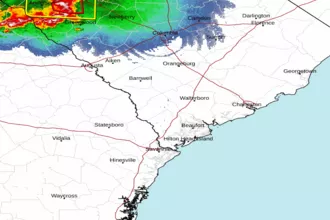 Charleston SC Radar
 Southeast Radar