Stonington ME to Port Clyde ME Marine Forecast
| Today...S Winds 10 To 15 Kt, Becoming Sw Late. Gusts Up To 25 Kt. Seas 3 To 4 Ft, Building To 4 To 6 Ft This Afternoon. Wave Detail: Se 3 Ft At 8 Seconds And S 3 Ft At 4 Seconds, Becoming Se 4 Ft At 10 Seconds And S 3 Ft At 5 Seconds. A Chance Of Showers Late This Morning And Afternoon. |
| Tonight...Nw Winds 20 To 25 Kt With Gusts Up To 30 Kt. Seas 5 To 7 Ft. Wave Detail: Se 5 Ft At 10 Seconds And Nw 5 Ft At 5 Seconds. |
| Thu...Nw Winds 15 To 20 Kt With Gusts Up To 30 Kt, Becoming W 10 To 15 Kt With Gusts Up To 20 Kt In The Afternoon. Seas 4 To 6 Ft, Subsiding To 3 To 4 Ft In The Afternoon. Wave Detail: Se 4 Ft At 9 Seconds And Nw 4 Ft At 4 Seconds, Becoming Se 3 Ft At 8 Seconds And W 2 Ft At 4 Seconds. |
| Thu Night...W Winds 5 To 10 Kt, Becoming Nw After Midnight. Seas 2 To 3 Ft. Wave Detail: Se 2 Ft At 8 Seconds And W 2 Ft At 5 Seconds. |
| Fri...Nw Winds Around 5 Kt, Becoming Sw With Gusts Up To 20 Kt In The Afternoon. Seas Around 2 Ft. Wave Detail: Se 2 Ft At 9 Seconds And Sw 2 Ft At 5 Seconds. |
| Fri Night...Sw Winds 5 To 10 Kt. Seas 2 To 3 Ft. Wave Detail: Se 2 Ft At 9 Seconds And Sw 2 Ft At 4 Seconds. |
| Sat...W Winds 5 To 10 Kt, Becoming Sw 10 To 15 Kt In The Afternoon. Seas 2 To 3 Ft. |
| Sat Night...Sw Winds 10 To 15 Kt. Seas 3 To 4 Ft. |
| Sun...S Winds 10 To 15 Kt. Seas 3 To 4 Ft. |
| Sun Night...S Winds 5 To 10 Kt. Seas 2 To 4 Ft. |
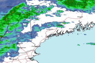
| Area Forecast Discussion National Weather Service Gray ME 320am EDT Wednesday April 24 2024 Synopsis Low pressure moves into the region today bringing rain showers and perhaps a few snow flakes to the mountains. Dry high pressure then moves across the region Thursday through Saturday. A warming trend can be expected over the weekend with chance of showers Saturday night or Sunday. Warmer weather is then expected early next week. Near Term - Until 7pm This Evening A cold front will cross the region today with an upper level short wave crossing the region during the midday hours. Models continue to be in relatively good agreement developing a weak area of low pressure along this system. Showers will cross western Maine and New Hampshire with the highest probability of precipitation over the northern mountains. The precipitation may end as a brief period of snow across the higher terrain this afternoon. Little accumulation is expected. Strong cold air advection and an increasing gradient will allow for gusty winds towards the later portion of today. Afternoon highs will generally be in the 40s north to the 50s in the south. .SHORT TERM /7pm THIS EVENING THROUGH 6pm THURSDAY/... Gusty winds expected tonight with GYX probabilistic data plots suggesting wind gusts in excess of 25 kts. Clearing will continue as a large ridge of high pressure builds into the region from Canada. It will be chilly with lows in the upper teens north to the 20s south. Much less in the way of wind is expected for Thursday as the ridge builds over northern New England. Highs will once again reach the 40s in the north to the lower to mid 50s across the south under mostly sunny conditions. Long Term - Thursday Night Through Tuesday Overview: A large dome of high pressure builds over the eastern CONUS Thursday through Saturday. This will result in warm days and cool nigheights under partly to mostly sunny skies. High pressure then moves to our east by early Sunday as a weak frontal boundary arrives from the west, resulting in an increased chance for scattered showers Saturday night through part of Sunday. Showery conditions at times along with warm temperatures look to continue through early to mid next week. Impacts: Low afternoon RH is likely on Friday with values falling into the teens to 20s percent range. This will be in combination with west-northwesterly wind gusts up to around 25 mph, which could result in increased fire weather conditions. Forecast Details: Surface high pressure will build over the eastern CONUS on Thursday through Saturday, resulting in warm days and cool nights. Thursday night will feature mainly clear skies along with light winds, which will result in good radiational cooling conditions. Therefore blended in raw MOS guidance into the overnight forecast, which brings some interior valleys down into the teens to near 20 degrees with middle 20s to near 30 degrees elsewhere. Friday will feature partly to mostly sunny skies with warm afternoon temperatures into the 50s to middle 60s from north to south. Westerly winds up to around 20-25 mph combined with afternoon RH into the teens to 20s percent range could result in increased fire weather concerns but it will otherwise be a nice day. Another night of radiational cooling is then likely Friday night under mostly clear skies and light winds. Lows will range from the 20s to lower 30s. Light winds and warm temperatures will prevail on Saturday with highs into the 60s in most locations. The weak flow will likely result in a sea breeze though, which would keep the coast cooler given current SSTs. Clouds will increase by Saturday night with perhaps a few scattered showers by dawn as a front approaches from the west. Scattered showers and mainly cloudy skies are then likely on Sunday as the frontal boundary remains near the region. It does not look like a washout though and latest ensemble guidance suggests light rainfall amounts. Despite the clouds it will remain warm with perhaps a few 70 degree readings over southern NH depending on cloud cover. Depending on the placement of another frontal boundary, some showery weather will remain possible at times through the first half of next week but rainfall looks to remain on the light side with temperatures remaining mild. Marine Short Term SCAs (Small Craft Advisories) have been issued as winds will be increasing over the coastal waters beginning this afternoon. A few gusts may approach gales for a short period this evening. Long Term Winds and seas to remain below thresholds hazardous to small crafts as high pressure builds over the waters. NOAA Gray/Portland ME Office - Watches - Warnings - Advisories ME...None. NH...None. Marine Small Craft Advisory from 1pm this afternoon to 8am EDT Thursday for ANZ150-152-154. Small Craft Advisory from 6pm this evening to 4am EDT Thursday for ANZ151-153. |
 Portland ME Radar
 Northeast Radar