Suwannee River to Apalachicola FL from 20 to 60 NM Marine Forecast
| Rest Of Today...East Winds Around 5 Knots, Becoming South Late. Waves 1 Foot Or Less. Protected Waters A Light Chop. |
| Tonight...West Winds 5 To 10 Knots, Becoming North After Midnight. Waves 1 Foot Or Less. Protected Waters A Light Chop. |
| Friday...Southeast Winds 5 To 10 Knots. Waves 1 Foot Or Less. Protected Waters A Light Chop. |
| Friday Night...East Winds 10 To 15 Knots, Increasing To 15 To 20 Knots After Midnight. Waves 1 Foot Or Less, Then 2 To 3 Feet With A Dominant Period Of 3 Seconds After Midnight. Protected Waters Choppy. |
| Saturday...East Winds 15 To 20 Knots, Diminishing To 10 To 15 Knots In The Afternoon. Seas 2 To 4 Feet With A Dominant Period Of 4 Seconds. Protected Waters Choppy. |
| Saturday Night...East Winds 15 To 20 Knots, Increasing To 20 To 25 Knots With Gusts Up To 30 Knots After Midnight. Seas 3 To 5 Feet With A Dominant Period Of 6 Seconds. Protected Waters Rough. |
| Sunday...East Winds 15 To 20 Knots, Becoming Southeast 10 To 15 Knots In The Afternoon. Seas 3 To 5 Feet With A Dominant Period Of 6 Seconds. Protected Waters Choppy. |
| Sunday Night...East Winds 10 To 15 Knots, Increasing To 15 To 20 Knots After Midnight. Seas 2 To 4 Feet With A Dominant Period Of 6 Seconds. Protected Waters Choppy. |
| Monday...Southeast Winds 15 To 20 Knots, Diminishing To 10 To 15 Knots In The Afternoon. Seas 2 To 4 Feet With A Dominant Period Of 6 Seconds. Protected Waters Choppy. |
| Monday Night...North Winds 5 To 10 Knots, Becoming East 10 To 15 Knots After Midnight. Seas 2 To 3 Feet With A Dominant Period Of 6 Seconds. Protected Waters A Moderate Chop. |
| Area Forecast Discussion National Weather Service Tallahassee FL 1032am EDT Thu April 25 2024 ...New Issued at 1027am EDT Thu April 25 2024 Forecast is on track. A weak frontal boundary may sag into our northern areas today along with a seabreeze that will move inland later today. Can't rule out a sprinkle along the seabreeze or in southeast Alabama later today. Otherwise, skies will be mostly sunny and highs in the 80s. Near Term (Today and tonight) Issued at 329am EDT Thu April 25 2024 Northwesterly upper level flow prevails through tonight ahead of a building upper level ridge currently across the central Plains. A weak shortwave will traverse across the region in the northwesterly flow aloft and combined with a warmer afternoon and slightly higher preciptable waters, we'll likely see a few more clouds around today. Rain is not expected, but a brief rain shower can't be ruled out across our southeast Alabama counties, but even here rain chances are less than 10%. Light north and northwest winds are forecast in the morning and will become southerly through the afternoon as the seabreeze develops and more through. High temperatures will be in the mid 80s. Quiet conditions are expected tonight with only forecast concerns being patchy/areas of fog developing across the Panhandle overnight. .SHORT TERM... (Friday through Saturday night) Issued at 329am EDT Thu April 25 2024 Surface high pressure slowly slides eastward on Friday, while a deep surface low develops over the central U.S. Upper level ridging will be building in from the west during this period, which will allow dry conditions to continue. The pressure gradient between the surface high over the east and the low over the upper Midwest/Great Lakes region will tighten allowing for breezier conditions on Saturday. Highs for Friday will generally be in the mid to upper 80s, although the FL coast will may only top out in the upper 70s to low 80s. Lows Friday night into Saturday morning will be in the low to mid 60s. Saturday's highs will generally be in the mid 80s for inland areas and low 80s near the coast. Saturday night into Sunday morning, lows vary from the low to mid 60s for much of the region. Long Term (Sunday through Wednesday) Issued at 329am EDT Thu April 25 2024 Upper level ridging looks to hold along the eastern seaboard for much of the region, with surface high pressure sliding down the seaboard and towards Bermuda. This will generally hold and keep fairly dry conditions in place. A disturbance passes to our north midweek which could lead to some showers and rumbles of thunder to our northern and eastern most counties late Tuesday into Wednesday. Marine Issued at 329am EDT Thu April 25 2024 No major changes to the forecast as light and variable winds are expected through the early morning. Winds will then shift to the east and southeasterly allowing for a brief period of onshore flow this afternoon. Winds once again go light and variable overnight, with a east and south east flow regime taking over on Friday and continuing into the weekend. With a strong pressure gradient developing, and the combination of the Atlantic Seabreeze, expect cautionary/advisory level conditions to develop for the weekend. The strongest winds are likely to be in the overnight and early morning hours as the easterly surges from the Atlantic seabreeze pass through. Fire Weather Issued at 329am EDT Thu April 25 2024 Light westerly and northwest are expected today with winds becoming southerly across Florida and into southern AL/GA as the seabreeze develops and moves inland in the afternoon. Dispersions will be similar to Wednesday, but greater mixing potential is expected along with warmer temperatures. Atmospheric stability will be a little lower this afternoon compared to Wednesday so would not be surprised for dispersions to verify a little higher than forecast today. Dry conditions are expected again, and through the upcoming weekend. Prevailing winds will increase Friday and into the weekend as an east and southeasterly flow regime develops. This will likely bring nocturnal increases in winds in the overnight hours. The only fire weather concerns through the period will be high dispersions on Friday and a period of higher dispersions over the weekend along conditions continuing to dry out. No appreciable rainfall is expected for at least the next 5 days, and possibly extending into much of next week. Hydrology Issued at 329am EDT Thu April 25 2024 Little to rain is forecast for the period, which means the only hydrology concerns are with the ongoing riverine flooding. Minor flooding continues along the middle and lower Suwannee, the lower Withlacoochee, the Aucilla, and the St. Marks Rivers. The Aucilla and St. Marks continue to fall and should exit flood stage in the next 1 to 2 days. On the Suwannee, the flood wave is now near Branford and will continue to move downstream over the next 5 to 7 days. NOAA Tallahassee FL Office: Watches - Warnings - Advisories FL...None. GA...None. AL...None. GM...None. |
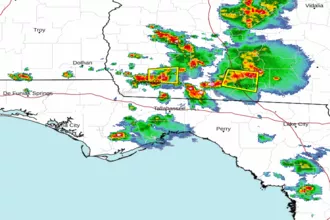 Tallahassee FL Radar
 Gulf Radar