Tampa Bay Marine Forecast
| Tonight...Northwest Winds 5 To 10 Knots, Becoming North Late. Bay And Inland Waters Light Chop. |
| Saturday...North Winds Around 5 Knots, Becoming West In The Afternoon. Bay And Inland Waters Light Chop. |
| Saturday Night...West Winds 5 To 10 Knots. Bay And Inland Waters Light Chop. |
| Sunday...South Winds 5 To 10 Knots, Becoming Southwest 10 To 15 Knots In The Afternoon. Bay And Inland Waters A Moderate Chop. |
| Sunday Night...West Winds 5 To 10 Knots. Bay And Inland Waters Light Chop. |
| Monday...West Winds 5 To 10 Knots, Increasing To 10 To 15 Knots With Gusts Up To 20 Knots In The Afternoon. Bay And Inland Waters A Moderate Chop. A Chance Of Showers With A Slight Chance Of Thunderstorms. |
| Monday Night...Northwest Winds 10 To 15 Knots, Becoming Northeast With Gusts Up To 20 Knots After Midnight. Bay And Inland Waters A Moderate Chop. A Slight Chance Of Showers And Thunderstorms In The Evening. |
| Tuesday...Northeast Winds Around 10 Knots. Bay And Inland Waters Light Chop. |
| Tuesday Night...North Winds Around 10 Knots, Becoming Northeast After Midnight. Bay And Inland Waters Light Chop. |
| Wednesday...East Winds 5 To 10 Knots, Becoming North In The Afternoon. Bay And Inland Waters Light Chop. Winds And Waves Higher In And Near Thunderstorms. |
| Area Forecast Discussion National Weather Service Tampa Bay Ruskin FL 227pm EDT Fri April 19 2024 ...New SHORT TERM, LONG TERM, Marine IRE WEATHER... Short Term - Today through Saturday Issued at 220pm EDT Fri April 19 2024 A fairly warm and rain free couple of days as high pressure remains over the Peninsula. Very dry airmass should also be in place with humidity values getting dangerously low over the interior. In terms of winds, both tonight and Saturday should be light and variable becoming onshore behind the afternoon sea breeze. Temperatures climb up into the low 90s in most areas, except for the immediate coast during this time. .LONG TERM (SUN-THU)... Issued at 220pm EDT Fri April 19 2024 During the long term, an upper level disturbance currently impacting the southwestern dessert should approach the Southeast by early next week and out of the area late on Monday. At this time, model guidance keeps most of the U/L support north of the CWA. If this materializes, the highest rain chances should lay along the I-4 corridor and north. Nonetheless, areas south could experiences a shower or two. Behind the aforementioned disturbance, a weak high pressure builds through the rest of the period. This should also push cooler temperatures into the state mainly in the morning. However, they will not last long. Afternoon highs warm back up to the 90s during the second half of the week. Marine Issued at 220pm EDT Fri April 19 2024 Area of high pressure should keep light winds and seas through the weekend with an onshore flow developing each afternoon along the coast. The next cold front will move across the waters on Monday with a chance of showers and thunderstorms, with the best chance across the northern waters. High pressure will build back over the region in the wake of the front on Tuesday. Fire Weather Issued at 130pm EDT Fri April 19 2024 High pressure remains in control across fore districts with light and variable winds early, and westerly in the afternoon through Saturday. The main concern will be the potential for low clouds and fog tonight and into Saturday morning. Most of it should be ground fog and should dissipate after sunrise. Minimum humidities are expected to be near or at critical levels during this time, especially over interior locations. However, the lack of wind should keep any warnings from being needed. Then, a disturbance increases rain chances into early next week. Followed by cooler and drier conditions later in the period as high pressure returns to the area. NOAA Tampa FL Office: Watches - Warnings - Advisories FL...None. Gulf waters...None. |
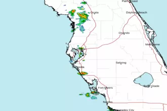 Tampa Bay FL Radar
 Gulf Radar