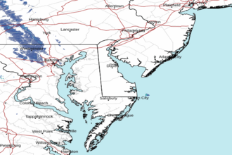
Tangier Sound and the inland waters surrounding Bloodsworth Island Marine Forecast
| Tonight...Se Winds 10 To 15 Kt...Becoming Sw 5 Kt Late. Waves 1 Ft. Isolated Showers Early This Evening, Then Numerous Showers With Isolated Tstms After Midnight With Vsby 1 To 3 Nm. |
| Sat...Nw Winds 10 To 15 Kt. Waves 2 Ft. Numerous Showers. Vsby 1 To 3 Nm. |
| Sat Night...W Winds 5 Kt...Becoming N 10 To 15 Kt In The Late Evening And Overnight. Gusts Up To 20 Kt. Waves 1 To 2 Ft. |
| Sun...Nw Winds 5 To 10 Kt. Waves 1 Ft. |
| Sun Night...W Winds 5 To 10 Kt. Waves 1 Ft. |
| Mon...N Winds 10 Kt. Waves 1 Ft. |
| Mon Night...E Winds 5 To 10 Kt. Waves 1 Ft. |
| Tue...E Winds 5 Kt...Becoming S 10 To 15 Kt. Waves 1 To 2 Ft. |
| Wed...Sw Winds 10 To 15 Kt...Becoming Nw. Waves 2 Ft. Winds And Waves Higher And Visibilities Lower In And Near Tstms. |
| Area Forecast Discussion National Weather Service Baltimore MD/Washington DC 906pm EDT Fri April 19 2024 Synopsis Low pressure will track well to our north today, causing a cold front to move through later tonight. High pressure will build into the area for this weekend into early next week. Low pressure will track to our north on Wednesday, causing another cold front to move through the area. Near Term - Through Saturday A cold front that extends southward from an area of low pressure near James Bay is just entering far western portions of the forecast area this evening. Over the course of the night, this front will spread eastward across the area, clearing southern Maryland just prior to daybreak. A few showers are currently located in the vicinity of the front across western MD and the WV Panhandle. These showers should spread eastward with the front over the course of the night, giving all locations a chance for a quick shower or two. Overall, coverage of the showers is rather unimpressive, so rainfall totals are expected to be minimal, and much of the night should stay dry in any given location. Outside of any showers, skies should remain cloudy. Winds will initially be light out of the southeast, but turn northwesterly later in the night behind the front. Overnight low temperatures will range from the upper 30s in the mountains to the low-mid 50s to the east of the Blue Ridge. Short Term - Saturday Night Through Sunday Night Low pressure will continue to depart well off to our north tomorrow. Post cold frontal northwesterly flow will gradually cool and dry out the boundary layer over the course of the day. Skies will start out mostly cloudy, but gradual clearing is expected as drier air works into the area. Seasonable temperatures are in the forecast, with highs generally in the 60s to lower 70s for most (50s in the mountains). Winds may gust to around 20 to 30 mph out of the northwest during the afternoon. Areas of low pressure will pass by both to our north and south Saturday night through Sunday night, with a narrow ridge of high pressure in place locally. Conditions will remain dry, with a mix of sun and clouds through that time. It will be cooler Sunday, with highs in the upper 50s/lower 60s for most. Some patchy frost may also be possible Saturday night or Sunday night in sheltered valleys to the west of the Blue Ridge. Long Term - Monday Through Friday High pressure over the region kicks off the beginning of the work week on Monday with a weak shortwave passing to our south. Tuesday will also be dry to start before high pressure moves offshore and low pressure with an associated cold front approaches from the west. Rain chances expand NW to SE across the area Tuesday night into Wednesday and exiting by Wednesday night. Another area of high pressure moves in behind it. With the tight pressure gradient between the low pressure and the high pressure on the front and back ends of the system, gusty winds are likely during the day Tuesday through Wednesday night, and possibly lingering into Thursday. Southerly winds on Tuesday could gust up to 20-25 kt. Stronger NW gusts are likely behind the cold front on Wednesday during the day, up to around 25-30 kt. Dry conditions continue Thursday into Friday with the next chance for precipitation approaching Friday night into the weekend. Temperatures will be near normal on Monday in the 50s and 60s, and warm to above normal Tuesday into Wednesday with the southerly flow. Highs on Wednesday will depend on the timing of the cold frontal passage as temps drop behind it. As such, expect it cooler on Thursday before moderating into the weekend. Marine Winds are currently sub-SCA (Small Craft Advisory) level over the waters. A cold front will move through later tonight, causing winds to turn northwesterly in its wake. SCAs (Small Craft Advisories) are in effect tomorrow afternoon into tomorrow evening as winds pick up in northwesterly flow. There also may be a 1-2 hour period immediately in the wake of the front around daybreak tomorrow where winds get close to SCA levels in northwesterly flow. Sub- SCA (Small Craft Advisory) northwesterly winds are expected on Sunday. Northwest winds on Monday are expected to remain below SCA (Small Craft Advisory) criteria and become southerly Monday night into Tuesday morning. As low pressure approaches the area, gusty southerly winds on Tuesday will likely exceed SCA (Small Craft Advisory) criteria by the afternoon, and continue overnight and into Wednesday. Tides / Coastal Flooding Tidal anomalies have drastically increased today, causing water levels to rise rapidly. Coastal Flood Advisories are in effect during the upcoming tidal cycle for DC/Alexandria, King George/Charles, Calvert, Baltimore, and Harford Counties, with Coastal Flood Warnings in effect for Anne Arundel and St. Mary's Counties. Water levels will likely remain elevated through the tide cycle tonight as well, and additional headlines may be needed. Anomalies should finally start to decrease late tonight into tomorrow as winds turn northerly and then eventually northwesterly, allowing water to drain out of the Bay. NOAA Baltimore MD/Washington DC Office: Watches - Warnings - Advisories DC...Coastal Flood Advisory until 9am EDT Saturday for DCZ001. MD...Coastal Flood Warning until 8am EDT Saturday for MDZ014. Coastal Flood Advisory until 3am EDT Saturday for MDZ016. Coastal Flood Warning until 4am EDT Saturday for MDZ017. Coastal Flood Advisory until 4am EDT Saturday for MDZ018. VA...Coastal Flood Advisory until 9am EDT Saturday for VAZ054. Coastal Flood Advisory until 3am EDT Saturday for VAZ057. WV...None. Marine Small Craft Advisory from noon Saturday to 2am EDT Sunday for ANZ530>533-535-536-538>542. Small Craft Advisory from 8pm Saturday to 2am EDT Sunday for ANZ534-537-543. |
 Dover DE Radar
 Northeast Radar