Hurricane Center - Atlantic
Tropical Outlook
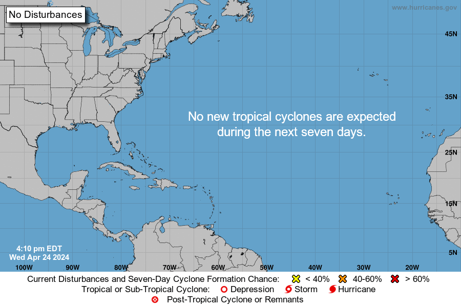
Tropical Weather Outlook
NWS National Hurricane Center Miami FL
700 PM EST Thursday November 30 2023
For the North Atlantic...Caribbean Sea and the Gulf of Mexico:
Tropical cyclone formation is not expected during the next 7 days.
This is the last regularly scheduled Tropical Weather Outlook of the 2023 Atlantic Hurricane Season. Routine issuance of the Tropical Weather Outlook will resume on May 15, 2024. During the off-season, Special Tropical Weather Outlooks will be issued as conditions warrant.
Forecaster: John Cangialosi, National Hurricane Center
2021 Storm Names
• Anna (May 22 - 23, 45 mph, 1004mb)
• Bill (June 14 - 16, 60 mph, 998mb)
• Claudette (June 19 - 22, 45 mph, 1004mb)
• Danny (June 28 - 29, 45 mph, 1009mb)
• Elsa (July 1 - 9, 85 mph, 991mb)
• Fred (Aug 11 - 18, 65 mph, 993mb)
• Grace (Aug 13 - 21, 125 mph, 962mb)
• Henri (Aug 16 - 24, 75 mph, 986mb)
• Ida (Aug 26 - Sept 2, 150 mph, 933mb)
• Julian (Aug 29 - 30, 60 mph, 995mb)
• Kate (Aug 28 - Sept 1, 40 mph, 1004mb)
• Larry (Aug 31 - Sept 11, 125 mph, 955mb)
• Mindy (Sept 8 - 10, 45 mph, 1002mb)
• Nicholas (Sept 12 - 17, 75 mph, 988mb)
• Odette (Sept 17 - 18, 45 mph, 1002mb)
• Peter (Sept 19 - 22, 50 mph, 1007mb)
• Rose (Sept 19 - 23, 40 mph, 1007mb)
• Sam (Sept 22 - Oct 5, 145 mph, 943mb)
• Teresa (Sept 24 - 25, 45 mph, 1008mb)
• Victor (Sept 29 - Oct 4, 65 mph, 997mb)
• NEXT: Wanda
• Adria
• Braylen
• Caridad


Tropical Discussion
Atlantic Tropical Weather Discussion
NWS National Hurricane Center Miami FL
2:05AM EDT (0605 UTC) Monday Apr 29 2024
Tropical Weather Discussion for North America, Central America Gulf of Mexico, Caribbean Sea, northern sections of South America, and Atlantic Ocean to the African coast from the Equator to 31N. The following information is based on satellite imagery, weather observations, radar and meteorological analysis.
Based on 0000 UTC surface analysis and satellite imagery through 0630 UTC.
Monsoon Trough And Intertropical Convergence Zone - ITCZ
(The ITCZ is also known by sailors as the doldrums)
The monsoon trough enters the Atlantic near 11N15W and continues southwestward to 06N10W. The ITCZ extends from 06N10W to 00N30W to 06N40W to 04N51W. Numerous moderate to isolated strong convection is from 01S to 04N between 15W and 35W.
Discussion: Gulf Of Mexico
High pressure over the western Atlantic extends across the Gulf coast states, supporting moderate to fresh easterly winds across much of the Gulf of Mexico. Strong winds are noted off northern Yucatan, in the Florida Straits, and in the north-central Gulf, north of 25N.6 to 8 ft seas are over most of the Gulf east of 85W and north of 22N, including within the Yucatan Channel. A recent buoy observation recorded peak seas of 9 ft within 150 nm east offshore Corpus Christi, Texas.
For the forecast, the area of high pressure will weaken over the next few days, loosening the pressure gradient, and diminishing winds and decreasing seas across the basin. Elsewhere, winds will pulse to fresh to strong speeds near the Yucatan Peninsula and south-central Gulf each evening through the forecast period.
Discussion: Caribbean Sea
The aforementioned strong ridge in the NW Atlantic is also sustaining fresh to strong easterly trade winds in the lee of Cuba, the Gulf of Honduras, the Windward Passage, and south of Hispaniola. Seas in these waters are 5 to 7 ft, with the highest seas occurring in the Windward Passage. A recent scatterometer pass confirmed strong winds within the Windward Passage. Moderate to fresh trades and seas of 4 to 6 ft are noted in the south- central Caribbean Sea and the remaining waters in the NW Caribbean. Elsewhere, moderate or weaker winds and 3 to 5 ft seas prevail.
For the forecast, the high pressure over the western Atlantic will gradually weaken over the next few days. As a result, the fresh to occasionally strong winds in the Gulf of Honduras, the lee of Cuba, the Windward Passage, and south of Hispaniola will diminish early this week. Otherwise, moderate to locally fresh easterly winds will prevail. Northerly swell will bring seas of 8 ft through the passages in the NE Caribbean early next week.
Discussion: Atlantic Ocean
A cold front extends from 31N45W to 20N65W. Moderate to fresh NW winds are noted in recent scatterometer imagery mainly east of 60W behind the front. 1025 mb high pressure offshore the SE U.S. building in behind the front supports moderate to fresh NE winds west of 60W. Winds increase to mainly fresh to locally strong south of 27N and west of 70W. Strong winds are noted within the Windward Passage. Seas of 8 to 11 ft are found over much of the SW North Atlantic behind the front and in areas of fresh to strong winds. Seas of 5 to 8 ft are occurring north of 27N east of the front to 50W. Farther east, broad ridging is supporting moderate to fresh winds and 5 to 8 ft seas over the eastern Atlantic south of 31N.
For the forecast west of 55W, the cold front will weaken over the far southeastern waters through Monday night. Fresh to strong N-NE winds will prevail N of 28N behind the front to 60W with seas to 14 ft. Also, fresh to locally strong winds will cover the waters S of 22N and W of 70W through Mon. More tranquil marine conditions are expected afterwards as high pressure becomes centered over the NW waters.
Forecaster: Cassandra Mora, National Hurricane Center