Cape Charles Light to Currituck Beach Light Offshore Forecast
| Tonight...Ne Winds 10 To 15 Kt, Becoming E 5 To 15 Kt, Then, Becoming Se 5 To 10 Kt. Seas 3 To 6 Ft. Slight Chance Of Tstms Early. Slight Chance Of Showers. |
| Wed...S To Se Winds 5 To 10 Kt, Becoming S 10 To 15 Kt. Seas 3 To 4 Ft. Chance Of Showers And Tstms With Vsby 1 Nm Or Less. |
| Wed Night...S To Sw Winds 10 To 15 Kt, Becoming Sw 15 To 20 Kt. Seas 3 To 6 Ft. Chance Of Showers And Tstms With Vsby 1 Nm Or Less. |
| Thu...W To Sw Winds 15 To 25 Kt, Becoming W To Nw 5 To 15 Kt. Seas 4 To 7 Ft. |
| Thu Night...N Winds 5 To 15 Kt, Increasing To 10 To 20 Kt. Seas 4 To 7 Ft. |
| Fri...N Winds 10 To 20 Kt, Becoming N To Nw 10 To 15 Kt. Seas 4 To 7 Ft. |
| Fri Night...N To Nw Winds Less Than 10 Kt, Becoming W. Seas 4 To 7 Ft. |
| Sat...Nw Winds 5 To 10 Kt, Becoming N. Seas 3 To 5 Ft. |
| Sat Night...E To Ne Winds Less Than 10 Kt. Seas 3 To 5 Ft. |
| Sun...Ne Winds 10 To 15 Kt, Becoming N. Seas 3 To 5 Ft. |
| Sun Night...Ne Winds 10 To 15 Kt, Increasing To 15 To 20 Kt. Seas 3 To 6 Ft. |
| Area Forecast Discussion National Weather Service Wakefield VA 254pm EDT Tuesday April 16 2024 Synopsis This morning's front is forecast to lift back north as a warm front late tonight into Wednesday. Another front crosses the area Thursday with a stronger cold front then expected by the weekend. Near Term - Until 6am Wednesday Morning As of 250pm EDT Tuesday... Afternoon analysis shows strong low pressure over eastern Nebraska with high pressure near the Hudson Bay ridging south into the local area. Skies are mostly clear N and E of I-64 with some high clouds across the SW half of the area. Temperatures are in the 70s for inland areas with upper 60s near the coast where onshore flow continues. The front that came through the region early this morning has moved well SW into NC. Expect dry conditions to persist through the remainder of the day but the front is forecast to begin lifting back NE tonight which will allow for a slight chance of showers across the west. A weak trough to the north may provide enough of a focus for a few showers across the northern tier of counties late tonight but Probability of Precipitation are generally below 20%. Lows tonight will fall into the low and mid 50s. Short Term - 6am Wednesday Morning Through Friday As of 250pm EDT Tuesday... The front lifts NE through the area on Wednesday, bringing an increase in cloud cover and a chance for showers during the afternoon and evening. Highs will climb into the upper 70s and low 80s SW of I-64. The front will slow/stall to the NE of 64 which will keep highs in the upper 60s to around 70 degrees. Some instability is noted on forecast soundings during the evening hours so have added a slight chance of thunder to the weather grids. Low temps will be a few degrees warmer with upper 50s to low 60s forecast. Warm temperatures return for Thursday with a weak cold front moving through in the afternoon. Most guidance keeps the local area dry. Temps range from the mid 80s across the SW to the 70s for the immediate coast and Eastern Shore. Lows Thursday night will mostly be in the 50s with a few upper 40s possible for the MD Eastern Shore. A stronger front approaches the region on Friday with increasing chances for showers across the west in the afternoon. Will keep a mention of thunder in the forecast as well. High temps will again be warmest across the SW counties and coolest NE, ranging from the mid to upper 70s to the low 60s. Long Term - Friday Night Through Tuesday As of 250pm EDT Tuesday... A stronger cold front is forecast to approach from the NW Fri night and the 12z/16 global models now all show the front crossing the area early in the day on Saturday. Shower chances increase Friday evening ahead of the front but remain below 50%. Guidance has trended downward with respect to Probability of Precipitation on Saturday with most areas now 20% or less. With the earlier frontal passage timing, any mention of thunder has been removed for the area Saturday. Temps on Saturday will range from the upper 60s for the Eastern Shore to he low and mid 70s elsewhere. It will be much cooler behind the front on Sunday and Monday with highs in the 60s and overnight lows in the 40s. In addition, a southern stream low pressure system may bring additional rain to the region during this time (highest Probability of Precipitation are in SE VA/NE NC)...although there is still quite a bit of uncertainty regarding this feature. Otherwise, high pressure slowly builds in from the NW into early next week. Warming trend for Tuesday with highs back into the low 70a away from the water. Marine As of 250pm EDT Tuesday... NE winds have decreased to generally 10 kt or less across the waters as high pressure builds overhead. The high will shift offshore by this evening allowing winds to turn SE into Wednesday. Winds turn southerly at 10 to 15 kt by Wednesday evening as a frontal boundary just south of the area moves back north. Weak low pressure moves across the waters Thu allowing winds to turn north to northeast by Thu afternoon. This low is forecast to deepen slightly just offshore of the Delmarva late Thursday into Thursday night, which will allow N- NE winds to increase to 15 kt across the waters. Will keep conditions below small craft advisory criteria for now as the low is expected to stay far enough offshore to limit SCA (Small Craft Advisory) conditions. NE winds will continue Friday into Saturday although they will gradually diminish as the low weakens just offshore and high pressure builds in. Waves generally 2 ft or less in the bay through the week (except building to up to 3 feet at the entrance of the bay by Friday). Waves 2 to 3 feet building to 3 to 4 ft by Friday over the ocean. Climate Norfolk (KORF) set a new daily record high temperature with their high of 90 yesterday (4/15), breaking the previous high of 89 (1941). Wallops (KWAL) set a new daily record high temperature with their high of 87 yesterday (4/15), breaking the previous high of 84 (1967). NOAA Wakefield VA Office: Watches - Warnings - Advisories MD...None. NC...None. VA...None. Marine None. |
 Northeast Radar
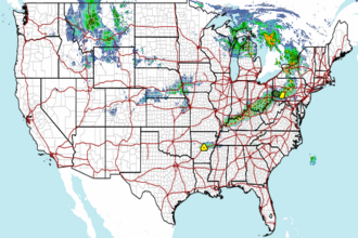 National Radar