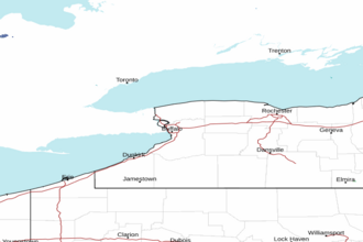
Lake Ontario - Mexico Bay to the Saint Lawrence River Marine Forecast
| Today...South Winds 5 To 10 Knots Becoming North. A Chance Of Showers Early This Afternoon. Rain Late. Waves 2 Feet Or Less. |
| Tonight...East Winds 5 To 15 Knots Becoming West. Rain. Waves 1 To 3 Feet Building To 2 To 4 Feet. |
| Thursday...West Winds 10 To 15 Knots Increasing To 15 To 20 Knots. A Chance Of Rain Showers. Waves 3 To 6 Feet Building To 4 To 7 Feet. Waves Occasionally Around 9 Feet. |
| Thursday Night...West Winds 15 To 20 Knots Diminishing To 5 To 15 Knots. Partly To Mostly Cloudy. Waves 4 To 7 Feet Subsiding To 2 To 4 Feet. Waves Occasionally Around 9 Feet. |
| Friday...West Winds 10 To 15 Knots. A Chance Of Rain Showers During The Day. Waves 1 To 3 Feet Building To 3 To 5 Feet. Waves Occasionally Around 6 Feet. |
| Saturday...West Winds 5 To 15 Knots. Partly Cloudy. Waves 2 To 4 Feet Subsiding To 1 To 3 Feet. |
| Sunday...West Winds 10 To 15 Knots Becoming Southwest. A Chance Of Rain Showers. Waves 2 Feet Or Less Building To 2 To 4 Feet, Then Subsiding To 1 To 3 Feet. |
| Area Forecast Discussion National Weather Service Buffalo NY 649am EDT Wednesday April 29 2026 .WHAT HAS CHANGED... No significant changes to the forecast with this update. .KEY MESSAGES... 1) A widespread soaking rain this afternoon and tonight. 2) Cool temperatures and continued potential for showers for late in the week into the start of next week. KEY MESSAGE 1...A widespread soaking rain this afternoon and tonight. Upper-level troughing sprawled across Ontario Province will gradually deepen as it digs southeastward across the Great Lakes today and tonight. As it does so...increasing height falls/DCVA on its eastern flank will spur the development of a secondary surface low across the Ohio Valley early this morning...with this low then deepening and lifting northeastward to the vicinity of Watertown by early this evening...before lifting out across southern Quebec tonight. As the low approaches and makes its way across our region today... increasing moisture will result in PWATs (Precipitable Waters) rising to the vicinity of 1 inch. At the same time...developing strong/deep-layer forcing driven by the advancing upper trough...favorable upper level jet dynamics/ diffluence aloft...and the tightening low level thermal gradient will all act to lift this moisture...resulting in a period of widespread soaking rain overspreading our region from southwest to northeast this afternoon. With some very weak instability (100-200 J/kg of MUCAPE) in place there could also be a few embedded rumbles of thunder...with the best chances for such extending from the southern Tier northeastward across the Finger Lakes and North Country. The rain will then diminish from west to east tonight as surface low and better large-scale forcing slide off to our northeast...with the latest guidance suite supporting a somewhat faster overall departure to the rain. This should result in most areas south of Lake Ontario seeing a return to dry weather by sunrise on Thursday...though some showers are likely to linger into early Thursday morning east of Lake Ontario. Basin-average rainfall amounts from this system still look be on the order of 0.75" to 1.25" for the majority of the area...though the axis of the heaviest rainfall has flopped a little further back to the west in the latest suite of guidance...with a multimodel consensus currently suggesting this will lie from the Genesee Valley eastward across the Finger Lakes and North Country. Provided the heavier rainfall does not jog a little further westward...extreme far WNY may see somewhat lower rainfall totals on the order of a half to three quarters of an inch. While such amounts should not be enough to result in any notable flood concerns...these will still lead to ponding of water in poor drainage and low-lying areas given the antecedent wet ground conditions...as well as within-bank rises on area waterways. KEY MESSAGE 2...Cool temperatures and continued potential for showers for late in the week into the start of next week. A developing mid/upper level closed low will be located near the Central Great Lakes and Central Ontario Thursday morning. This low will start to wrap moisture into itself from todays passing surface low bringing rain to the region. As this closed low slowly tracks across SE Canada through the weekend, it will bring a cyclonic pattern and cool temperatures to the region. This will result in periods of showers through at least the weekend and into early next week. Showers will be generally light, but will have more coverage with passing shortwave troughs within the larger scale trough and closed low. As these shortwave troughs cross the area and increase forcing, some response off of both Lake Erie & Ontario, as well as upsloping, areas of surface convergence and daytime heating with cooler temperatures aloft (steeper lapse rates) will all contribute to the potential for showers at different times through the weekend and into early next week. Depending on time of day/night and elevation, snow will mix in at times, but no accumulations are expected. With the cold temperatures aloft to around -5C at times and at times strong daytime heating for late April/early May daytime instability showers will be possible with graupel/small hail. Temperatures will average some 10 to 15 degrees below normal for most locations, with most areas only in the upper 40s to low 50s through the weekend. With the cooler than normal temperatures expected at night as well, areas where clearing skies and weak winds setup will have the potential for frost. The growing season starts on May 1st for most of the counties in the BUF CWA, except for Allegany, Cattaraugus, Lewis and Jefferson counties. For counties where the growing season starts on May 1st, appropriate frost/freeze headlines will be issued if necessary. Temperatures will start to warmup at least briefly as this deeper and cooler closed low finally shifts northeast away from the area, but precipitation wise the active pattern will continue through much of next week as well with large scale troughing patterns expected to remain over the region. Marine Developing low pressure over the Ohio Valley early this morning will deepen and track northeastward to the vicinity of Watertown by early this evening...before lifting out across southern Quebec tonight. Out ahead of this system a north to northeasterly flow will develop and slowly increase today...though winds should generally remain at or under 15 knots. Winds will then back to westerly and increase further on Lake Ontario tonight in the wake of the departing low... with a moderately brisk westerly flow then continuing across the lake through Thursday. This will likely result in a period of Small Craft Advisory conditions on central and eastern portions of Lake Ontario from the second half of tonight through Thursday and into Thursday evening. Depending upon how much the pressure gradient tightens across the region on Thursday...a brief period of SCA (Small Craft Advisory) conditions is also possible on Lake Erie from Thursday afternoon into early Thursday evening...though confidence in this is notably lower. Looking further out through the end of the week...a continued unseasonably cool airmass and moderate pressure gradient may support additional periods of SCA (Small Craft Advisory) conditions at times...particularly across Lake Ontario. NOAA Buffalo NY Office: Watches - Warnings - Advisories NY...None. Marine Small Craft Advisory from 11pm this evening to 2am EDT Friday for LOZ043-044. Small Craft Advisory from 2am Thursday to 2am EDT Friday for LOZ045. |
 Buffalo NY Radar
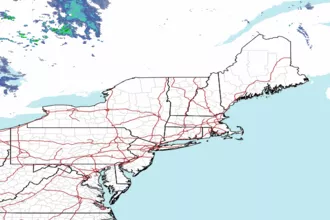
 Northeast Radar