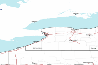
Lake Ontario - Open Waters from the Niagara River to Hamlin Beach Marine Forecast
| Rest Of Tonight...South Winds 10 To 15 Knots Becoming Southwest 15 To 20 Knots. Showers With A Chance Of Thunderstorms, Then Showers Late. Patchy Fog After Midnight. Some Thunderstorms May Produce Gusty Winds. Waves 3 To 5 Feet. |
| Sunday...West Winds 15 To 25 Knots. Waves 3 To 6 Feet Building To 5 To 8 Feet. Waves Occasionally Around 10 Feet. |
| Sunday Night...West Winds 15 To 25 Knots. Waves 5 To 8 Feet Subsiding To 3 To 6 Feet. Waves Occasionally Around 10 Feet. |
| Monday...West Winds 15 To 20 Knots Diminishing To 10 To 15 Knots. A Chance Of Rain And Snow Showers In The Afternoon. Waves 3 To 5 Feet Subsiding To 1 To 3 Feet. |
| Monday Night...West Winds 10 To 15 Knots Becoming Northwest 15 To 20 Knots. Snow And Rain Showers. Waves 1 To 3 Feet Building To 3 To 5 Feet. |
| Tuesday...Northwest Winds 15 To 25 Knots Becoming West And Diminishing To 5 To 10 Knots. Snow Showers During The Day. Waves 3 To 6 Feet Subsiding To 1 To 3 Feet. |
| Wednesday...South Winds 5 To 10 Knots Increasing To 15 To 25 Knots. Waves 1 Foot Or Less Building To 3 To 6 Feet. |
| Thursday...Southwest Winds 15 To 25 Knots Becoming West. A Chance Of Showers. Waves 4 To 7 Feet Subsiding To 3 To 6 Feet. Waves Occasionally Around 9 Feet. Winds And Waves Higher In And Near Thunderstorms. |
| Area Forecast Discussion National Weather Service Buffalo NY 717pm EDT Sat April 4 2026 .WHAT HAS CHANGED... Wind Advisory issued for Jefferson and Lewis counties for localized downslope wind gusts of around 50 mph tonight. .KEY MESSAGES... 1) Showers and scattered thunderstorms will move from west to east across the area tonight, with localized strong wind gusts and heavy rainfall possible. 2) Localized strong downslope winds tonight across the North Country. 3) Much cooler with gusty winds and scattered showers Sunday. 4) Well below normal temperatures and snow at times for Sunday night through Tuesday. KEY MESSAGE 1...Showers and scattered thunderstorms will move from west to east across the area tonight, with localized strong wind gusts and heavy rainfall possible. A warm front will continue to move northeast across the area through the rest of the afternoon, reaching northeast NY by early this evening. A few showers will continue along and ahead of the advancing warm front, reaching the eastern Lake Ontario region mid to late afternoon. Farther west, modest instability will develop in the expanding warm sector across Western NY and the Finger Lakes, but a layer of warm air in the mid levels and lack of forcing for ascent or low level foci will keep any convection isolated, or possibly non-existent in the warm sector this afternoon and early evening. The main focus will continue to be tonight as a strong cold front moves east across the eastern Great Lakes. Thermal and wind field analysis suggests the cold front will come through in two segments, with the focus for strong to severe convective potential along the first boundary. Diurnal timing is less than ideal, with the line of convection expected to enter Western NY during the mid to late evening, reaching the Genesee Valley by around or shortly after midnight. The limited surface based instability that develops will be on the wane, and may prove to limit the severe weather potential. Wind fields and shear are impressive, with a narrow axis of 50-70 knots of mid level flow along and just ahead of the cold front. Given the strong shear environment and strong forcing, a narrow, shallow band of convection may persist into the late evening despite the limited instability, with any convective line segments supporting the potential for localized strong wind gusts across Western NY. Overnight, instability will diminish further, with a lowering risk of convective winds with eastern extent. The advancing cold front will be situated in the favorable right entrance region of an upper level jet streak, with upper level divergence atop the strong frontal zone supporting a wide band of moderate rain along the front, which will last for 4-6 hours at any one location as it moves east across the area tonight. Any embedded convection will produce embedded downpours. PWAT (Precipitable Water) values briefly surge to 1.25" or better, which is close to 3 standard deviations above average for early April. Expect rainfall amounts to average 0.50" to 0.75" in most areas, with more localized amounts of around 1.0" to 1.25" possible in any embedded convection. These amounts will produce some minor ponding of water in poor drainage areas and some within bank rises on area creeks and rivers, but should not be enough to result in significant flood issues. KEY MESSAGE 2...Localized strong downslope winds tonight across the North Country. A strong low level jet will propagate across the area tonight, with a brief window of 60-70 knots near the top of the boundary layer. For most of the area, stability will not be favorable for mixing of strong winds to the surface (outside of convection), or for downslope winds across Western NY. The setup across the North Country will be much more favorable for downslope winds, with forecast BUFKIT soundings suggesting a more stable inversion layer near the top of the Tug Hill Plateau and western Adirondacks. This layer of ridgetop stability will likely support localized strong downslope wind gusts along the north slopes of the Tug Hill Plateau, the Black River Valley, and near the northwest slopes of the Adirondack Plateau. Expect gusts to peak for a few hours just ahead of the rain, with gusts to around 50 mph. A Wind Advisory has been issued for tonight in Jefferson and Lewis counties. KEY MESSAGE 3...Much cooler with gusty winds and scattered showers Sunday. Strong cold advection will develop late tonight through Sunday in the wake of the departing cold front. A few scattered showers will develop, especially in the afternoon as lapse rates steepen with cold air aloft and modest boundary layer heating. DPVA will increase ahead of an incoming shortwave later in the afternoon. The most persistent showers will likely focus on a lake breeze convergence zone stretching from the Niagara Peninsula eastward in a band just north of the NYS Thruway during the afternoon and early evening. Precipitation type will be mostly rain for lower elevations, although some wet snow, graupel, or even small hail may mix in within any heavier showers. The higher terrain will have a better chance of going over to snow later in the day as temps aloft continue to cool. It will be quite windy areawide Sunday with 30-40 knots of wind in the post-frontal boundary layer. This will translate into surface gusts in the 25-35 mph range, and as high as 40-45 mph in the typically windier locations northeast of Lake Erie and Lake Ontario. KEY MESSAGE 4...Well below normal temperatures and snow at times for Sunday night through Tuesday. A cold front crossing the area tonight will bring cooler than normal temperatures to the region for the Sunday night through Tuesday night time period. Another cold front and associated surface low will track across the area Monday evening. This will bring a reinforcing cold airmass to the region through Tuesday night. Afternoon temperatures on Monday will be in the mid 30s to mid 40s for the entire area, which will be around 10 degrees cooler than normal. On Tuesday, afternoon temperatures will only reach the upper 20s to mid 30s, around 15 degrees below normal for most areas. A large scale troughing pattern will be in place during this time, resulting in an active period. The combination of the cold temperatures aloft and passing surface lows and embedded shortwave troughs crossing the area will result in periods of showers, with widespread, upslope and lake enhanced/effect all possible. A passing shortwave trough, combined with upsloping will cause rain and snow to continue into Sunday night. As the night progresses, any precipitation that falls in the form of rain will slowly mix with and then change to snow as temperatures cool through the night. Snow amounts for Sunday night will be limited to and inch or two over the higher terrain with only a coating for the lower elevations expected. Another shortwave trough and surface low will cross the area Monday into Monday night, precipitation will remain mostly as rain or a rain/snow mix during the daytime hours on Monday, with the greatest chance for more snow across the higher terrain. Once again, any rain will mix with and then change to snow Monday night as temperatures cool. A cold front associated with this surface low will also cross the area Monday night, cooling temperatures aloft to -12C by early Tuesday morning. With a northerly flow over Lake Ontario, lingering synoptic moisture, the cold temperatures and a trough aloft, lake enhanced snow south of Lake Ontario will linger through the night and into the start of the morning on Tuesday. Snow amounts on Monday into Monday night in the 1 to 3 inch range will be possible for areas north of I90 toward the south shore of Lake Ontario, and for the higher terrain of the Western Southern Tier where upsloping will continue. For the lower elevations and areas farther away from the lakes, up to an inch of snow will be possible. Marine Moderate to strong easterly flow on Lake Ontario will continue to produce Small Craft Advisory conditions on the west half of Lake Ontario through early this evening before winds become south and briefly diminish. A cold front will then move east across the lower Great Lakes tonight. South winds will increase on Lake Ontario just ahead of the cold front, especially at the east end of the lake where sustained winds may briefly approach 30 knots. Winds will becoming southwest behind the cold front late tonight through Sunday and increase again, with a period of Small Craft Advisory conditions on Lake Erie and Lake Ontario, along with the Niagara River and Saint Lawrence River. Winds will remain elevated on Lake Ontario through Sunday night before diminishing Monday. Hydrology A Flood Advisory remains in effect for the Salmon River in northern Oswego County. High flows will continue as water is released from the Salmon River Reservoir due to runoff from recent heavy rain and snowmelt. The water expected water levels will not produce any significant flooding, but will continue to produce minor flooding in low lying areas along the creek and create dangerous currents. Fisherman should avoid the river until flows subside. A cold front will cross the area tonight, producing another round of soaking rainfall. The rain will result in minor ponding of water in poor drainage areas and within-bank rises on area creeks and rivers, but is not expected to be enough to produce any more impactful flooding. NOAA Buffalo NY Office: Watches - Warnings - Advisories NY...Wind Advisory until 4am EDT Sunday for NYZ007-008. Marine Small Craft Advisory from 8am to 10pm EDT Sunday for LEZ020- 040-041. Small Craft Advisory from 8am to 10pm EDT Sunday for LOZ030. Small Craft Advisory until 4am EDT Monday for LOZ042. Small Craft Advisory until 10am EDT Monday for LOZ043. Small Craft Advisory until 10am EDT Monday for LOZ044-045. Small Craft Advisory from 11am to 10pm EDT Sunday for SLZ022-024. |
 Buffalo NY Radar
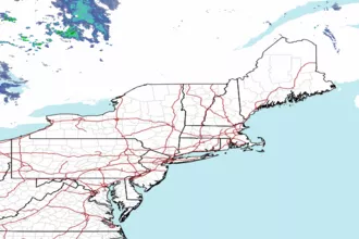
 Northeast Radar