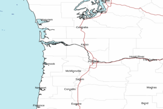
Cape Lookout to Florence OR between 60 and 150 NM Offshore Forecast
| Today...W To Nw Winds 20 To 25 Kt. Seas 7 To 10 Ft. |
| Tonight...Nw Winds 15 To 25 Kt. Seas 9 To 11 Ft. |
| Thu...Nw Winds 15 To 20 Kt, Becoming W To Nw 10 To 15 Kt. Seas 9 To 11 Ft. |
| Thu Night...W Winds 10 To 15 Kt. Seas 7 To 9 Ft. |
| Fri...W Winds 5 To 15 Kt. Seas 6 To 8 Ft. |
| Fri Night...W To Nw Winds 5 To 10 Kt. Seas 6 To 7 Ft. |
| Sat...Nw Winds 5 To 10 Kt. Seas 6 To 8 Ft. |
| Sat Night...Nw Winds 10 To 15 Kt, Becoming W 5 To 10 Kt. Seas 7 To 8 Ft. |
| Sun...W Winds 10 To 15 Kt. Seas 7 To 8 Ft. |
| Sun Night...Nw Winds 15 To 20 Kt, Becoming N 10 To 15 Kt. Seas 7 To 9 Ft. |
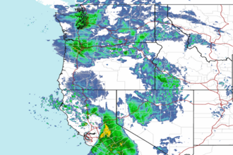
| Area Forecast Discussion National Weather Service Portland OR 430am PST Wednesday Mar 4 2026 Synopsis A cold front will move through the region this morning, bringing widespread rain. Behind the front, rain transitions to scattered showers by mid to late morning. Expect impactful Cascade snow today, mainly along the Santiam and Willamette Passes. Increased instability today will also result in a 15-25% chance for thunderstorms across the area. Late in the week, a strong ridge develops over the northeast Pacific, however, precipitation chances continue through early next week as moisture rides over the ridge and into the Pacific Northwest. Now through Tuesday...An upper-level trough will move into the Pacific Northwest today, swinging a cold front through the area this morning. Radar imagery as of early Wednesday morning shows widespread rain associated with this cold front moving through the I-5 corridor. Rain should transition into scattered post-frontal showers by mid to late morning. Following the inland progression of the upper trough and cold front, air will cool down aloft and lead to increased atmospheric instability. Forecast soundings continue to show skinny CAPE profiles across the area with HREF/REFS guidance showing CAPE values of 100-200 J/kg. As a result, there is a 10-25% chance for thunderstorms through this afternoon. Any passing thunderstorms may result in lightning, brief heavy downpours, erratic winds, and small hail. Total precipitation amounts will vary across the area given the showery nature of the precipitation, but chances for 24 hour liquid precipitation exceeding 0.50 inch ending 10pm Wednesday is around 15-30% along the I-5 corridor from Cowlitz to Lane County, 40-60% along the coast, and 80-90%+ across the Coast Range and Cascades. Not expecting wind impacts with this system, though could see some southwesterly wind gusts up to 25-30 mph along the coast and 20-25 mph inland, with locally stronger gusts over higher terrain as the front passes through this morning. The Winter Weather Advisory for the Marion, Linn, and Lane County Cascades remains in effect from 4am Wednesday to 4am Thursday as snow levels drop to 3500-4000 feet today. Moderate to heavy snow will fall at times along Santiam and Willamette Passes through during the advisory period, leading to lower visibilities and travel impacts. REFS guidance suggests that there is a 10-20% chance for snowfall rates exceeding 1" at any given hour through 9pm along these passes. It will all depend on where the heavier snow showers set-up. If heavy snow materializes and persist long enough, 24 hour snowfall amounts ending 4am Thursday may exceed 12 inches (30-40% chance) along Santiam and Willamette Passes. North of Marion County, temperatures will be a few degrees warmer and result in lower snow amounts. Therefore, the South Washington Cascades and North Oregon Cascades remain out of the Winter Weather Advisory. If you plan on traveling through the Cascades, make sure to check road conditions before leaving and carry an emergency supply kit in your vehicle. Showers likely continue through Thursday as moist northwest flow persists, though precipitation amounts are expected to be much less. Snow levels drop to around 2500-3500 ft on Thursday, but additional snow will be light with sub-advisory accumulations. Friday and through the weekend, upper-level ridging strengthens offshore over the northeast Pacific. Despite the ridging, precipitation chances continue across the area due to moisture riding the northern/eastern periphery of the ridge. Overall, the majority of ensemble members are suggesting non-impactful precipitation amounts. By early next week, ridging over the northeast Pacific flattens as a trough dips down from British Columbia, resulting in more zonal flow and renewed precipitation chances across the Pacific Northwest. In addition, about 40% of ensemble members are showing below-average 500 mb heigheights returning to the area by Tuesday, meaning we could see a cool down to more winter-like temperatures and increasing chances for Cascade snow. -10 Marine A cold front moving through the region will result in breezy southwesterly winds across the waters with gusts up to 25 kt. Once the front pushes further inland, winds will gradually turn northwesterly this afternoon and remain breezy through the evening. Seas build to 6-8 ft at 10-13 sec today, further building to 10-11 ft at 11-12 sec on Thursday as a westerly swell moves in. Chances for seas exceeding 10 ft by Thursday are 50-80%, with the highest chances beyond 10 NM offshore. Given the breezy winds and building seas, the Small Craft Advisory was extended through 4 PM Thursday for all waters including the Columbia River Bar. High confidence for calmer marine conditions behind this system at the end of the week and into the weekend, with seas falling below 10 feet and winds turning more westerly and remaining under 15 kt. -10 NOAA Portland OR Office: Watches - Warnings - Advisories OR...Winter Weather Advisory until 4am PST Thursday for ORZ127-128. WA...None. PZ...Small Craft Advisory until 4pm PST Thursday for PZZ210-251>253- 271>273. |
 Portland OR Radar
 Northwest Radar