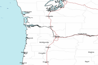
Cape Shoalwater WA to Cape Lookout OR between 150 and 250 NM Offshore Forecast
| Today...N Winds 10 To 20 Kt. Seas 7 To 9 Ft. |
| Tonight...N Winds 10 To 20 Kt. Seas 6 To 9 Ft. |
| Sat...N Winds 15 To 25 Kt. Seas 6 To 10 Ft. |
| Sat Night...N Winds 15 To 25 Kt. Seas 6 To 11 Ft. |
| Sun...N Winds 15 To 25 Kt. Seas 8 To 12 Ft. |
| Sun Night...N To Nw Winds 15 To 25 Kt. Seas 9 To 11 Ft. |
| Mon...Nw Winds 15 To 25 Kt. Seas 8 To 10 Ft. |
| Mon Night...Nw Winds 15 To 20 Kt. Seas 7 To 9 Ft. |
| Tue...Nw Winds 10 To 15 Kt, Becoming N. Seas 7 To 8 Ft. |
| Tue Night...N Winds 10 To 15 Kt. Seas 7 To 8 Ft. |
| Area Forecast Discussion National Weather Service Portland OR 401am PDT Fri April 24 2026 Synopsis Dry conditions with mostly sunny skies through Saturday. Potential for frost tonight across the Upper Hood River Valley and southern Willamette Valley. High temperatures remain near or slightly above seasonable normals for late April. Chances for light, non-impactful showers increase Sunday to Tuesday, with the highest chances over the Cascades. Drier and potentially warmer temperatures return by Wednesday to Thursday as high pressure re-builds. Today through Thursday...Satellite imagery as of early Friday morning depicts mostly clear skies with a few low clouds across northwest Oregon and southwest Washington. Given the clear skies and light winds, there should be some decent radiation cooling early this morning. However, the vast majority of the area will remain warm enough to prevent frost development. An exception is the Upper Hood River Valley, where temperatures have fallen to around 33-35 degrees for locations above 1000 feet (south of Odell). Closer to river level, temperatures are relatively warmer in the mid to upper 30s, but can't rule out some patchy frost. A Frost Advisory has been issued for the Upper Hood River Valley through 10am this morning. Meanwhile, along the I-5 corridor, the highest threat for frost will be across the southern Willamette Valley, with chances for temperatures dropping below 36 degrees in this area being around 15-25% this morning. Expect dry weather with mostly sunny skies across northwest Oregon and southwest Washington today and Saturday. The upper level pattern over the Pacific Northwest remains northerly to northwesterly, mainly due to an amplified ridge over far northwest Canada and the northeast Pacific, and a stalled closed low over south-central Canada and the northern Plains. Since we're in a drier airmass and far removed from the low, conditions remain dry through Saturday. Temperatures are forecast near to slightly above normal this weekend, with highs in the mid to upper 60s for interior lowland valleys, and upper 50s to low 60s along the immediate coast. Since skies will remain clear Friday night, there will be renewed chances for frost development across interior valleys heading into Saturday morning. Chances for temperatures falling below 36 degrees are higher Friday night: 30-40% for the southern Willamette Valley, and 50-80% across the Upper Hood River Valley with the highest chances above 1000 feet elevation. Will need to potentially consider another Frost Advisory for the Upper Hood River Valley for tonight. Yesterday's cloud cover resulted in uncertainty for frost in the Upper Hood River Valley this morning, but there is higher confidence that conditions will be clear going into tonight. Sunday through Tuesday, additional weak shortwave troughs extending from the parent low over south-central Canada will swing through the Pacific Northwest and bring increased chances for light, non-impactful showers. Chances for showers peak around 10-20% along the I-5 corridor and 20-40% across the Cascades, with the highest chances on Monday. Temperatures remain seasonable and in the mid to upper 60s for interior valleys early next week, but could be a few degrees cooler on Monday due to potential showers. Wednesday to Thursday, the majority of LREF ensemble members suggest that upper level ridging will build over the northeast Pacific and shift into the Pacific Northwest. Most ensemble members also show above-average 500 mb heigheights over the area, suggesting warmer temperatures by mid to late next week. There still remains some uncertainty on the exact strength and placement of the ridge axis, thus leading to a wide range of high temperatures: high end max temperatures for Thursday next week are currently in the upper 70s to low 80s, while low end max temperatures are in the low to mid 60s. -10 Marine High pressure over the waters and a thermal trough along the coast will result in north-northeasterly winds across the waters today. Pressure gradients will tighten tonight into early Saturday morning, resulting in breezy northerly winds with gusts up to 25 kt. The strongest winds will be south of Cape Falcon, so Small Craft Advisories have been issued for these central and southern marine zones through 2am Saturday. Pressure gradients gradually ease throughout Saturday morning, weakening northerly winds. Seas remain around 6-8 ft at 9-10 sec today, building to 8-9 ft tonight south of Cape Falcon as wind waves increase. High pressure continues late this weekend into early next week, with winds turning more west-northwesterly and remaining under 15 kt. A northwesterly swell also persists through next week, with seas falling to 5-6 ft by Monday to Tuesday. -10 NOAA Portland OR Office: Watches - Warnings - Advisories OR...Frost Advisory until 10am PDT this morning for ORZ121. WA...None. PZ...Small Craft Advisory from 3pm this afternoon to 2am PDT Saturday for PZZ252-253-272-273. |
 Portland OR Radar
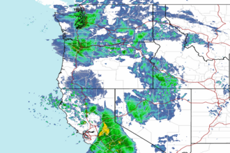
 Northwest Radar