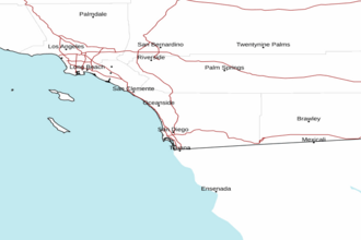
Santa Cruz Island to San Clemente Island CA between 60 and 150 NM Offshore Forecast
| Today...Nw Winds 10 To 20 Kt, Diminishing To 5 To 15 Kt. Seas 5 To 9 Ft. |
| Tonight...Nw Winds 5 To 15 Kt. Seas 4 To 8 Ft. |
| Sat...N To Nw Winds 5 To 15 Kt. Seas 5 To 8 Ft. |
| Sat Night...W To Nw Winds 5 To 15 Kt. Seas 4 To 7 Ft. |
| Sun...W To Nw Winds 5 To 15 Kt. Seas 3 To 6 Ft. |
| Sun Night...W To Nw Winds 5 To 15 Kt. Seas 4 To 7 Ft. |
| Mon...W To Nw Winds 5 To 10 Kt. Seas 4 To 7 Ft. |
| Mon Night...W Winds 5 To 10 Kt. Seas 4 To 7 Ft. |
| Tue...Nw Winds 10 To 15 Kt, Diminishing To 5 To 10 Kt. Seas 5 To 7 Ft. |
| Tue Night...Nw Winds 10 To 15 Kt, Becoming 10 To 20 Kt. Seas 3 To 6 Ft. |
| Area Forecast Discussion National Weather Service San Diego CA 258am PDT Fri May 1 2026 Synopsis High temperatures will warm to above average for today and Saturday, cool to below average for Sunday through Tuesday, then warm to above average again for Wednesday and Thursday of next week. Night and morning coastal low clouds will spread into portions of the valleys early today and early Sunday, then farther into the valleys for Sunday through early next week. Southwest to west winds for the mountains and deserts will be strongest on Sunday afternoon and evening with gusts to 35 to 45 mph with isolated gusts to 60 mph. There is also a slight chance for mostly light showers at times for late Sunday night through Tuesday afternoon from the coast to the mountains. For Extreme Southwestern California Including Orange... San Diego...Western Riverside and Southwestern San Bernardino Counties Short Term - Today Through Sunday Weak high pressure aloft will bring several degrees of warming today with high temperatures as much as 5 to 10 degrees warmer for the valleys and lower coastal slopes of the mountains. High temperatures for Saturday will remain 5 to 10 degrees above average with high temperatures ranging from around 70 near the coast to the 80s for the Inland Empire with the lower deserts in the mid to upper 90s. Night and morning coastal low clouds and fog will spread into portions of the inland valleys early this morning, then only into portions of the western valleys for tonight into Saturday morning as the marine layer decreases in depth. A low pressure system moving southward off the California coast on Sunday will spread cooling inland with high temperatures as much as 8 to 12 degrees cooler for the inland valleys and lower elevations of the mountains with high temperatures on Sunday ranging from the mid to upper 60s near the coast to the 70s for the Inland Empire with the lower deserts in the upper 80s to mid 90s. Southwest to west winds for the mountains and deserts for Sunday afternoon and evening will gust to 35 to 45 mph with isolated gusts to 60 mph. .LONG TERM (Sunday night through Thursday)... A low pressure system will move slowly inland through central and southern California on Monday and Tuesday. High temperatures will continue to cool on Monday, as much as another 8 to 12 degrees cooler for the mountains and deserts, with not much change on Tuesday. High temperatures for Monday and Tuesday will be around 10 degrees below average for inland areas to as much as 12 to 18 degrees below average for the mountains. High temperatures on Monday and Tuesday will be mostly in the mid 60s to around 70 for the coast and valleys with the lower deserts in the mid 70s to lower 80s. There is also a slight chance of mostly light showers at times for Sunday night through Tuesday afternoon. High pressure over California will bring much warmer weather for Wednesday and Thursday with Thursday high temperatures 5 to 10 degrees above average for inland areas, similar to those of today and Saturday. High temperatures for Thursday of next week will range from around 70 near the coast to the 80s for the Inland Empire with the mid to upper 90s for the lower deserts. Marine Moderate onshore flow this afternoon and evening with gusts approaching 20 kts near San Clemente Island. No hazardous marine conditions are expected through Tuesday. Skywarn Skywarn activation is not requested. However weather spotters are encouraged to report significant weather conditions. NOAA San Diego CA Office: Watches - Warnings - Advisories CA...None. PZ...None. |
 San Diego Radar
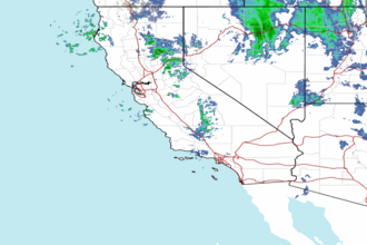
 Pacific Southwest Radar