Sandy Hook to Manasquan Inlet NJ out 20 NM Marine Forecast
| Overnight...S Winds 5 To 10 Kt. Seas 2 To 3 Ft. Wave Detail: E 3 Ft At 8 Seconds. |
| Tue...S Winds 5 To 10 Kt, Increasing To 10 To 15 Kt With Gusts Up To 20 Kt In The Afternoon. Seas 2 To 3 Ft. Wave Detail: E 3 Ft At 8 Seconds And S 2 Ft At 3 Seconds. |
| Tue Night...S Winds 10 To 15 Kt With Gusts Up To 20 Kt. Seas 3 To 4 Ft. Wave Detail: S 3 Ft At 4 Seconds And E 3 Ft At 9 Seconds. |
| Wed...S Winds 10 To 15 Kt. Seas 2 To 4 Ft. Wave Detail: S 3 Ft At 4 Seconds And E 2 Ft At 9 Seconds. |
| Wed Night...S Winds 10 To 15 Kt With Gusts Up To 20 Kt. Seas 3 To 4 Ft. Wave Detail: S 3 Ft At 5 Seconds And E 2 Ft At 8 Seconds. |
| Thu...S Winds 10 To 15 Kt With Gusts Up To 20 Kt. Seas 2 To 3 Ft. Wave Detail: S 3 Ft At 5 Seconds And E 2 Ft At 8 Seconds. Scattered Showers And Tstms In The Afternoon. |
| Thu Night...Sw Winds 10 To 15 Kt. Seas 2 To 3 Ft. Scattered Showers And Tstms. |
| Fri...W Winds 5 To 10 Kt, Becoming Sw In The Afternoon. Seas Around 2 Ft. |
| Fri Night...Sw Winds Around 10 Kt, Becoming Nw After Midnight. Seas Around 2 Ft. |
| Sat...Ne Winds Around 10 Kt, Becoming Se In The Afternoon. Seas Around 2 Ft. |
| Sat Night...Se Winds Around 10 Kt. Seas Around 2 Ft. Winds And Seas Higher In And Near Tstms. |
| Area Forecast Discussion National Weather Service Mount Holly NJ 946pm EDT Monday May 20 2024 Synopsis A weak area of high pressure over our area will gradually settle to our south and east Tuesday. A cold front crosses our region Thursday afternoon or evening, then it stalls to our south through the holiday weekend. As high pressure slides across New England Friday through Saturday, weak low pressure may track near Delmarva. Another low pressure system is forecast to track across the Ohio Valley to near the eastern Great Lakes Sunday into Monday. Near Term - Through Tuesday Forecast running on track. No changes will be made to the database other than to adjust hourly grids based on latest surface obs. Heading into tonight, the surface high will move overhead before ultimately settling to our south on Tuesday. Overall, not expecting too much change for the first portion of the night other than winds gradually becoming more southerly. However, hi- res guidance continues to indicate another round of low stratus moving onshore and overspreading the area early Tuesday morning. Not anticipating as strong of a push as this morning due to southerly flow, but general thinking is there will be areas of mist and fog, more so across the immediate coastal plain. Lows mostly in the mid 50s to around 60 degrees. For Tuesday, any morning fog and/or stratus will quickly lift and dissipate by mid-morning. This will give way to clear skies during the afternoon with just some spotty diurnal cumulus. Another dry and quiet weather day is expected. High temps should be a bit warmer than those of today, rising into the upper 70s to mid 80s. Temps will be noticeably cooler along/near the shore thanks to light surface winds allowing an afternoon sea breeze circulation to develop. Short Term - Tuesday Night Through Thursday Night Warmth continues and turning more humid ahead of a cold front. As a ridge sits to our east and south, surface high pressure will also be centered near and offshore of the Carolinas. This will continue to circulate warmer air into our area. A strong upper-level trough is forecast to be tracking across the Midwest Wednesday before lifting into adjacent Canada Wednesday night and Thursday. Tuesday night and most of Wednesday is therefore expected to be dry across our area, with a continuation of building warmth. The flow looks to be southerly enough Wednesday to keep it cooler along the coast. Some weakening convection from the west could make a run at our western zones Wednesday evening before dissipating. As the parent upper-level trough remains into Canada Thursday, surface low pressure will be tied to it and track well to our north. An associated cold front however will move across our area Thursday afternoon or Thursday night. Prior to the cold front arriving, a pre- frontal trough may become established just to our west and then shift eastward during the peak heating Thursday afternoon. While the main forcing is removed from our area given the main trough aloft is so far to our north, a band of stronger southwesterly flow in the mid levels is forecast to arrive during the day Thursday. The model guidance overall shows ample instability with some increase in shear due to the strengthening mid level southwesterly flow. The model forecast soundings from the GFS (Global Forecast System) and NAM show an inverted-V profile in the lower levels given ample heating of the boundary layer. Despite generally weaker forcing, a band or broken band of convection may accompany the pre-frontal trough well ahead of the cold front Thursday afternoon. Given the forecast environment, may have to watch for locally strong winds with any more organized line segments. The convection should be weakening or moving offshore Thursday night as the cold front moves through. High temperatures both Wednesday and Thursday are forecast to be well into the 80s for much of the area (coolest along the coast and higher elevations of the Poconos). Dew points are forecast to rise into the 60s, with the highest values on Thursday ahead of the cold front. Long Term - Friday Through Monday Summary...Some cooling through the holiday weekend although high temperatures at or above average. Some showers are possible especially Sunday and Monday. Synoptic Overview...A more zonal flow aloft Friday as an upper-level trough passes by well to the north, then a weak shortwave trough may slide by as a ridge slides across parts of eastern Canada Saturday into Sunday. Another upper-level trough may lift across the Great Lakes and adjacent Canada Sunday into Monday. At the surface, a front is forecast to be stalled to our south for the holiday weekend. A few ripples of energy may slide across our nearby with some weak surface lows also tracking up the Ohio Valley to near the Great Lakes. High pressure initially sliding across New England into Canada should extended into our area for a time. For Friday and Saturday...As an upper-level trough glances our region to the north Friday, surface low pressure is well to our north. An associated cold front however should be stalling to our east and south. There is limited cold air advection in the wake of this cold front, and while temperatures will be cooler Friday they are forecast to remain above average. The flow looks light and therefore a sea breeze should develop and thus keeping it cooler along the coast. The front remains to our south Saturday as well and high pressure builds across portions of eastern Canada and extends down across New England. This will turn our low-level flow to onshore resulting in some cooling. This will be most notable closer to the coast. Some showers and perhaps thunder will be possible especially across our southern zones as a weak shortwave trough may arrive later Friday into Saturday. For Sunday and Monday...As the aforementioned shortwave trough departs to the east to start Sunday, surface high pressure may remain extended southwestward across much of our area. This will maintain an onshore wind. While some showers will be possible during both days, there may be a greater chance during Monday. This is less certain though as it will depend on the timing and strength of an upper-level trough shifting eastward from the Ohio Valley region. Given the uncertainty, kept Probability of Precipitation no higher than the chance range which is similar to the NBM guidance. Marine No marine headlines are in effect through Tuesday. South-southeast winds around 10-15 kt with occasional gusts up to 20 kt. Seas around 3-4 feet. Patchy dense marine fog possible late tonight into Tuesday morning. Outlook... Tuesday night through Saturday...The conditions are anticipated to be below Small Craft Advisory criteria. Some locally gusty thunderstorms possible later Thursday afternoon and evening. Rip Currents... Winds become S from 5 to 15 mph on Tuesday. Winds in northern NJ will be closer to 10 to 15 mph, and winds at coastal DE will be a bit more offshore. For beaches in Monmouth, Ocean, southeast Burlington counties, as well as Delaware beaches, there is a MODERATE risk for the development of dangerous and life threatening rip currents. For southern NJ, winds will be a bit lighter, generally 5 to 10 mph. As a result, there is a LOW risk for the development of dangerous and life threatening rip currents for beaches in Atlantic and Cape May counties. There will be a Full Moon on May 23. S winds will range from 10 to 15 mph with gusts up to 20 mph. As a result, there is a MODERATE risk for the development of dangerous and lift threatening rip currents at NJ and DE beaches on Wednesday. NOAA Mount Holly NJ Office: Watches - Warnings - Advisories PA...None. NJ...None. DE...None. MD...None. Marine None. |
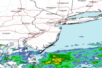 Mount Holly NJ Radar
 Northeast Radar
 East Coast Satellite