Marine Weather Net

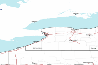
Lake Ontario - Hamlin Beach to Sodus Bay including Irondequoit Bay Marine Forecast


REST OF TONIGHT

N
WINDS
15 - 20
KNOTS

MONDAY

N
WINDS
15 - 20
KNOTS

MONDAY NIGHT

NW
WINDS
15 - 25
KNOTS

TUESDAY

W
WINDS
15 - 25
KNOTS

The Marine Weather Forecast In Detail:
LOZ043 Forecast Issued: 1003 PM EST Sun Nov 09 2025

SMALL CRAFT ADVISORY IN EFFECT THROUGH TUESDAY EVENING
Rest Of Tonight...North Winds 15 To 20 Knots. Snow With A Chance Of Rain Showers Late This Evening, Then A Chance Of Snow And Rain Showers After Midnight. A Chance Of Snow Showers Late. Waves 5 To 8 Feet. Waves Occasionally Around 10 Feet.
Monday...North Winds 15 To 20 Knots Becoming Northwest. Snow Showers Likely. Waves 3 To 5 Feet. Waves Occasionally Around 6 Feet.
Monday Night...Northwest Winds 15 To 25 Knots Becoming West. Snow Showers. Waves 3 To 6 Feet Building To 4 To 7 Feet. Waves Occasionally Around 9 Feet.
Tuesday...West Winds 15 To 25 Knots Increasing To 30 Knots. Snow Showers In The Morning, Then Rain And Snow Showers Likely In The Afternoon. Waves 5 To 8 Feet Building To 7 To 11 Feet. Waves Occasionally Around 14 Feet.
Tuesday Night...West Winds To 30 Knots Becoming Southwest 15 To 25 Knots. Rain Showers. Waves 7 To 10 Feet Subsiding To 3 To 6 Feet. Waves Occasionally Around 13 Feet.
Wednesday...Southwest Winds To 30 Knots Becoming West. Rain Showers. Waves 4 To 7 Feet Building To 7 To 10 Feet. Waves Occasionally Around 13 Feet.
Thursday...West Winds To 30 Knots Diminishing To 15 To 20 Knots. Rain Showers Likely. Waves 7 To 11 Feet Subsiding To 4 To 7 Feet. Waves Occasionally Around 14 Feet.
Friday...West Winds 15 To 20 Knots Becoming North 10 To 15 Knots. A Chance Of Rain Showers During The Day. Waves 3 To 5 Feet Subsiding To 2 To 4 Feet. Waves Occasionally Around 6 Feet. The Water Temperature Off Rochester Is 53 Degrees.
SHARE THIS PAGE:           
Area Forecast Discussion
National Weather Service Buffalo NY
638pm EST Sunday Nov 9 2025

Synopsis
A complex storm system will continue to produce freezing rain and a wintry mix across the North Country this evening, with wet snow and rain elsewhere. All precipitation will transition to snow overnight as colder air arrives. An early winter flow of arctic air will lend to chilly conditions for Monday with temperatures well below normal, brisk winds and lake effect snow, that will increase in intensity Monday evening southeast of the Lakes. Accumulating lake snows will continue southeast of the lakes through Tuesday before slightly milder air arrives Wednesday, allowing snow to mix back with rain.

Near Term - Through Monday
A deep long wave trough driving this surface low will drop down across the Great Lakes this evening, forming a closed low over our region by late tomorrow afternoon. This will allow for a much colder airmass to push across the Lower Great Lakes tonight changing rain to snow...with wintry mix east of Lake Ontario becoming all snow later through the night.

Could see a decent accumulation of snow (2-5") for Niagara-Orleans which will lie closer to the 850 hPa temperature gradient, for which a winter weather advisory will remain in effect. A few inches of snow will be possible for northern Erie and Genesee Counties through tonight. Northerly upslope flow and increasing lake induced instability will bring an increase in snow along the Chautauqua Ridge overnight through Monday morning, with 3-6" possible in a narrow band along the first rise in elevation inland from the lake. For the rest of the area, minimal accumulation is expected overnight.

A dry slot will reach across our region later tonight, tapering off precipitation before synoptic moisture returns later Monday afternoon with the approach of the closed upper level low. Outside the aforementioned areas snow totals will be under an inch...but still for most this will be the first measurable snow of the season.

For all tomorrow will be cold with most areas remaining around or below the freezing mark. Adding in a brisk northwest flow, wind chill values will be in the mid teens to mid 20s through the day.

Short Term - Monday Night Through Wednesday Night
The mid-level trough axis begins to cross the Lower Lakes Monday night into Tuesday morning, then exits off to our east while de- amplification of the trough takes place by Tuesday afternoon. While this occur...the core of the coldest air aloft is advertised to move across the region Monday night, with H850 T's briefly (6-10 hour window) down to -10C to -12C before modifying as warm air advection process take over Tuesday morning. This BRIEF window looks like it may be our best chance too see accumulating lake effect snow E and ESE of both lakes, especially off Lake Ontario. That said...BUFKIT profiles look fairly unfavorable (shear) initially Monday evening until a bit later in the evening-night, this is when flow veers from SW to W-NW and becomes fairly uniform. This is also where moisture increases and the environmental conditons line up enough to send over lake equilibrium levels up to 12-15K feet. The main issue will 'likely' be residence time as it appears the band or bands may move around some. Summing it all up...even with some band movement there is enough confidence that we may see decent snowfall in areas.

Off Lake Ontario...a 280-290 WNW flow will direct a moderate to heavy lake effect snow band or bands across Wayne, N. Cayuga, and Oswego county beginning Monday evening and then lasting into Tuesday. As was noted above...subtle wind shifts may limit accumulations but have enough confidence at this point that we will see +6 inches of snow in spots. Given that...will issue a Winter Storm Watch for Wayne (eastern portion), N. Cayuga, and Oswego Co. but accumulations will 'likely' be highly variable across these counties. Additional headlines may be needed for the remaining counties along the south shore of the Lake Ontario where we could see lighter accumulations.

Off Lake Erie...while there will be accumulating snowfall east of the lake the best potential may be found across far southwest Chautauqua county and Chautauqua Ridge. An upstream connection to Lake Huron may for a time may aid in decent accumulating snows late Monday night into early Tuesday morning. However...the heaviest snows from latest guidance shows the greatest snowfall over PA and OH. Therefore will just continue to highlight the possibility of potentially headline-worthy snows in the HWO for now.

Lake effect snows are advertised to shift northward Tuesday afternoon off Lake Erie, and then Lake Ontario by Tuesday evening as flow backs to the west then southwest. This will bring the lakes snows across the Niagara Frontier and Watertown areas but should be less intense and moving fairly rapidly northwards. Therefore snowfall accumulations should be fairly light over any given spot.

Otherwise...outside of the lake snows it is look rather cold (highs in the 30s) and blustery with winds gusting up to 30 to 35 mph.

Weak ridging over the region by Tuesday evening-night quickly moves east as a surface low sinks southeast past the Hudson Bay sending a front towards the eastern Great Lakes. Any remaining lake effect snow or mix rain/snow showers now northeast of the lakes will be in a very weakened state as the low/mid-levels warm further. Our area will remain under the influence of upper-level trough Wednesday through Wednesday night, with the aforementioned weak surface wave passing just to our north. This feature will bring mainly light precipitation to our area which may be mixed with snow across the higher terrain.

Long Term - Thursday Through Sunday
An amplified pattern this period, with a cold upper level trough beginning the period over the Great Lakes and Northeast, with a building ridge of high pressure over the Central Plains. Temperatures at 850 hPa in the mid single digits below zero Celsius will be cool enough for a lake response...though thermal profiles suggest a mix of rain and snow on a northwest flow.

Any lake snow will predominately be overnight and early morning, before increasing mixing heigheights and solar heating destruct any snowbands.

To start the weekend this upstream ridge of high pressure will build towards our region. Any drying with this ridge will be temporary as a digging trough over the Rockies will develop our next storm system...one that could bring light rain back into our region by the end of the weekend.

Temperatures at or below normal through much of this period until a southerly flow ahead of the next storm system brings slightly above normal warmth back into our region.

Marine
Low pressure across the southwest mid-Atlantic region will push towards eastern New York this evening and then to New England tonight. A stiffening northeasterly breeze will turn north- northwesterly behind the system tonight and remain elevated through Monday night. Winds will then turn westerly later Tuesday and further strengthen. This will result in long duration SCA (Small Craft Advisory) conditions on all nearshore waters of both lakes as outlined below. It is not out of the question that winds could hit gale force Tuesday night through Wednesday night on the open eastern Great Lakes waters.

NOAA Buffalo NY Office: Watches - Warnings - Advisories
NY...Winter Weather Advisory until 7am EST Monday for NYZ001-002- 007-008. Winter Storm Watch from Monday evening through Tuesday evening for NYZ004>006. Winter Weather Advisory until 1pm EST Monday for NYZ019.

Marine
Small Craft Advisory until 7pm EST Tuesday for LEZ040-041. Small Craft Advisory until 7pm EST Tuesday for LOZ042>045. Small Craft Advisory until 10pm EST Monday for LOZ030.

markerCities        markerTides        marker This Coastal Forecast
NEARBY TIDES: