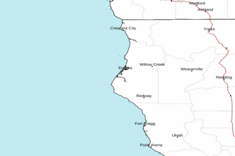
Point St. George to Cape Mendocino CA from 10 to 60 NM Marine Forecast
| Rest Of Today...S Wind 15 To 20 Kt. Seas 17 Ft. Wave Detail: W 16 Ft At 17 Seconds. Rain Likely. |
| Tonight...N Wind 10 To 15 Kt. Seas 13 Ft. Wave Detail: W 13 Ft At 16 Seconds. A Chance Of Rain. |
| Sun...N Wind 20 To 25 Kt. Seas 13 Ft. Wave Detail: N 9 Ft At 8 Seconds And W 11 Ft At 15 Seconds. |
| Sun Night...Nw Wind 15 To 20 Kt. Seas 13 Ft. Wave Detail: N 9 Ft At 7 Seconds And Nw 10 Ft At 14 Seconds. |
| Mon...S Wind 10 To 15 Kt. Seas 11 Ft. Wave Detail: N 3 Ft At 4 Seconds And Nw 11 Ft At 14 Seconds. A Chance Of Rain. |
| Mon Night...S Wind 20 To 25 Kt. Seas 9 Ft. Wave Detail: Nw 9 Ft At 13 Seconds And S 2 Ft At 15 Seconds. Rain Likely. |
| Tue...S Wind 25 To 30 Kt. Seas 10 Ft. Wave Detail: S 8 Ft At 7 Seconds And Nw 7 Ft At 13 Seconds. Rain. |
| Tue Night...S Wind 30 To 40 Kt. Seas 11 Ft. Wave Detail: S 11 Ft At 9 Seconds And W 6 Ft At 13 Seconds. Rain. |
| Wed...S Wind 25 To 35 Kt. Seas 15 Ft. Wave Detail: S 15 Ft At 10 Seconds And W 10 Ft At 13 Seconds. Showers. |
| Wed Night...S Wind 15 To 20 Kt. Seas 17 Ft. Wave Detail: S 12 Ft At 9 Seconds And W 15 Ft At 13 Seconds. A Chance Of Showers. |
| Area Forecast Discussion National Weather Service Eureka CA 1211am PDT Sat Nov 1 2025 Synopsis Sneaker wave threat today through early Sunday morning. Light rain possible in Del Norte and northern Humboldt this afternoon and evening, while dry weather prevails elsewhere. Stronger storm possible Wednesday, with the potential for strong south winds, heavy rainfall, and urban/small stream flooding. Higher than normal astronomical tides Tuesday through Saturday. .KEY MESSAGES... - Sneaker wave threat for the coast today through early Sunday morning. - Chance of light rainfall over Del Norte and northern Humboldt on this afternoon and evening. - Active weather returns next week, with the potential for strong south winds, heavy rainfall, urban/small stream flooding. - Higher than normal tides next week, with storm surge promoting coastal flooding in Humboldt Bay, Crescent City, and possibly areas on the Mendocino Coast. High clouds have started to stream in as high pressure begins to weaken and a weak cold front approaches the area. A chance for light rain arrives by the afternoon or evening hours in Humboldt and Del Norte Counties. Otherwise, impacts are limited to mid to high clouds across the area and moderated interior temperatures in the 70s. At the coast, light southerly flow ahead of the front may actually promote slightly warmer temperatures in the mid 60s before rain arrives in the late afternoon. High pressure rebuilds temporarily Sunday, clearing skies. Interior temperatures remains generally in the 70s, but coastal temperatures may drop down into the high 50s as winds turn more northerly. The start of a wetter pattern arrives Monday afternoon as a shortwave trough dips down into the Pacific Northwest and northwestern California. There is a fair amount of variability in this system. Some ensemble members show a surface low forming off the coast of northern California and moving northwest. Others do not show any significant surface low forming off the coast. Because of these differences, the possible precipitation amounts vary greatly. In Del Norte and northern Humboldt, precipitation amounts range from 1/10 to 3/4 of an inch. The NBM 50th percentile shows 0.25-0.50 inches in Humboldt and Del Norte with much lower amounts elsewhere. Confidence is increasing of a second, stronger system approaching the area late Tuesday into Wednesday. Strong southerly wind is likely ahead of the front Tuesday night into Wednesday as a low- level jet strengthens off the coast. Models are showing winds at 925 mb (~2000 ft) at around 70 kts right off the coast. These translate to surface gusts of 40-60 mph over coastal headlands and exposed ridges. NBM is showing 40-50% probabilities for lower elevations to see gusts over 40 mph, with much higher probabilities over higher terrain. Probabilities of over 50 mph drop off to 20% or less outside of the exposed ridges. However, if the 70+ kt coastal jet is realized, wind gusts are more likely to be on the higher end of the range. Significant wind impacts are possible if this trend continues. As for precipitation impacts, models are fairly consistent in showing a period of heavy rain across the area early Wednesday. Much colder temperatures aloft behind the frontal passage could support greater instability with heavier rain showers and possibly thunderstorms continuing Wednesday afternoon and overnight into Thursday. There is a fairly large spread in precipitation estimates. Comparing the low end and high end amounts (25th and 75th percentile) for 48 hour precipitation (4am Tuesday to 4am Thursday), Del Norte, Humboldt, and Trinity range from around 1-3 inches, and Mendocino and Lake range from around 0.5-2.0 inches. Because of the narrow band of moisture, some areas are likely to see high end amounts while some areas see low end amounts. Details will become clearer in the coming days. JB Marine The northerly swell is expected to get reinforced and this is increasing periods back to 14 seconds and heigheights building slightly. Farther north the approaching frontal boundary will start bringing some light southerly winds early Saturday. These southerly winds are expected to peak in the north on Saturday around 10 to 15 kt. A larger northwest swell is expected to combine with the existing swell and peak around 10 feet at 16 seconds on Saturday. There will likely be some set behavior with these waves. Northerly winds are expected to quickly return Saturday evening and overnight. These are expected to peak around 20 kt off the coast on Sunday. The northwest swell is expected to continue to be around 10 feet on Sunday. Sunday night and Monday the winds drop off quickly and become southerly again early Monday with another frontal boundary approaching. This is expected to quickly increase the southerly winds and has them peaking Monday afternoon or evening near 20 to 25 kt. Models appear to have trended slightly faster and stronger with this system. Tuesday the southerly winds diminish slightly, but remain near 15 kt. The next system is expected to move into the area Tuesday night and Wednesday. The CMC, ECMWF (European Centre for Medium-Range Weather Forecasts) and GFS (Global Forecast System) all show at least gale force sustained southerly winds. The CMC and the GFS show storm force sustained winds. Needless to say this will need to be watched as it gets closer. MKK .BEACH HAZARDS...The next swell is expected to arrive this morning. This could pose a sneaker wave threat. Initially wave periods are expected to be around 20 seconds with waves building and combining with the current swell to around 12 to 13 feet at 17 seconds. Winds will still be southerly and fairly light. This will likely increase the set behavior and therefore the sneaker wave potential. MKK Coastal Flooding Next week astronomical high tides are above 8 feet at the North Spit starting on Wednesday and peak at 8.5 feet Thursday. Moderate to strong southerly winds are now expected in this time frame and this will likely cause at least minor coastal flooding. If the timing lines up with the wind and high tides this event may end up with water levels near 10 feet at the North Spit tide gauge. Outside of Humboldt Bay there is the potential for coastal flooding if the waves end up large. Confidence is low, but it looks like there may be large waves at this time. MKK. .EKA WATCHES/WARNINGS/ADVISORIES... CA... Beach Hazards Statement from 5am PDT early this morning through late tonight for CAZ101-103-104-109. NORTHWEST CALIFORNIA COASTAL WATERS... Small Craft Advisory from 8am this morning to 3am PDT Monday for PZZ450. Small Craft Advisory from noon today to 3am PDT Monday for PZZ455-475. Small Craft Advisory until 3am PDT Monday for PZZ470. For forecast zone information see the forecast zone map online: https://www.weather.gov/images/eka/zonemap.png |