West Coast Vancouver Island South Marine Forecast
Marine Weather Statement For The Pacific Waters
Issued By Environment Canada 10:12am PDT Tuesday 28 July 2026.
A Frontal System Will Approach Bowie On Wednesday And Move Slowly Eastward Across The Northern And Central Waters Through Friday. Ahead Of The Front, South To Southeasterly Gale Force Winds Will Develop Over Bowie Wednesday Afternoon And Spread Eastward Across The Northern And Central Waters Through Thursday.
Technical Marine Synopsis For The Pacific Waters
Issued By Environment Canada 10:30am PDT Tuesday 28 July 2026 For Today Tonight And Wednesday. The Next Scheduled Synopsis Will Be Issued At 4:00pm PDT.
Systems Position. At 10:30am PDT Today Dissipating Low Located Over Haida Gwaii.
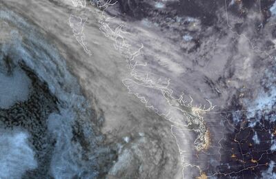
At 10:30am PDT Today Frontal System Located On A Line Northeast-Southwest Over Southern Vancouver Island. By 5:00pm PDT Today Dissipating Frontal System Located Over The Lower Mainland.
At 9:30pm PDT Tonight Frontal System Located Over Western Bowie. By Midnight PDT Wednesday Frontal System Located On A Line North-South Over Eastern Bowie.
 Pacific Satellite