Hurricane Center - Atlantic ~ test page
Tropical Outlook
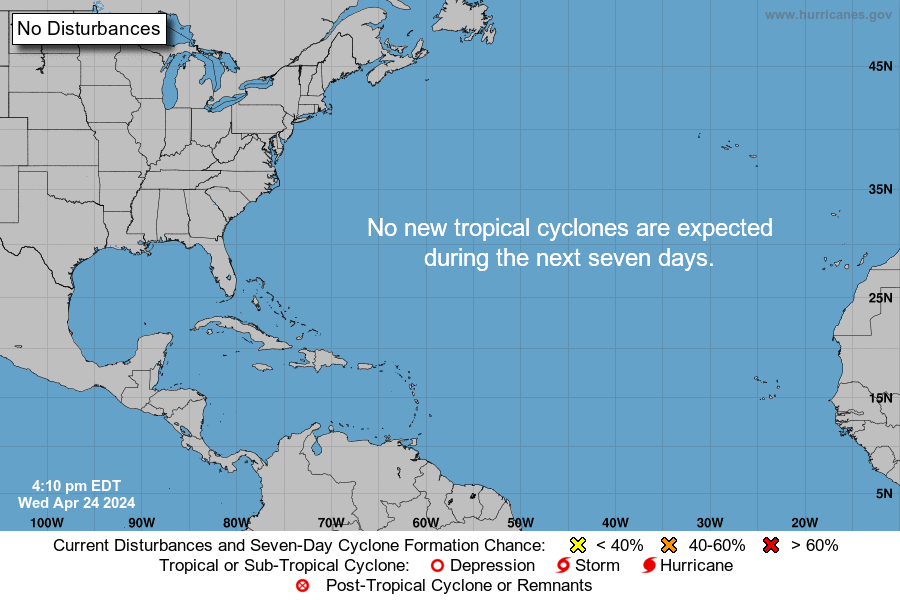
Tropical Weather Outlook
NWS National Hurricane Center Miami FL
700 PM EST Thursday November 30 2023
For the North Atlantic...Caribbean Sea and the Gulf of Mexico:
Tropical cyclone formation is not expected during the next 7 days.
This is the last regularly scheduled Tropical Weather Outlook of the 2023 Atlantic Hurricane Season. Routine issuance of the Tropical Weather Outlook will resume on May 15, 2024. During the off-season, Special Tropical Weather Outlooks will be issued as conditions warrant.
Forecaster: John Cangialosi, National Hurricane Center
2021 Storm Names
• Anna (May 22 - 23, 45 mph, 1004mb)
• Bill (June 14 - 16, 60 mph, 998mb)
• Claudette (June 19 - 22, 45 mph, 1004mb)
• Danny (June 28 - 29, 45 mph, 1009mb)
• Elsa (July 1 - 9, 85 mph, 991mb)
• Fred (Aug 11 - 18, 65 mph, 993mb)
• Grace (Aug 13 - 21, 125 mph, 962mb)
• Henri (Aug 16 - 24, 75 mph, 986mb)
• Ida (Aug 26 - Sept 2, 150 mph, 933mb)
• Julian (Aug 29 - 30, 60 mph, 995mb)
• Kate (Aug 28 - Sept 1, 40 mph, 1004mb)
• Larry (Aug 31 - Sept 11, 125 mph, 955mb)
• Mindy (Sept 8 - 10, 45 mph, 1002mb)
• Nicholas (Sept 12 - 17, 75 mph, 988mb)
• Odette (Sept 17 - 18, 45 mph, 1002mb)
• Peter (Sept 19 - 22, 50 mph, 1007mb)
• Rose (Sept 19 - 23, 40 mph, 1007mb)
• Sam (Sept 22 - Oct 5, 145 mph, 943mb)
• Teresa (Sept 24 - 25, 45 mph, 1008mb)
• Victor (Sept 29 - Oct 4, 65 mph, 997mb)
• NEXT: Wanda
• Adria
• Braylen
• Caridad


Tropical Discussion
Atlantic Tropical Weather Discussion
NWS National Hurricane Center Miami FL
2:05AM EDT (0605 UTC) Saturday Apr 20 2024
Tropical Weather Discussion for North America, Central America Gulf of Mexico, Caribbean Sea, northern sections of South America, and Atlantic Ocean to the African coast from the Equator to 31N. The following information is based on satellite imagery, weather observations, radar and meteorological analysis.
Based on 0000 UTC surface analysis and satellite imagery through 0440 UTC.
Monsoon Trough And Intertropical Convergence Zone - ITCZ
(The ITCZ is also known by sailors as the doldrums)
The monsoon trough passes through the coastal plains of southern Guinea-Bissau close to 11N15W, to 06N19W. The ITCZ continues from 06N19W, to the Equator along 27W, to 01S30W and 03S40W. Precipitation: widely scattered moderate to isolated strong is from 07N southward.
...Discussion: Gulf Of Mexico
A surface ridge passes through an Atlantic Ocean 1019 mb 27N76W high pressure center, to an eastern Gulf of Mexico 1018 mb 27N84W high pressure center, to the SW coastal areas of Louisiana. Broad middle level to upper level anticyclonic wind flow spans the area. Broken to overcast middle level and upper level clouds are to the west of the line that runs from the Florida Panhandle, to 26N86W, to 18N95W in the SW corner of the area.
Fresh to strong E winds are within 150 nm of the northern coast of the Yucatan Peninsula. Moderate or slower SE winds are in much of the rest of the Gulf of Mexico. Moderate seas are from 21N to 26N from 90W westward. Slight seas are elsewhere.
High pressure extending across the basin from the western Atlantic will prevail through Sat, with gentle to moderate winds in the NE half of the basin, and moderate to fresh in the SW half of the basin. Winds will pulse fresh to strong in the evenings NW of the Yucatan Peninsula through at least Saturday evening. A cold front is forecast to move into the NW Gulf late Saturday night into early Sun, stalling and dissipating near 23N early next week. Fresh to locally strong winds and building seas may follow the front through Sun night. High pressure will again dominate the basin by Tuesday and continue into Wednesday night.
...Discussion: Caribbean Sea
A 1019 mb sub-tropical high persists near 28N72W, and is promoting a weakened trade wind flow across the basin. Fresh NE to E winds and seas of 4 to 6 ft are noted offshore of Colombia and Venezuela, near the Windward Passage, and just south of the Dominican Republic.
Slight to moderate seas are between 70W and 80W, and in the NW corner of the area. Slight seas are elsewhere in the Caribbean Sea. Fresh to strong NE winds are moving through the Windward Passage. Moderate to fresh NE winds are within 210 nm of the coasts of Venezuela and Colombia between 68W and 77W, including in the Gulf of Venezuela. Fresh NE to E winds are within 150 nm of the coast of Honduras from 83W westward. Moderate or slower winds are in the remainder of the Caribbean Sea.
Broad high pressure N of the basin will support pulsing fresh to locally strong winds near the Windward Passage, S of the Dominican Republic, and near the coast of northern Colombia through early Sun. Similar winds will return and pulse near northern Colombia Monday evening through Wednesday evening. Winds will pulse to moderate to locally fresh in the NW Caribbean through early Sun, then again by mid-week. Gentle to moderate trades will prevail elsewhere, along with slight to moderate seas.
...Discussion: Atlantic Ocean
A surface trough is along 29N45W 26N50W 20N58W, curving to 10N61W near the coast of NE Venezuela. A 1022 mb high pressure center is near 32N31W. Broad surface anticyclonic wind flow is to the east of the 29N45W 10N61W surface trough. Broad surface anticyclonic wind flow is to the west of the surface trough. A 1019 mb high pressure center is near 27N76W.
Moderate seas are everywhere in the Atlantic Ocean. Mostly fresh to some strong NE winds are within 200 nm to 300 nm on either side of 21N18W 16N26W 14N33W 13N40W. Moderate NE winds are from 24N southward between 70W and 78W. Fresh NE winds are within 200 nm on the NW side of the surface trough between 47W and 54W, and from 22N to 25N between 59W and 65W. Fresh southerly winds are within 240 nm on the SE side of the trough between 46W and 51W. Moderate or slower winds are in the remainder of the Atlantic Ocean.
A surface trough from 22N55W to the NE Caribbean Islands will dissipate through Sat. Otherwise, high pressure from near Bermuda to E central Florida will prevail through Sun supporting mainly gentle to moderate winds. A cold front is forecast to move into the NW waters Sun night, reaching from 31N72W to near Jupiter, Florida Monday evening, from 31N69W to the central Bahamas Tuesday evening, then from near Bermuda to the SE Bahamas Wednesday evening. Moderate to fresh winds, locally strong near 31N, are forecast to accompany the front, along with building seas. Otherwise seas will be mainly slight to moderate.
Forecasters: Mike Tichacek, Jeffrey Lewitsky, National Hurricane Center