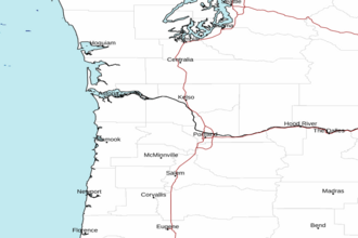
Cape Shoalwater WA to Cape Lookout OR between 60 and 150 NM Offshore Forecast
| Today...Nw Winds 10 To 15 Kt. Seas 6 To 8 Ft. |
| Tonight...Nw Winds 10 To 15 Kt, Becoming N. Seas 6 To 7 Ft. |
| Wed...N Winds 10 To 15 Kt, Diminishing To 5 To 10 Kt. Seas 6 To 7 Ft. |
| Wed Night...N Winds 10 To 20 Kt, Becoming N To Nw 10 To 15 Kt. Seas 6 To 7 Ft. |
| Thu...N Winds 15 To 20 Kt. Seas 6 To 7 Ft. |
| Thu Night...N To Nw Winds 10 To 20 Kt. Seas 6 To 7 Ft. |
| Fri...N To Nw Winds 10 To 20 Kt. Seas 6 To 8 Ft. |
| Fri Night...N Winds 15 To 20 Kt. Seas 7 To 9 Ft. |
| Sat...N Winds 15 To 25 Kt. Seas 8 To 10 Ft. |
| Sat Night...N Winds 10 To 20 Kt. Seas 7 To 9 Ft. |
| Area Forecast Discussion National Weather Service Portland OR 354am PDT Tuesday April 28 2026 Synopsis Onshore flow will bring widespread cloud cover this morning with chances for drizzle along the coast. Clouds should lift and break out this afternoon. Drier and warmer weather returning Wednesday through the weekend as high pressure builds. A passing trough at the end of the week will bring chances for light showers across the Cascades, but everywhere else remains dry. For those cooling down at our local rivers later this week, be aware of cold water shock due to cold river temperatures. Make sure to practice cold water safety and wear a life vest. Today through Monday...Satellite imagery as of early Tuesday morning depicts widespread stratus across northwest Oregon and southwest Washington as a weak shortwave trough maintains onshore flow. Sufficient lift from this shortwave will also support chances for light drizzle along the coast this morning. Later this afternoon, increased mixing from daytime heating will allow clouds to break out and return some sun. Afternoon highs are forecast near to slightly below normal today due to cloud cover, with highs in the low 60s across interior valleys and mid 50s along the coast. Winds will generally be light and westerly/northwesterly today, except for the Columbia River Gorge and Upper Hood River Valley where gusts are forecast to peak around 25-30 mph this afternoon. Wednesday to Thursday, warmer temperatures and sunny skies return as an upper-level ridge builds over the northeast Pacific and shifts into the Pacific Northwest. 500mb heigheights remain elevated and dry air will move into the region. High confidence (>80% chance) for temperatures rebounding into the upper 60s to low 70s by Wednesday and upper 70s to near 80 by Thursday. Chances for exceeding 80 degrees on Thursday are around 50-70% for the Portland/Vancouver Metro Area, and 15-25% for the rest of the I-5 corridor. HeatRisk remains Minor due to sufficient cooling overnight. Friday through Saturday, most deterministic and ensemble guidance depicts the upper-level ridge breaking down as a weak trough moves into the Pacific Northwest from Canada. It appears that there is limited moisture with this trough, so precipitation chances remain around 20-40% across the Cascades and less than 10% elsewhere. Temperatures cool down a few degrees during this time, however, we'll still be seasonably warm as 500 mb heigheights remain above-average over the area despite the passing trough. Sunday to Monday, most ensemble members have this trough moving southward toward California and becoming a closed low, while upper-level ridging builds over the Pacific Northwest, creating a rex-block pattern. Chances for precipitation continue over the Cascades since there may be some wrap-around moisture from this low. 500 mb heigheights also increase, suggesting a renewed warm-up over the region. Even this far out, NBM guidance is already suggesting high confidence (>90% chance) that temperatures exceed 80 degrees along the I-5 corridor on Sunday. For Monday, chances for exceeding 80 degrees are around 50-80% along the I-5 corridor, with the highest chances across the Portland/Vancouver Metro Area. Those heading to local rivers to cool off should note that river temperatures remain cold and can lead to shock. Make sure to practice cold water safety and wear a life vest. -10 Marine High pressure will maintain north-northwesterly winds across the waters this week, strongest in the afternoon/evening when pressure gradients are tightest. Wind gusts are expected to remain below 20 kt through Wednesday morning. From Wednesday evening through at least Friday, there is a 70-90% chance for at least isolated small craft wind gusts up to 20-25 kt. The strongest gusts would mainly be south of Cape Falcon and over the outer waters (beyond 10 NM offshore). Seas of 6-8 ft persist through the week with a northwesterly swell. Long periods of 13-15 seconds mid week will also result in a moderate sneaker wave threat from Wednesday-Thursday. Those participating in razor clam digs should take extra precaution. -10 NOAA Portland OR Office: Watches - Warnings - Advisories OR...None. WA...None. PZ...None. |
 Portland OR Radar
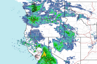
 Northwest Radar